Professional commercial drone services across Australia, including aerial filming, surveying, mapping, inspections, construction, enterprise operations, specialist industry solutions and location-based drone services.

Construction Site Drone Flyover Services Australia

From residential estates to commercial infrastructure, a construction site drone flyover is fast becoming an indispensable tool on modern Australian building sites. This powerful method of aerial data capture offers developers, architects, and site managers clear visibility across all project stages — from earthworks to final inspection. But what exactly is a drone flyover, and how can it transform your next build?

A construction site flyover is one part of our broader construction drone services, which support builders and developers with progress monitoring, aerial photography and video, mapping, inspections, level views and development visualisation throughout the project lifecycle.

What Is a Construction Site Drone Flyover?

At its core, a construction site drone flyover is the aerial equivalent of a site walk — only faster, safer, and far more informative. Using high-end drones like our DJI Inspire 3, we capture sweeping 4K (or higher) video and high-resolution stills from multiple altitudes and angles. The footage is used to:

  • Track site progress over time
  • Generate marketing assets
  • Support council submissions or client updates
  • Assist with insurance and compliance documentation

Flyovers are typically conducted at regular intervals — weekly, fortnightly or around key project milestones — giving construction teams a reliable, visual project history without ever leaving the ground.

Why the Construction Industry is Embracing Drones

The answer to “Do construction sites use drones?” is a definitive yes — and it’s not just about convenience. Drones have carved out a permanent role in the construction lifecycle due to their unmatched efficiency and accuracy.

From documenting site conditions to providing clients with real-time updates, drones offer benefits across design, execution, compliance, and even dispute resolution. Project managers no longer need to rely on still photos or verbal updates — a flyover provides a complete visual overview that’s hard to dispute.

And it’s not just large-scale developers jumping on board. Builders of all sizes now turn to drone flyovers as a practical way to communicate progress and stay on top of on-site activity.

Real-World Applications of Construction Drones

The application of drones in construction is more diverse than ever. At Flying Glass, we’ve supported projects including multi-storey apartment builds, luxury home estates, shopping precincts, and even regional infrastructure works.

Common use cases include:

  • Time-lapse documentation of progress over months
  • Real estate marketing for off-the-plan sales
  • Capturing drone renders for investor presentations
  • Supporting RLs and level views for DA submissions
  • Pre-earthworks terrain scanning with LiDAR data

For developers looking for aerial support across more than one stage of a project, our drone services for property developers bring together pre-construction imagery, level views, renders, mapping, progress capture and completed-project content in one coordinated service.

Whether you’re planning a new development or tracking progress on a live site, a flyover brings all the benefits of boots-on-the-ground photography with none of the risk or time delay.

Which Drone Is Best for Construction?

When clients ask “Which drone is best for construction?”, the answer depends on the outcome they’re after. For sharp, cinematic-grade footage, our go-to is the DJI Inspire 3, which delivers incredible quality even in complex environments. We pair this with a suite of prime lenses tailored to the required framing.

For smaller sites or tighter airspace, the Mavic 3 Pro Cine offers excellent image stabilisation and fast deployment. When projects require measurement accuracy, our LiDAR-equipped drones gather elevation data suitable for BIM integration, site grading analysis, and engineering overlays.

The choice of drone isn’t just about pixels — it’s about mission success. At Flying Glass, we match the gear to your project’s needs, always balancing visual quality, airspace constraints, and site safety.

Construction Site Drone Flyover Services Australia

What Are the Disadvantages of Drones in Construction?

It’s important to acknowledge the disadvantages of drones in construction — not to deter use, but to ensure they’re deployed responsibly and effectively.

  • Weather dependency: High winds or rain can ground operations, although rescheduling is usually straightforward.
  • Regulatory restrictions: Flying near controlled airspace or sensitive sites requires CASA authorisation, which our team manages.
  • Privacy concerns: Capturing adjacent properties can create legal or reputational issues, which is why we adhere strictly to defined boundaries.
  • Licensing and insurance risks: Using unlicensed pilots exposes your business to serious penalties and invalidated insurance. That’s why it’s critical to use a CASA-certified provider like Flying Glass.

Why Choose a Professional Drone Flyover Provider?

We’re not just drone enthusiasts — we’re experienced aerial cinematographers and CASA-accredited operators. With over 30 years of aviation experience on our team, we understand how to integrate safely into active construction zones, coordinate with site supervisors, and deliver footage that’s not only stunning but also useful.

Our operations meet the highest safety standards, and every mission is backed by our Operator’s Certificate, appropriate risk assessments, and full public liability insurance. We’re also quick — many clients receive edited flyover videos within 24 hours of the shoot.

Custom Scheduling to Suit Every Stage

There’s no one-size-fits-all approach. We tailor flyover frequency to your project’s pace and goals. Here’s how our clients typically schedule:

  • Weekly: For fast-moving civil works or marketing-heavy projects
  • Fortnightly: Ideal for mid-scale residential or commercial builds
  • Milestone-based: Capture specific stages such as slab pours, framing, or handover

We also offer packages that combine regular flyovers with one-off drone renders or LiDAR scans depending on what your project needs next.

Where the project needs more than a structured site overview, our construction drone videography service can add cinematic progress footage, milestone filming, stakeholder updates and completed-project video.

Case Example: Time-Lapse Flyovers for a Tier 2 Builder

Flying Glass recently partnered with a well-known Tier 2 builder working on a coastal shopping centre. Over six months, we conducted fortnightly flyovers capturing structural milestones, facade work, and final landscaping. The edited footage formed part of the builder’s compliance documentation and was later repurposed into a marketing asset for their next tender. It’s a perfect example of one drone service delivering value long after project completion.

Book Your Construction Site Drone Flyover

A construction site drone flyover is more than a flashy video — it’s a smart, repeatable tool that supports construction management, marketing, and compliance. Whether you’re tracking earthworks, satisfying council requirements, or producing investor-ready visuals, Flying Glass can help.

Get in touch to arrange your first flyover, or explore our full suite of aerial services designed to support the entire construction journey, from concept to completion.

Central Coast Drones flying above Terrigal Beach by Flying Glass

At Flying Glass, we’ve travelled across Australia and around the globe capturing aerial cinematography for major productions, but the Central Coast remains our home base. There’s something special about filming in the region where we live and work. If you’re looking for professional Central Coast drones for your next project, you’ve come to the right place. Whether it’s a one-off shoot or an ongoing campaign, we bring cinematic quality and operational expertise to every job.

For clients requiring capability beyond the Central Coast, Flying Glass also provides commercial drone services across Australia for filming, construction, inspections, mapping, industrial projects and specialist drone operations.

Premium Central Coast Drone Services

Whether you’re producing a television commercial, filming a documentary, or need stunning aerials for a real estate campaign, Flying Glass delivers world-class Central Coast drone services. We bring the same expertise, equipment and approvals to local jobs as we do on national productions. Our team is fully licensed with a CASA Operator’s Certificate (OC), and all flights are insured and compliant with CASA regulations. Our commitment to safety and storytelling excellence ensures clients receive the highest quality service.

We’ve filmed infrastructure projects for councils, tourism campaigns for local businesses, and even fast-paced FPV sequences for social media.

Why Choose a Local Drone Pilot on the Central Coast?

Hiring a drone pilot on the Central Coast gives you the benefit of local knowledge. From understanding how weather patterns behave around Avoca Beach cliffs, to knowing where the best sunrise shots are at Terrigal, our team is embedded in the region. We’re not just visitors; we’re locals who care about showcasing the Central Coast at its best. This insider insight helps us work more efficiently, anticipate challenges, and ultimately deliver better footage, faster.

We’re also able to respond quickly to last-minute jobs or weather windows, which can be essential for certain industries. Whether it’s a time-sensitive real estate campaign or a live TV cross, being nearby makes a difference. Our clients appreciate not only our skillset but our proximity.

Some of Our Favourite Local Locations

Over the years, we’ve captured breathtaking aerial footage across the entire Central Coast. Some of our most requested locations include:

  • Terrigal: Stunning beach vistas, the iconic Skillion, and early morning surfing sequences.
  • Avoca Beach: Dramatic coastline, lush hinterland surrounds and cinematic wave action.
  • Gosford: Government, infrastructure and real estate projects across the city centre.
  • The Entrance: Coastal lifestyle content, family-friendly drone visuals, and seasonal events.
  • Bateau Bay and Wamberal: Residential developments and premium real estate marketing footage.
  • Killcare and Macmasters Beach: Boutique tourism and luxury home projects.
  • Umina and Ettalong: Community projects, local events and council-led initiatives.

Each of these suburbs offers its own unique aerial perspective, from long uninterrupted beach shots to stunning bushland flyovers. We love helping clients visualise the best angles before a shoot and then bringing those scenes to life through our lens.

The Best Drone Central Coast Has to Offer

Our reputation as the best drone Central Coast provider is built on more than just high-end gear. It’s our 30+ years of aviation experience, storytelling instincts, and commitment to client satisfaction that set us apart. We work with real estate agents, architects, councils, television producers, and marketing teams to get the perfect shot, every time.

We also collaborate with production companies seeking aerial cinematography for commercials and films. Our Inspire 3, with its full-frame 8K RAW capabilities and multiple lens options, is ideal for narrative and cinematic content. Whether you’re capturing a fast-paced car chase or a serene property fly-through, we’ve got the equipment and experience to match your vision.

How Much Do Central Coast Drone Services Cost?

If you’re searching for drone Central Coast cost or Central Coast drone photography pricing, we offer both standard and custom packages. Our pricing is transparent and competitive, starting from half-day rates for simple shoots to bespoke packages for ongoing campaigns or large productions. We also offer a discounted local rate for clients within the Central Coast region. When planning a shoot, we’re happy to provide a detailed quote upfront so you know exactly what to expect.

We understand that cost is often a major consideration, so we make sure each quote reflects the unique needs of the job. Our rates are based on factors like location, equipment used, flight complexity, airspace classification, and post-production requirements.

Drone Central Coast NSW Map: Know What’s Possible

We regularly fly within the guidelines of the Drone Central Coast NSW map, including restricted airspace zones near the Gosford Hospital helipad and Warnervale Airport. As fully certified operators, we can apply for controlled airspace approvals and work closely with CASA to ensure safe and legal flights. If you’re unsure whether your shoot location is accessible, we can advise quickly and accurately.

We also assist developers and production companies with early-stage location feasibility, helping them assess risks and logistics before finalising their shoot schedule. This can save significant time and cost down the line.

Need to Buy a Drone? We Can Help

Many of our clients searching drone Central Coast NSW for sale come to us for advice before purchasing. Whether you’re looking to get into aerial photography or need a professional drone setup for commercial use, we’re happy to offer honest recommendations. We also run training courses for those pursuing their RePL (Remote Pilot Licence). Our drone school is CASA-approved and based right here on the Coast.

Central Coast Drones flying above Terrigal Beach by Flying Glass

Cost of a Professional Drone Pilot on the Central Coast NSW

When looking up drone Central Coast NSW cost, it’s important to remember that not all drone operators are equal. Our fully licensed pilots, redundancy equipment, pre-approved risk assessments, and post-production add-ons mean we deliver a premium service that’s worth every cent. While you can find cheaper operators, you won’t find our combination of reliability, creative quality, and local insight elsewhere.

We’re also often engaged for high-risk, complex jobs that require experience with CASA exemptions or controlled airspace approvals. We’re used to working under pressure and delivering footage under tight timelines without sacrificing quality.

Our Work in Central Coast Drone Photography

Central Coast drone photography is one of our most in-demand services, from lifestyle content and holiday parks to high-end property and construction monitoring. We capture cinematic footage with drones such as the Inspire 3 (ProRes/RAW), Mavic 3 Pro Cine, and FPV drones for dynamic close-range flying. Our team also offers editing and colour grading to provide a polished final product.

Our photography has been featured in council campaigns, architectural showcases, national media, and luxury real estate listings. Every frame is carefully composed to maximise impact while ensuring technical precision.

Book a Local Drone Team That Knows the Area

If you want the best drone Central Coast NSW team for your next shoot, contact Flying Glass. We’re proud to live and work here and love seeing the Central Coast through a cinematic lens. View our showreel or contact us to discuss your upcoming project.

We film everything from sunrise at Pearl Beach to large-scale projects in Tuggerah and everything in between. No matter the size of your job, we bring world-class cinematography home to the Central Coast. Let’s make something amazing together.

Aerial photo used for drone renders of a high-rise development with cityscape backdrop in Sydney Australia

In today’s competitive property and construction market, high-quality visuals aren’t just a nice-to-have – they’re a critical sales tool. Drone renders are becoming a game-changer for developers, architects, visualisation studios, and marketing agencies across Australia. At Flying Glass, we deliver ultra-accurate drone imagery to support photomontage, CGI compositing, and 3D visualisations that help your audience picture your future development with absolute clarity.

Drone renders form part of Flying Glass’ broader construction drone services, supporting developers and project teams from pre-construction visualisation and level views through to progress capture, mapping and completed-project imagery.

What Are Drone Renders?

Drone renders combine high-resolution aerial photography with computer-generated images (CGIs) of proposed developments. This integration places your unbuilt structure directly into the real-world environment it will one day occupy. Whether it’s a new apartment block, commercial precinct, or luxury home, drone renders showcase exactly how your project will appear from any angle or elevation. Clients across Sydney and Australia use drone renders for:

  • Pre-sales and off-the-plan marketing
  • Development Application (DA) submissions
  • Investor presentations
  • Stakeholder engagement
  • Sun shadow and viewline analysis

Why Drone Captured Renders Matter

Most renders fall flat when they don’t match the real-life context. Our drone survey imagery is captured at exact floor heights, using approved flight plans and precise GPS locking, ensuring your 3D model integrates perfectly with the surrounding landscape.

Benefits of Drone Renders for Your Project

  • Authentic Visual Context: Showcase actual viewlines and outlooks from Level 3, 10, 18 and beyond.
  • Faster Approvals: Council DAs and town planners are more likely to approve developments when they can visualise the impact with photorealistic precision.
  • Higher Buyer Engagement: Buyers respond emotionally to renders that reflect real-life views, lighting, and landscaping.
  • Customised to Your Timeline: We can simulate different times of day, seasons, or weather conditions to match your marketing strategy.

Our Process: From Flight to Final Render

  1. Flight Planning: We assess your site, airspace regulations, and line-of-sight to ensure safe and legal drone operations.
  2. Drone Capture: Our CASA-certified pilots capture high-resolution images, including spherical panoramas, bracketed exposures, and backplates.
  3. Visual Integration: Your rendering team (or ours) inserts the 3D model of your development into the imagery for realistic and compliant presentation.
  4. Delivery: We provide layered images, high-resolution JPEGs for marketing, and optional TIFFs for large-format printing.

Who We Work With

Our drone renders are used by:

  • Property Developers – to show views and architectural impact from every floor.
  • Architects and Town Planners – for shadow studies, council submissions, and design validation.
  • CGI and Visualisation Studios – needing accurate drone-captured backplates to match their models.
  • Real Estate Marketing Teams – creating campaigns that attract off-the-plan buyers and investors.

Use Cases for Drone Rendering

Drone renders are incredibly flexible and can be used in a variety of projects:

  • Multi-level residential towers with panoramic views
  • Commercial precincts that need exact elevation context
  • Luxury homes in coastal or hillside locations
  • Master-planned communities showing integration with surrounding infrastructure

360-Degree Views and Spherical Panoramas

Our drone fleet includes aircraft capable of capturing 360-degree spherical panoramas at defined elevations. These can be embedded in online sales tools, displayed in virtual reality environments, or stitched into immersive flythroughs. Using Gaussian Splatting, we can now turn those panoramic image sets into interactive 3D reconstructions — offering developers and architects a more immersive way to visualise their future builds.

Aerial photo used for drone renders of a high-rise development with cityscape backdrop in Sydney Australia

Secondary Services to Enhance Your Visualisation

  • Drone Videography: Dynamic aerial video sequences to pair with your still renders.
  • Time-Lapse Setup: Monitor progress from site acquisition to project completion.
  • Sun Path Simulation: Show light exposure and shading throughout the day/year.

Industry Services We Offer

We understand the language of architecture, planning, and design. That’s why our work aligns with the services and deliverables you rely on throughout a project lifecycle, including:

  • Drone survey capture: Aerial data acquisition to support site accuracy and terrain modelling workflows.
  • Photomontage backplates for seamless CGI integration
  • 360-degree drone panoramas at key floor heights
  • Architectural visualisation inputs for DA submissions and client approval
  • Aerial imagery for rendering with calibrated lens data and GPS metadata
  • Drone photography for architects supporting sun studies and view assessments
  • CGI-ready drone capture tailored for visualisation studio workflows

In addition to our Sydney-based crew, for Melbourne developments, Flying Glass provides specialist RLs and level views Melbourne imagery captured at nominated heights and camera positions for integration into architectural renders and visualisations.

Why Choose Flying Glass for Drone Renders?

  • 30+ years of combined aviation and cinematography experience
  • Trusted by property developers and architects
  • Full compliance with CASA regulations
  • Flexible scheduling across NSW, Victoria and major Australian cities
  • Fast turnaround times and collaborative workflows

Need a Quote for Your Next Project?

We can provide a tailored quote based on location, number of levels, required outputs and usage rights. Whether you’re a boutique architectural studio or a national property developer, we’ll ensure you receive compelling, accurate aerial imagery tailored to your visualisation workflow. Contact Flying Glass today to start planning your next drone render session.

How to become a drone surveyor operating drone at Australian construction site

With rapid advancements in drone technology, the world of surveying is undergoing a revolution. Traditional surveying techniques are being enhanced, and often replaced, by efficient, cost-effective, and safer drone-based solutions. In Australia, the demand for drone surveyors is growing fast, opening doors to diverse and rewarding career opportunities. This guide explores everything you need to know about how to become a drone surveyor, including required training, equipment, and job pathways.

What is Drone Surveying?

Drone surveying refers to the use of remotely piloted aircraft (drones) to capture aerial data that can be processed into detailed maps, models, or measurements. These aerial surveys are commonly used in civil construction, mining, agriculture, environmental studies, and infrastructure monitoring. Drone surveyors use GPS, LiDAR, photogrammetry, and other geospatial technologies to ensure accuracy and consistency.

What Do You Need for Drone Surveying?

To start drone surveying, you’ll need a combination of certifications, equipment, and software. Here’s a breakdown:

  • Remote Pilot Licence (RePL) – Required by CASA for anyone operating drones commercially.
  • Operator’s Certificate (OC) – For those managing their own drone business or operation.
  • Survey-grade drone – Typically equipped with RTK/PPK GPS, a high-resolution camera or LiDAR sensor.
  • Mapping and processing software – Such as Pix4D, DroneDeploy, or Agisoft Metashape.
  • Strong understanding of airspace regulations – Including how to obtain approvals where necessary.

Drone Surveying Jobs in Australia

Drone surveying jobs span multiple industries across Australia. Whether working in-house with civil contractors, mining firms, or environmental agencies, or running your own operation as a contractor, drone surveyors are in high demand. The role may include tasks such as site inspections, progress monitoring, volumetric analysis, boundary mapping, and asset documentation. Positions range from field technicians to GIS analysts and survey project leads.

Drone Surveying from Scratch

If you’re new to the world of drones or surveying, don’t worry. Many professionals transition into drone surveying from photography, IT, engineering, or construction. The best place to start is with a certified Remote Pilot Licence (RePL) course, which we offer at Flying Glass. From there, you can build your experience with mapping tools and flight hours, eventually taking on more complex survey tasks. Mentorship and hands-on projects are essential to develop skills and confidence.

What Are Two Industries That Benefit from Drone Surveying?

Drone surveying plays a crucial role in:

  • Construction: Drones are used for site planning, volume measurement, and progress tracking, reducing manual labour and increasing safety.
  • Mining: Aerial surveys help with stockpile analysis, terrain modelling, and monitoring hazardous zones with precision and speed.

What is the Purpose of Drone Mapping?

The primary purpose of drone mapping is to collect accurate, up-to-date spatial data from above. This data is used to generate orthophotos, digital surface models (DSMs), digital terrain models (DTMs), and 3D reconstructions. These outputs allow decision-makers to plan, analyse, and manage projects more effectively. Whether it’s tracking erosion, assessing roadworks, or measuring crop health, drone mapping provides insights that are otherwise expensive or time-consuming to acquire.

How to become a drone surveyor operating drone at Australian construction site

Which Drone is Best for Survey?

Choosing the best drone for surveying depends on the job. Popular models include:

  • DJI Mavic 3 Enterprise: Compact and RTK-capable, great for small-to-medium mapping projects.
  • DJI Matrice 350 RTK: Designed for rugged field conditions and compatible with multiple sensors including LiDAR.
  • WingtraOne Gen II: A fixed-wing VTOL drone ideal for covering large areas with high precision.

At Flying Glass, we fly a range of drones suitable for survey-grade mapping and can provide guidance on selecting the right platform.

Drone Mapping and Surveying in Australia

Drone mapping and surveying in Australia must comply with CASA regulations. This includes holding the appropriate RePL and following strict operational guidelines. Surveying companies often employ pilots who are experienced in both drone flight and geospatial data processing. Australia’s vast landscapes, mining sites, and infrastructure projects make it an ideal environment for drone mapping technologies to thrive.

Drone Surveyor Course Options

To become a professional drone surveyor, training is essential. At Flying Glass, we offer comprehensive RePL training that equips you with the legal and practical skills required for commercial drone work. We also provide mentorship for those wanting to specialise in aerial surveying, including how to interpret mapping outputs, conduct safe operations, and manage data workflows. When choosing a drone surveyor course, look for those that include real-world flying, CASA-approved content, and instructors with industry experience. You’ll benefit from learning in small groups with hands-on field training, ensuring you’re job-ready from day one.

If you’re looking to commission aerial survey data rather than train as a pilot, Flying Glass also provides professional drone surveying services for projects across Australia, working alongside qualified surveying professionals where required.

How to Become a Drone Surveyor – Step-by-Step

  1. Get your RePL: Enrol in a certified Remote Pilot Licence course. This is the legal minimum for commercial drone work in Australia.
  2. Gain flying experience: Log hours with a variety of drone types and payloads.
  3. Learn mapping software: Tools like DroneDeploy, Pix4D, and Metashape are essential.
  4. Understand surveying principles: Learn about georeferencing, ground control points (GCPs), and photogrammetry basics.
  5. Invest in equipment: Choose a drone setup tailored to your surveying niche (e.g. construction, mining, agriculture).
  6. Get your OC (Operator’s Certificate): If you’re starting your own drone surveying business.
  7. Find work or freelance: Apply for roles in engineering firms, councils, construction companies, or start your own survey operation.

Drone Surveying: Future Outlook

Drone surveying is a rapidly growing profession. With the rise of smart cities, precision agriculture, and renewable infrastructure, the need for accurate spatial data will only increase. Becoming a drone surveyor puts you at the forefront of this technological evolution. Australia’s regulatory environment supports safe drone growth, and skilled professionals are increasingly sought-after. If you’re ready to launch your career in drone surveying Australia, there’s never been a better time to start. At Flying Glass, we provide expert training, guidance, and opportunities for aspiring drone professionals. Whether you want to join a company or fly solo, the journey begins with learning the rules and building your skillset from the ground up. Interested in getting your RePL and starting a new career in drone mapping? Check out our RePL drone training course.

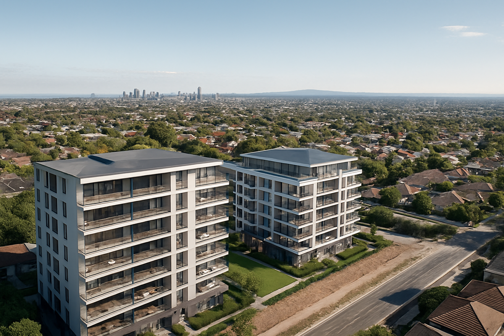
Drone RLs and level views of waterfront residential development site in Australia

Need drone RLs and level views for a development?

Flying Glass captures precise drone RLs and level views for property developers, architects, builders, planning consultants, visualisation studios and real estate marketing teams across Australia.

We fly drones to specific Reduced Levels, floor heights or proposed apartment levels so your team can show the future view before the building exists. These images can support architectural renders, off-the-plan sales, planning submissions, investor presentations and view impact assessments.

Book Drone RLs and Level Views

Drone RLs and Level Views for Architects, Developers and Render Studios

At Flying Glass, we specialise in capturing drone RLs and level views for architects, property developers, building companies, planning consultants and visualisation studios across Australia. These images help project teams show buyers, councils, investors and stakeholders what the future view will look like from each level of a proposed development.

In a competitive property market, a clear view can make an enormous difference. If a future apartment, hotel room, rooftop terrace or commercial space will have ocean views, skyline views, district views or a particular outlook, your marketing and design team needs to show that accurately before construction begins.

Our drone RLs and level views service gives your team real imagery captured from the correct height. This can be used in architectural renders, planning reports, sales campaigns, visual impact studies, DA documentation and investor materials.

Instead of relying entirely on simulated views, street-level guesses or generic aerials, drone RLs and level views allow you to ground your project visuals in real, site-specific imagery.

RL and level-view photography is one of the specialist services available through our broader construction drone services, supporting developers, architects and builders from early planning and visualisation through to construction progress and project completion.

What Are Drone RLs and Level Views?

Drone RLs and level views are height-based drone photographs or videos captured at specific Reduced Levels, also known as RLs. An RL is a measured height used in architectural, planning and construction documentation.

Where these images are being used to visualise an unbuilt development, our drone renders service provides the accurately positioned aerial backplates required to integrate proposed buildings into their real-world surroundings.

For a proposed building, your architect or surveyor may provide RLs for each level, apartment, balcony, rooftop or key viewpoint. Flying Glass can then fly a drone to those heights and capture the view from each nominated position.

These images are commonly used to show:

  • The future view from each apartment level
  • Views from balconies, terraces and rooftop areas
  • Outlooks from proposed hotel rooms or commercial spaces
  • View corridors from a future development
  • Visual impact from specific heights
  • Real-world context for architectural renders
  • Marketing imagery for off-the-plan sales

Drone RLs and level views are especially useful before construction begins, when developers need to demonstrate what buyers, councils or investors will see from a building that does not yet exist.

Show the Future View Before the Building Exists

The real value of drone RLs and level views is simple: they help your team show the future.

For off-the-plan buyers, the view can be one of the biggest drivers of perceived value. A premium apartment may achieve a stronger result if buyers can clearly understand the outlook from Level 6, Level 10 or the penthouse. For developers, accurate drone level views can support pricing, sales conversations and campaign confidence.

For architects and render studios, drone RLs and level views provide real-world photographic material that can be integrated into renders, photomontages and visualisation packages. This helps the final imagery feel more credible, more accurate and more site-specific.

For planning consultants, drone level views can support view sharing analysis, visual impact reports, design review documentation and stakeholder communication.

Who Uses Drone RLs and Level Views?

Our drone RLs and level views service is used across the Australian property, architecture, construction and visualisation industries.

Typical clients include:

  • Property developers preparing off-the-plan sales campaigns
  • Architects developing visual material for design and planning
  • Render studios needing real view plates for 3D imagery
  • Building companies preparing stakeholder presentations
  • Town planners preparing development application material
  • Real estate marketers promoting premium apartments
  • Visualisation teams building accurate project imagery
  • Landscape architects assessing outlook and view corridors
  • Environmental consultants preparing visual impact studies
  • Councils and urban designers reviewing development impacts. For development teams requiring aerial support beyond RL photography alone, our drone services for property developers can support the project across planning, visualisation, construction progress, marketing and completion.
  • Investment teams preparing feasibility or funding material

Drone RLs and level views are useful wherever a project team needs to understand, explain or market the view from a proposed future height.

Why Drone RLs Are Essential for Property Developers

For developers, drone RLs and level views can support the commercial story of a project. A future view is not just a design detail. It can influence pricing, buyer confidence, investor appetite and marketing strength.

Drone RLs and level views can help developers:

  • Demonstrate views before construction begins
  • Support off-the-plan apartment sales
  • Show buyers the difference between lower and upper levels
  • Provide real imagery for brochures, websites and display suites
  • Give sales teams stronger visual material
  • Support investor and financier presentations
  • Show the value of premium outlooks
  • Provide accurate reference material for renders
  • Improve confidence in pricing and positioning

When buyers can see the likely view from a specific level, they have a clearer sense of what they are purchasing. This is especially important for coastal developments, high-rise apartments, waterfront sites, city towers and premium residential projects.

Drone Level Views for Architects

Architects use drone RLs and level views to better understand the relationship between a proposed building and its surroundings. Height-based drone photography can help design teams assess outlook, orientation, neighbouring structures, landscape features and potential visual constraints.

Drone RLs and level views can support architects with:

  • Concept design
  • Design development
  • View corridor assessment
  • Client presentations
  • DA imagery
  • Photomontage reference material
  • Rooftop and balcony outlook studies
  • Site context analysis
  • Coordination with render studios

Flying Glass can work from architectural plans, RL schedules, marked-up drawings or a simple list of required floor heights. We can also liaise directly with your project architect or visualisation team to ensure the imagery is captured in the right direction, format and sequence.

Drone Photography for Architectural Renders

One of the most common uses for drone RLs and level views is architectural rendering. Render studios need accurate view plates, context imagery and background photography to create credible project visuals.

By capturing drone photographs from nominated RLs, Flying Glass helps visualisation teams produce renders that reflect the real outlook from the proposed building. This is far more useful than generic aerial photography because the image is captured from the height and direction required for the project.

Drone RLs and level views can be supplied for:

  • Apartment view renders
  • Balcony outlook renders
  • Penthouse marketing visuals
  • Hotel room views
  • Rooftop terrace imagery
  • Commercial office outlooks
  • Mixed-use precinct renders
  • Sales suite displays
  • Interactive project websites

We can capture stills, panoramas, 360-degree views or video footage depending on the needs of the render workflow.

Our Process for Drone RLs and Level Views

Flying Glass makes the process straightforward for busy project teams. We understand that developers, architects and render studios often need this material quickly, clearly and without unnecessary back and forth.

Our process usually works like this:

  1. You send the site details: including the address, access notes and any known timing requirements.
  2. You provide the RLs or floor heights: this may be an RL schedule, architectural plan, marked-up drawing or simple list of heights.
  3. We confirm the shot requirements: including direction, angle, stills, video, panoramas or 360-degree views.
  4. We conduct airspace and site checks: including CASA requirements, access, weather and operational constraints.
  5. We capture the drone RLs and level views: flying to the specified heights and documenting the requested outlooks.
  6. We deliver organised files: labelled by level, height, direction or agreed naming convention.

Our goal is to make drone RLs and level views easy for your team to use. We can match your required naming convention, preferred file format and delivery structure so the images flow smoothly into your render, marketing or planning workflow.

What We Need From You

To quote and plan drone RLs and level views accurately, we usually need:

  • The site address
  • The required date or deadline
  • The RLs, floor heights or nominated viewpoints
  • The number of levels or positions required
  • The required directions, such as north, south, east and west
  • Whether you need stills, video, panoramas or 360-degree imagery
  • Any access instructions or site restrictions
  • Any preferred file naming or delivery requirements

If you do not have everything ready, that is fine. We can often work with preliminary information and help you identify what is needed before the shoot.

Why Accuracy Matters for Drone RLs and Level Views

Drone RLs and level views need to be captured carefully because small height or direction errors can create confusion later. If imagery is being used for architectural renders, sales material or planning documentation, it needs to be organised and reliable.

Flying Glass uses professional drone equipment, flight logging systems and experienced pilots to capture height-based imagery with care. We understand that the files may be used by several different teams, including architects, developers, marketers, render artists and consultants.

Accuracy matters because drone RLs and level views can influence:

  • Buyer expectations
  • Sales presentations
  • Architectural visualisations
  • Planning discussions
  • Visual impact assessments
  • Investor confidence
  • Marketing claims

We take a methodical approach so your team receives clear, well-labelled imagery that is easy to interpret and use.

Fast Drone RLs and Level Views for Tight Deadlines

Development projects often move quickly. Marketing teams may need imagery for a sales launch. Render studios may need view plates before a presentation. Architects may need supporting material for a DA package. Developers may need images for an urgent investor meeting.

Flying Glass can support tight timelines for drone RLs and level views across many Australian locations. We are Sydney-based with experienced drone crews available across the country, allowing us to service projects in capital cities, coastal areas and regional development locations.

Where possible, we can prioritise urgent RL drone photography and provide fast delivery of high-resolution files. Weather, airspace and access requirements still need to be managed, but we understand the commercial urgency behind development timelines.

Need Future Views for Renders, Sales or Planning?

Flying Glass captures drone RLs and level views for property developers, architects and visualisation teams across Australia. Send us the site address, required heights and deadline, and we can help plan the shoot.

Request Drone RL Photography

What Formats Can You Receive?

Different project teams need different formats. A render studio may need RAW stills, while a marketing team may want ready-to-use JPEGs, panoramas or video. Flying Glass can tailor delivery to the needs of the project.

For drone RLs and level views, clients can request:

  • High-resolution JPEG stills
  • RAW stills
  • Panoramic views
  • 360-degree aerial panoramas
  • Raw video footage from each RL height
  • Short cinematic clips
  • Time-stamped files
  • Height and GPS reference information where available
  • Files labelled by level, height, direction or apartment stack
  • Custom folders for architects, render studios or marketing teams

We can also capture repeated views at multiple heights so your team can compare outlooks across levels. This is particularly useful when assessing which floors have clear views, partial views or obstructed views.

Drone RLs and level views of waterfront residential development site in Australia

Drone RLs and Level Views for Off-the-Plan Marketing

Off-the-plan marketing relies on confidence. Buyers are often making decisions before they can physically stand inside the finished apartment. Drone RLs and level views help bridge that gap.

By showing the expected view from specific levels, your sales team can explain the differences between apartments more clearly. For example, Level 3 may have a leafy outlook, Level 7 may clear neighbouring buildings, and Level 12 may achieve broader ocean or skyline views.

These view differences can influence:

  • Apartment pricing
  • Sales strategy
  • Premium positioning
  • Display suite content
  • Website imagery
  • Buyer conversations
  • Investor presentations

Drone RLs and level views give your marketing team real imagery to support the story of the building.

Drone RLs and Level Views for Development Applications

Drone RLs and level views can also support planning and development application material. While marketing images focus on buyer appeal, planning imagery often focuses on context, impact, views and relationship to surrounding sites.

Planning teams may use drone RLs and level views for:

  • Visual impact assessments
  • View sharing studies
  • Urban context documentation
  • Neighbouring property outlook analysis
  • Design review presentations
  • Council submissions
  • Community consultation material

Flying Glass can work with planning consultants and architects to capture the required viewpoints in a structured, repeatable and well-documented way.

Drone RLs and Level Views for Coastal and Waterfront Developments

Coastal and waterfront projects often benefit strongly from drone RLs and level views because the view is a major part of the project’s value. Ocean, harbour, lake and river outlooks can become key selling points, but only if they are shown accurately.

Flying Glass can capture drone level views for:

  • Beachside apartment projects
  • Waterfront residential developments
  • Harbour-view sites
  • Lakefront projects
  • Coastal hotel developments
  • Rooftop terraces
  • Mixed-use precincts near water

For these projects, drone RLs and level views can help demonstrate how the outlook changes from lower floors to upper levels. This can be especially important when neighbouring buildings, vegetation, topography or future development may affect view corridors.

Drone RLs and Level Views for Urban and High-Rise Projects

Urban developments often need drone RLs and level views to show skyline outlooks, district views, street context and the relationship between neighbouring buildings.

In city and suburban environments, the challenge is often not just height. It is also airspace, access, nearby buildings, people, roads and operational constraints. Flying Glass manages these practical considerations as part of the shoot planning process.

Urban drone level views may support:

  • High-rise residential towers
  • Mixed-use developments
  • Commercial office projects
  • Hotel developments
  • Build-to-rent projects
  • Student accommodation
  • Senior living and retirement projects

Our CASA-aware planning process helps ensure the drone RLs and level views are captured safely and legally, even in complex urban environments.

Once construction begins, many of the same clients continue with scheduled construction site drone flyovers to document progress, provide stakeholder updates and create a consistent visual record through to completion.

Do You Need Permission for Drone Level Views?

Many drone RLs and level views jobs require careful aviation planning. Some sites are straightforward. Others may be near controlled airspace, airports, heliports, dense urban areas, roads, buildings or public spaces.

Flying Glass handles CASA permissions and operational planning where required. We assess the site, review airspace, plan the flight and manage the safety requirements so your team can focus on design, sales and approvals.

Our background in aviation means compliance is built into the process. We do not simply arrive and hope the location is suitable. We check the operational requirements before the shoot.

Why Choose Flying Glass for Drone RLs and Level Views?

Flying Glass is trusted by clients across Australia for specialist drone work that requires precision, professionalism and aviation expertise.

Clients choose us for drone RLs and level views because:

  • We hold a full Operator’s Certificate (OC) and operate in compliance with CASA regulations.
  • Our team includes aviation professionals with decades of flying experience.
  • We understand the needs of developers, architects and render studios.
  • We can capture floor-by-floor imagery at nominated heights.
  • We provide clear file organisation and practical delivery formats.
  • We can work to tight development and marketing timelines.
  • We are Sydney-based with experienced drone crews across Australia.
  • We regularly support projects in Sydney, Brisbane, Melbourne, regional NSW and other locations.
  • We can support connected services such as construction site drone filming, property marketing imagery and architectural render support.
  • Flying Glass has local Victorian crews providing specialist RLs and level views Melbourne services for property developers, architects and rendering companies throughout metropolitan Melbourne and regional Victoria.

Our role is to make the process easy for your team. You provide the site, RLs and required outcome. We handle the drone planning, capture and delivery.

When You Might Need This Service

In addition to searching for drone RLs and level views, clients often contact us when they need:

  • Drone level views
  • Drone views for property developers
  • Future apartment views
  • Height-based drone photography
  • Drone photography for architectural renders
  • Drone imagery for off-the-plan sales
  • Drone images for development applications
  • Drone view studies for property development
  • Pre-construction drone views
  • Drone architectural photography Australia
  • Drone elevation views for marketing
  • Level height drone photos
  • Development visualisation drone services
  • Drone photos for urban planning
  • Aerial RL surveys

Whatever terminology your team uses, the goal is usually the same: accurate imagery from the future height of the project.

Work With Flying Glass

If you need drone RLs and level views captured for an upcoming development, Flying Glass can help. We support property developers, architects, planning consultants, builders, render studios and marketing teams with accurate height-based drone imagery across Australia.

Whether you need future apartment views for a sales campaign, view plates for architectural renders, supporting imagery for a DA or visual material for an investor presentation, we can plan and capture the required footage efficiently.

These views are not just photographs. They are the future of your project, visualised before a single brick is laid.

Book Drone RLs and Level Views

Send Flying Glass your site address, required RLs or floor heights, deadline and preferred output format. We will assess the shoot, manage the drone requirements and capture the imagery your project team needs.

Contact Flying Glass

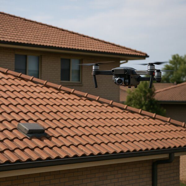
Drone roof inspection in Australia showing a drone surveying a large tiled rooftop

When it comes to maintaining residential, commercial, or industrial buildings, few tasks are as crucial – or as challenging – as inspecting the roof. Traditional roof inspections often require expensive scaffolding, elevated work platforms, or risky manual climbs. Fortunately, there’s a better way. A drone roof inspection provides a faster, safer, and more cost-effective alternative – and it’s a service we proudly offer at Flying Glass across Sydney and Australia.

Why Choose a Drone Roof Inspection?

Using a drone for roof inspection provides a number of compelling benefits. With high-resolution cameras and precision flight control, drones can quickly access difficult or dangerous areas, capturing detailed footage and imagery without the need for ladders or safety harnesses.

  • Speed: A full drone roof survey can often be completed in under an hour, with zero downtime required for the building’s occupants.
  • Safety: No need to send personnel onto unstable or unsafe rooftops.
  • Cost-efficiency: Save thousands on scaffolding and access equipment.
  • High-quality visuals: Get 4K video and high-resolution images from various angles for accurate analysis.
  • Real-time insights: Review findings instantly or stream them live to off-site stakeholders

What Does a Drone Roof Survey Involve?

At Flying Glass, our drone roof inspection service starts with a short pre-flight survey to assess airspace safety and visual line-of-sight. We then perform a comprehensive aerial survey, capturing overlapping images and videos to give you a complete view of the roof’s condition. Depending on your needs, this can include:

    • Inspection for cracked or slipped tiles
    • Checking for ponding, leaks, and gutter blockages
    • Thermal imaging (if required) for identifying heat loss or water ingress
    • Assessing roof-mounted solar panels or HVAC systems. For larger solar installations and energy infrastructure beyond individual rooftops, see our renewable energy drone services for solar farms, wind energy assets and utility-scale projects.
    • Photogrammetry and drone mapping to create detailed 3D models of the roof or surrounding asset.

We supply your deliverables in whatever format suits you: raw footage, high-resolution JPEGs, processed orthomosaics, or even a PDF inspection report summarising key findings. If you don’t have the resources to process or interpret the data – we can do that too.

Where rooftop inspection also involves telecommunications antennas, mounts or associated network equipment, Flying Glass provides specialist utility and telecom drone inspections for broader infrastructure assessment.

Industries That Benefit from Drone Roof Inspections

Whether you’re a real estate investor, facilities manager, insurance assessor, or builder, our drone roof inspection services can streamline your operations and cut costs.

  • Real Estate: Market your property with detailed roof visuals or confirm condition during due diligence.
  • Construction: Track the build stage of new roofs and compare progress with plans and project milestones.
  • Insurance: Use drone data to support claims assessments and expedite payouts.
  • Maintenance: Perform routine inspections to prevent major issues and extend asset life.
  • Strata and Body Corporate: Manage large roof areas efficiently without disturbing residents.

For facilities where roof inspection forms part of a broader process-asset review, Flying Glass also provides oil and gas drone inspections covering tanks, pipework, stacks and other elevated industrial infrastructure.

Drone Roof Inspection in Sydney and Beyond

Flying Glass is Sydney-based with experienced drone operators across Australia. We are CASA-certified and hold a full Operator’s Certificate (OC), which means we can legally and safely operate in complex airspace – including urban environments.

Many commercial buildings are located in complex operating environments, but that does not necessarily place aerial inspection out of reach. For building, infrastructure and industrial assets beyond rooftops, explore our broader drone inspection services across Australia. We can assess the site, airspace and operational requirements and determine the appropriate approach for the project.

If you need high-quality footage but don’t have a licensed operator – we can do the shoot for you. We work with property developers, RLs, architects, builders, councils, and insurers to get the right angles, the right data, and the right results.

What Type of Drone Is Best for Roof Inspections?

Not all drones are created equal. For a thorough drone for roof inspection, we typically use equipment like the DJI Mavic 3 Pro Cine or the Inspire 3. These offer:

  • High-resolution imaging (5K to 8K)
  • Zoom lenses for capturing close-ups from a safe distance
  • Obstacle avoidance sensors
  • GPS-stabilised flight for smooth, repeatable paths

In some cases, FPV drones can be used for tricky under-eaves access, although this depends on the project’s specific needs and risks.

Drone roof inspection in Australia showing a drone surveying a large tiled rooftop

What Does a Drone Roof Inspection Cost?

Pricing depends on your location, the complexity of the roof, and the level of reporting required. As a general guide:

  • Basic visual-only roof checks from $500 AUD
  • Comprehensive inspections with reporting from $950 AUD
  • Thermal imaging, 3D modelling, or urgent inspections are quoted per job

We offer fast-turnaround options if you’re in a hurry, and we’re happy to liaise directly with trades, architects, or insurers to make life easier.

Want to Learn to Do It Yourself?

We don’t just offer drone roof survey services – we teach them too. Our fully licensed drone training school offers RePL (Remote Pilot Licence) courses, including hands-on flight training and theory. Learn the rules, master the tech, and legally fly for commercial jobs anywhere in Australia. This is ideal for:

  • Roofers and trades wanting to expand their services
  • Insurance firms adding drone capability in-house
  • Facilities managers wanting safer, cheaper inspections

Our graduates include professionals from construction, emergency services, and inspection companies – many of whom now handle their own drone roof inspections.

Book Your Drone Roof Inspection Today

If you’re looking for a professional drone roof inspection in Sydney or anywhere across Australia, we’re ready to help. Flying Glass combines cinematography-level quality with practical inspection expertise. We deliver the data you need in the format you want – on time and on budget.

Contact us today to request a quote or learn more about our training programs. Your roof deserves a closer look. Let’s get it done – from above.

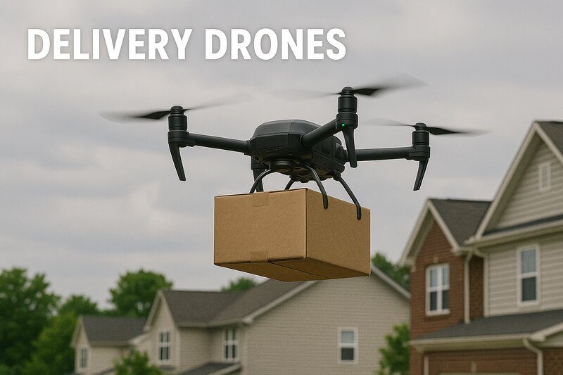
Delivery Drones Australia

There’s no denying it – delivery drones are changing the face of logistics, transport, and customer service across Australia and beyond. What once felt like sci-fi is now a viable, efficient, and often faster way to deliver everything from coffee to medical supplies. But what does it actually take to launch a delivery drone operation in Australia?

That’s where we come in.

At Flying Glass, we offer drone consultancy services for businesses and government agencies exploring drone delivery – backed by over 30 years of aviation experience and a deep understanding of CASA requirements. Whether you’re designing a drone drop stunt, piloting a prototype delivery drone fleet, or just figuring out where to start, this guide explains everything you need to know—and how we can help.


What Are Delivery Drones?

A delivery drone is a type of remotely piloted aircraft system (RPAS) used to transport goods from one location to another – usually within a 10 km radius. They’re typically lightweight, battery-powered multirotor drones equipped with GPS, collision-avoidance sensors, and a payload delivery system.

Applications include:

  • Medical deliveries (e.g., blood samples, vaccines)
  • Food delivery (coffee, meals, groceries)
  • Retail (e-commerce packages, fast fulfilment)
  • Event stunts and promotional drops
  • Emergency supplies in disaster zones
  • Remote location deliveries (islands, national parks)

Why Use Delivery Drones in Australia?

Australia’s geography makes it uniquely suited to drone deliveries. Our vast distances, urban congestion, and remote communities create logistical challenges that drones are primed to solve. Early adopters like Wing (a Google company) and Swoop Aero have already proven this in suburbs like Logan, QLD and Canberra, ACT, while Europe is seeing rapid suburban scaling with Manna drone delivery.

Key benefits:

  • Faster last-mile delivery
  • Lower carbon emissions
  • Less road congestion
  • Access to remote or isolated communities
  • Contactless delivery (especially useful during pandemics)
  • Incredible PR and marketing potential

What’s Stopping Most Companies from Getting Started?

Despite the hype, very few companies are flying delivery drones at scale – and for good reason. It’s not as simple as buying a drone and hitting ‘go’.

Here’s where it gets complex:

1. CASA Regulations Are Strict

Australia’s drone laws are among the most detailed in the world, especially for delivery drones. CASA requires:

  • An Operator’s Certificate (OC)
  • At least one licensed Remote Pilot (RePL)
  • A detailed Operations Manual
  • Approval to fly over populated areas
  • Approval for dropping objects from drones
  • BVLOS (Beyond Visual Line of Sight) approvals
  • A Safety Management System

2. Liability and Insurance

You’ll need comprehensive public liability insurance, plus plans to handle accidents, privacy breaches, or damage caused by your aircraft or payload.

3. Public Safety and Perception

Even if you’re legal, the public still needs to feel safe. Issues such as drones dropping boxes onto homes or buzzing overhead in quiet suburbs can lead to backlash or police attention.

Read our detailed guide on dropping from a drone for a breakdown of the legalities and risks involved in aerial delivery.


Flying Glass: Your Drone Delivery Partner

We’re not just drone pilots – we’re aviation consultants. At Flying Glass, we help businesses plan, test, and launch drone delivery operations from the ground up.

Here’s how we support you:

Regulatory Guidance

We help you understand what’s required to run a drone delivery operation, assist with RePL and OC pathways, and guide you through SORA and BVLOS applications.

Safety & Airspace Planning

We’ll map your flight zones, identify risk factors, and propose mitigation strategies that actually get CASA approval.

Drop Payload Design & Testing

We help develop your drop-release systems to meet CASA’s ‘safe release’ criteria – and conduct test flights that prove safety and accuracy.

Where an off-the-shelf delivery mechanism does not meet the project requirements, Flying Glass can also provide custom drone payload integration for specialist carrying, mounting, release and delivery systems.

Permits and Documentation

We prepare the technical documentation required for CASA – including your risk assessment, job safety analysis, and mission profiles.

Marketing and Media Integration

Thinking of using a delivery drone in your campaign or event? We’ve supported everything from TV ads to influencer drops and cinematic PR stunts. Watch our showreel to see our work in action.


Use Cases for Delivery Drones in Australia

Wondering if drone delivery could work for your industry? Here are a few applications we’ve supported or consulted on.

Retail & E-Commerce

Brands are looking for ways to get closer to same-day and even same-hour delivery. Drones offer ultra-fast service with zero road congestion – ideal for urban ‘last mile’ logistics or remote-area drops.

Healthcare

Delivery drones are already being used to transport critical medical items in Africa and rural Australia. We’re working with health providers to ensure compliance with CASA when transporting temperature-sensitive or high-value cargo.

Events & Promotions

Want to deliver a product sample onto a beach, launch a product from the air or create an unexpected promotional moment? We have delivered exactly this type of work for major campaigns. For creative and promotional applications, see our drone brand activation services.

Construction & Mining

Remote project sites often suffer from equipment or supply delays. Delivery drones can drop small components or tools on demand.

Food Delivery

Flying burritos? It’s already happening. But it requires creative packaging, accurate drop systems, and delivery within a small radius.

Delivery Drones Australia


Legal Considerations for Delivery Drones

As exciting as delivery drones are, there are strict boundaries you need to work within.

Here are just some of the legal concerns:

Dropping from a Drone

Any time you’re releasing a payload mid-air, CASA considers it “dropping of an object,” which is heavily regulated.

  • Must be authorised in your OC and operational documentation
  • Must not pose a risk to people or property
  • May require parachutes or soft-release systems
  • CASA may require flight testing and detailed safety reports

See our full post: Dropping from a Drone: Legal Guide for Australia

Flying Over Populous Areas

This includes suburbs, beaches, or anywhere people gather. CASA generally does not allow RPA flights over populous areas without a complex application and significant safety evidence.

Flying Glass can help prepare these approvals through SORA or other risk-based frameworks.

Where a delivery or promotional operation also requires the aircraft to operate over or near people, Flying Glass holds specialist OONP capability and can advise on the appropriate operational pathway for the proposed flight.

BVLOS Operations

To fly your delivery drone beyond visual line of sight, you’ll need special CASA authorisation, robust detect-and-avoid systems, and a proven track record of safe flight ops.


Delivery Drone Technology: What’s Available?

We work with clients to evaluate and deploy the best delivery drone solutions based on their use case.

Current tech includes:

  • VTOL drones that can launch and land vertically but cruise like planes
  • Multirotor drones with fixed payload arms or drop-release mechanisms
  • AI-enhanced routing for real-time adjustments based on wind, traffic, and airspace
  • Mobile ground stations with automated loading
  • Weatherproof enclosures for temperature-sensitive items

For organisations planning unattended launch, landing, charging and scheduled missions, drone-in-a-box systems can provide the infrastructure required to support more automated delivery and remote-operation models.

We help clients compare off-the-shelf drones like DJI Matrice or Flytrex with custom-built platforms for scalability.

Featured Delivery Drone: DJI FlyCart 30

The DJI FlyCart 30 is purpose-built for logistics, with a 30kg payload, 16km range, and parachute integration. It’s ideal for BVLOS delivery operations in Australia and fully compatible with CASA compliance pathways.

DJI FlyCart 30 – Enterprise Delivery Drone

A high-performance delivery drone built for commercial logistics and emergency supply missions. Features 30kg payload, BVLOS support, and integrated parachute recovery.

Price: AUD $26,830

View Product


Why Flying Glass?

There are a lot of drone companies in Australia. But here’s what sets us apart:

  • Australian-owned and CASA-certified
  • Proven work across film, TV, and government sectors
  • 30+ years of manned and unmanned aviation experience
  • Consultancy, not just pilot hire—we do strategy, compliance, and execution
  • Specialists in high-complexity operations
  • Direct access to experienced RePL/AROC/OC professionals

Whether you’re building an internal drone delivery service or need a one-time promotional drop, we’re your first call.


Frequently Asked Questions

Can I just buy a drone and start delivering?

No. Not legally. You need a Remote Pilot Licence, and any commercial drone ops (especially delivery) require an Operator’s Certificate, approved documentation, and proper insurance.

Do I need CASA approval for a one-time product drop?

Yes – especially if you’re flying over people or built-up areas. We can help get these approvals and even operate the flight on your behalf under our OC.

What’s the range of a delivery drone?

Usually 2–10 km depending on drone type, weight, battery capacity, and CASA restrictions.

Can Flying Glass supply the pilot and drone?

Absolutely. We offer turnkey operations with equipment, crew, permits, and delivery execution included.


Let’s Talk

If you’re considering launching – or even testing – a delivery drone solution in Australia, don’t guess. Let us help you do it safely, legally, and creatively.

Contact us today
Watch our showreel
Explore our drone consultancy services

Hire a Professional Drone Operator in Sydney

Need a professional drone operator in Sydney?

Flying Glass provides high-end drone cinematography for film, television, TV commercials, live events, brand campaigns and major productions across Sydney and Australia.

As an experienced drone operator in Sydney, we bring far more than a drone and a licence. We bring advanced aircraft, CASA approvals, OONP capability, FPV options, Sydney Harbour experience, broadcast workflows and a production-first mindset.

Book a Drone Operator in Sydney

Drone Operator in Sydney for Film, TV and Commercials

Choosing the right drone operator in Sydney can make or break your aerial footage. Sydney is one of the most visually powerful cities in the world, but it is also one of the most complex places to fly. Between the harbour, controlled airspace, public locations, waterfront activity, major events, dense urban areas and council requirements, you need a drone team that understands both cinematography and compliance.

For TVCs, advertising campaigns, automotive shoots and network promos requiring a complete aerial production capability, explore our dedicated drone filming for commercials service.

Flying Glass provides professional drone services for film, television, TV commercials, streaming content, brand campaigns, live events, property, tourism and complex commercial projects. Our work has appeared across high-end productions for major broadcasters, streamers, agencies and brands.

We are not a generic drone company. We specialise in cinematic drone work for productions that need polished imagery, experienced crew and serious aviation planning. If you need a drone operator in Sydney who can work with directors, DOPs, producers, agencies and safety teams, Flying Glass is built for that environment.

Hire a Drone Operator in Sydney With Serious Production Experience

Flying Glass has worked across major film, television, commercial and live event productions. Our experience includes work connected to BBC, Netflix, Amazon, Apple TV, Top Gear Australia, SAS Australia, Luxe Listings Sydney, Red Bull, Canva, Virgin Voyages, Destination NSW and major Australian event productions.

That experience matters. A professional drone operator in Sydney needs to understand more than flight controls. They need to understand shot design, production timing, camera movement, lens choice, director language, safety expectations, data workflows and what it takes to deliver usable footage under pressure.

Our drone crews regularly work with:

  • Television networks
  • Streaming platforms
  • Feature film producers
  • Advertising agencies
  • Production companies
  • DOPs and directors
  • Event producers
  • Tourism boards
  • PR and experiential agencies
  • Property developers
  • Government and commercial clients

Whether you need a one-off aerial hero shot or a multi-day drone unit for a major production, Flying Glass can provide an experienced drone operator in Sydney with the right aircraft, approvals and crew structure.

For overseas production companies travelling to Sydney or elsewhere in Australia, Flying Glass also provides local drone filming support for international productions, combining experienced Australian aerial crews with CASA and location knowledge.

Why Choose a Sydney-Based Drone Operator?

Sydney is a spectacular filming location, but it is not always an easy one. A local drone operator in Sydney understands the practical realities of flying around the harbour, beaches, CBD, rooftops, major venues, public areas and sensitive airspace.

Flying Glass is Sydney-based and works regularly across the city and surrounding regions. This local knowledge helps us plan shoots more efficiently, identify approval requirements earlier and avoid preventable delays.

As a Sydney drone operator, we understand:

  • Sydney Harbour filming requirements
  • Controlled airspace considerations
  • Public land and council approval processes
  • Water-based drone operations
  • Barge and boat-based filming logistics
  • CBD and rooftop filming constraints
  • Busy public locations and crowd management
  • Major event and live broadcast environments
  • Golden hour and coastal weather conditions

When your production is working to a tight schedule, that experience is valuable. We know where problems are likely to appear, and we plan for them before shoot day.

Commercial Drone Operator Sydney

If you are searching for a commercial drone operator Sydney, you probably need more than a basic aerial photo. You may need a crew that can operate legally, safely and confidently around complex locations, strict timelines and demanding creative requirements.

Flying Glass holds a full Operator’s Certificate (OC) and works in compliance with CASA regulations. We can manage airspace checks, risk assessments, flight planning, operational approvals and site-specific requirements for commercial drone work.

Our commercial drone operator Sydney services include:

  • Aerial cinematography for film and TV
  • Drone filming for TV commercials
  • FPV drone filming
  • Sydney Harbour drone filming
  • Drone filming for live events
  • Concert and stadium drone filming
  • Drone filming over or near people where approved
  • Tourism campaign drone footage
  • Property and development drone filming
  • Construction and infrastructure drone content
  • Brand activation and PR stunt drone filming
  • Broadcast-ready aerial footage

Flying Glass is the right drone operator in Sydney for projects where quality, compliance and reliability all matter.

Drone Operator Sydney for Film and Television

Film and television productions need a drone operator in Sydney who understands how aerial footage fits into a wider scene. It is not enough to capture a pretty shot. The drone movement, lens, height, timing and framing need to serve the story.

Flying Glass works as a true aerial cinematography partner. We can collaborate with the director, DOP, camera department, locations team and production manager to plan shots that are cinematic, achievable and safe.

For film and television work, we can support:

  • Scripted drama
  • Reality television
  • Documentary
  • Streaming series
  • Feature films
  • Opening sequences
  • Location reveals
  • Vehicle tracking shots
  • Establishing shots
  • Action sequences
  • Second unit aerial work

Our crews understand production etiquette, on-set communication and the need to keep moving without compromising safety. If you need a drone operator in Sydney for film or television, Flying Glass brings both the technical and creative experience required.

Drone Operator Sydney for TV Commercials

TV commercials often require precise, polished and repeatable drone moves. A TVC shoot may involve agency clients, brand teams, tight schedules, expensive locations, talent, vehicles, product moments and demanding creative expectations.

Flying Glass provides a professional drone operator Sydney service for TV commercials and advertising campaigns. We can work from storyboards, treatments, previs, shot lists or director references to design aerial movement that supports the campaign.

For TVCs and commercials, we can provide:

  • Inspire 3 aerial cinematography
  • RAW and ProRes workflows
  • FPV drone shots
  • Precision repeatable moves
  • Monitor feeds for director and agency viewing
  • Lens options for different visual styles
  • Location and airspace planning
  • Backup aircraft and redundancy

When a commercial shoot has limited time to capture the shot, the drone operator must be calm, prepared and production-aware. That is where Flying Glass adds value.

Our Drones and Cinematic Capabilities

Flying Glass brings the right drone, camera and crew for the brief. A professional drone operator in Sydney should not use the same aircraft for every job. The right platform depends on the visual style, location, airspace, payload, crew requirements and final delivery.

Our aerial fleet includes:

  • DJI Inspire 3: full-frame 8K sensor with RAW, ProRes RAW and ProRes workflows, plus 18mm, 24mm, 35mm, 50mm and 75mm lens options.
  • DJI Mavic 3 Pro Cine: 5K Micro Four Thirds sensor with ProRes recording and 24mm and 70mm lens options, ideal for fast-moving productions and flexible capture.
  • Custom FPV drones: naked and full GoPro options for immersive, fast-moving, high-energy shots.
  • Specialist heavy-lift options: available where a project requires larger payloads or more advanced camera systems.

We match drone type, lens, recording format and crew structure to your production goals. Our understanding of movement, light, colour and framing allows us to operate as cinematographers in the sky, not just pilots.

Watch Our Showreel

The best way to understand what Flying Glass can deliver is to see the work. Watch our showreel to see why producers, directors and agencies trust us for high-end aerial cinematography.

Our showreel includes drone work across television, commercials, tourism, events, action, vehicles, water, architecture and complex production environments. If you need a drone operator in Sydney who can deliver this level of footage, Flying Glass is ready to support your project.

FPV Drone Operator Sydney

FPV drone filming has become one of the most exciting areas of aerial cinematography. If you need an FPV drone operator Sydney, Flying Glass can provide custom FPV rigs and experienced pilots for fast, immersive and dynamic shots.

FPV drones can be used for:

  • Fly-throughs
  • Vehicle sequences
  • Event coverage
  • Concert and festival filming
  • Brand campaigns
  • Sports-style sequences
  • Action transitions
  • Tourism content
  • Social media hero shots

FPV drone filming requires specialist skill, careful planning and clear safety controls. Flying Glass treats FPV as a production tool, not a gimmick. We help design FPV shots that are exciting, safe and achievable.

For more information, visit our FPV drone services page.

OONP: Drone Filming Over or Near People

Many Sydney productions involve people, crowds, public areas, talent, performers or active locations. This is where a standard drone operator in Sydney may not be enough.

Flying Glass holds specialist OONP approval, which allows certain operations over or near people under specific conditions. This capability is critical for productions that need drone filming around crowds, events, actors, public locations or live environments.

OONP capability can support:

  • Concert drone filming
  • Live event drone filming
  • Brand activations
  • Public location filming
  • Film and TV scenes involving people
  • Commercial shoots with talent
  • Drone filming in controlled public environments

If your project needs a drone operator in Sydney who can legally and safely work near people, Flying Glass can assess the requirements and advise on the correct approval pathway.

Sydney Harbour Drone Operator

Sydney Harbour drone filming is one of Flying Glass’ specialist Sydney capabilities and one of the most valuable aerial filming environments in Australia. It is also one of the most operationally complex. Harbour filming can involve marine traffic, controlled airspace, iconic landmarks, public areas, event restrictions, boat operations, wind, glare and fast-changing weather.

Flying Glass has extensive Sydney Harbour drone filming experience and can provide a drone operator in Sydney for water-based productions, harbour events, TVCs, tourism campaigns and major broadcast moments.

Our Sydney Harbour drone work can include:

  • Boat and yacht filming
  • Drone operations from barges
  • Drone filming around Circular Quay
  • Drone filming near the Sydney Opera House and Harbour Bridge where permitted
  • Harbour event filming
  • Sunrise and sunset aerials
  • Tourism and destination campaigns
  • Live broadcast support

We also have access to reliable barge support where required. For complex harbour work, choosing an experienced drone operator in Sydney can save significant time and reduce operational risk.

Recent Sydney Drone Projects

Flying Glass has supported many major Sydney-based drone projects across television, events, commercials, tourism and live production. These projects demonstrate the breadth of our experience as a drone operator in Sydney.

Recent and notable Sydney work includes:

  • Dom Dolla at Allianz Stadium, including over-crowd concert drone filming
  • Vivid Sydney drone filming and harbour-based aerial work
  • Sydney to Hobart yacht race filming
  • Canva Create event drone filming
  • Red Bull Cliff Diving Sydney
  • Virgin Voyages Sydney Harbour campaign work
  • Revlon Lipstick Day at Luna Park
  • Glass Island DJ event filming
  • Luxe Listings Sydney aerial cinematography
  • Destination NSW tourism and destination content

These projects show why Flying Glass is trusted for complex Sydney drone filming. We know the city, the harbour, the production environment and the compliance requirements.

CASA Compliance and Why It Matters

Operating legally and safely is not just administrative red tape. It protects your production, your insurance, your schedule and your reputation.

Flying Glass is:

  • CASA-certified with a current Operator’s Certificate (OC)
  • Experienced in commercial drone operations across Sydney and Australia
  • Approved for certain operations over or near people through OONP
  • Fully insured for commercial drone work
  • Experienced in risk assessments and site-specific safety planning
  • Used to working with venues, councils, harbour authorities and production safety teams

Whether we are filming over Sydney Harbour, near a busy public location, at a live event or on a commercial set, we build compliance and safety into the shoot from the beginning.

Unique Challenges of Drone Filming in Sydney

Sydney offers extraordinary aerial visuals, but drone filming here requires preparation. A professional drone operator in Sydney needs to anticipate the challenges before they affect the shoot.

Common Sydney drone filming challenges include:

  • Controlled airspace: parts of Sydney require careful airspace assessment and approval planning.
  • Harbour operations: marine traffic, water take-off logistics and authority coordination may be required.
  • Public locations: busy areas often need permits, timing controls and risk planning.
  • Weather and wind: coastal and harbour conditions can change quickly.
  • Iconic landmarks: landmark filming may involve extra permissions and stakeholder coordination.
  • Urban structures: rooftops, cranes, buildings and RF congestion must be considered.
  • Events and crowds: over-people operations require specialist approval and careful planning.

Flying Glass has already worked through these issues across many Sydney productions. We help clients understand what is possible, what approvals are needed and how to plan the aerial component properly.

Behind the Scenes: How We Work

Every production is different, but our process is designed to make hiring a drone operator in Sydney straightforward and reliable.

1. Pre-Production

  • Review the treatment, storyboard or shot list
  • Discuss creative intent with the director, DOP or producer
  • Recommend the best drone, lens and camera workflow
  • Scout the location virtually or in person
  • Conduct aviation checks and airspace analysis
  • Identify CASA, venue, harbour or council requirements
  • Prepare risk assessments and safety documentation
  • Confirm crew roles, timings and contingency plans

2. Shoot Day

  • Arrive early with full kits and backup equipment
  • Brief crew, production and relevant stakeholders
  • Confirm operating area and safety controls
  • Provide monitor feed where required
  • Capture the planned shots safely and efficiently
  • Adapt to changing light, weather and production needs

3. Post-Shoot

  • Offload and verify footage
  • Organise files clearly for post-production
  • Supply RAW, ProRes or agreed formats
  • Provide upload or handover options
  • Support additional post-production requirements where needed

This process helps productions get the shots they need without adding unnecessary stress to the day.

Hire a Professional Drone Operator in Sydney

What Makes Flying Glass Different?

There are many drone operators in Sydney, but not all drone operators are suitable for high-end production work. Flying Glass brings a combination of aviation experience, cinematic understanding, advanced approvals and professional set behaviour.

Clients choose Flying Glass because:

  • We understand production: we work with directors, DOPs, producers and agencies.
  • We use high-end aircraft: including Inspire 3, Mavic 3 Pro Cine and custom FPV drones.
  • We hold advanced approvals: including OONP capability for operations over or near people.
  • We know Sydney: including harbour operations, CBD filming and major event environments.
  • We bring redundancy: backup drones, batteries, media and critical equipment.
  • We plan properly: airspace, permits, risk and safety are handled early.
  • We deliver cinematic footage: not just technically correct aerials.

As a drone operator in Sydney, our job is to make the aerial component feel easy for the production while delivering footage that adds real value on screen.

A Day in the Life of a Flying Glass Sydney Shoot

Imagine your production is set up at Barangaroo just before golden hour. The DOP wants a sweeping move past the skyline, across the water and into the final hero frame. Our Inspire 3 is ready with the right lens, batteries are prepared, monitor feed is live and the flight path has already been checked.

The director calls for the move. The drone lifts smoothly. The shot tracks past glass towers, catches the harbour light, reveals the scale of the city and lands exactly where the frame needs to be. The crew sees the feed. The DOP nods. The producer relaxes.

That is the Flying Glass approach. Professional planning, calm execution and cinematic results from an experienced drone operator in Sydney.

Drone Operator Sydney for Property, Development and Architecture

Although Flying Glass is best known for high-end film, TV and commercial drone work, we also support property developers, architects and construction clients who need premium aerial imagery.

Our Sydney drone operator services can support:

  • Development site filming
  • Construction progress content
  • Drone RLs and level views
  • Architectural renders and view plates
  • Luxury property marketing
  • Project launch films
  • Investor presentation imagery

For property and development work, we apply the same level of professionalism, planning and image quality expected on commercial productions.

Drone Operator Sydney for Brand Activations and PR Stunts

Brands and agencies increasingly use drones for brand activations and PR stunts, product launches and bold public-facing campaigns.

A drone operator in Sydney can support PR stunts, product launches, drone delivery activations, aerial banners, brand filming and social-first content.

Flying Glass can provide drone support for:

  • Brand activations
  • Drone delivery stunts
  • Product launches
  • Aerial advertising
  • Custom branded drones
  • PR campaign filming
  • Experiential marketing events

Because many brand activations involve public locations or people, our OONP capability and compliance experience can be especially valuable.

Testimonials

“Cam and the Flying Glass team are phenomenal. They always understand the shot intuitively. We never have to explain twice, and the footage is always stunning.”

Line Producer, TVC

“We have shot in tricky locations around Sydney and Flying Glass never fails to get the drone in the air safely and legally. They are always ahead of the game.”

Executive Producer, Feature Film

Drone Operator Sydney Pricing

Every drone job is different, so pricing depends on the requirements of the production. We price transparently based on the scope, crew, equipment, approvals and deliverables required.

Factors that may affect the cost of hiring a drone operator in Sydney include:

  • Half-day, full-day or multi-day booking
  • Drone platform required
  • Single operator or dual operator crew
  • FPV drone requirements
  • Location complexity
  • CASA or site-specific approvals
  • OONP requirements
  • Harbour, boat or barge operations
  • Broadcast or live feed requirements
  • Post-production or file delivery needs

Send us your brief, location, shoot date and desired shots, and we can provide a clear quote. If the job needs extra planning, we will explain what is required upfront.

Ready to Book a Drone Operator in Sydney?

If you need a professional drone operator in Sydney for film, television, commercials, events, FPV filming, harbour work, OONP operations or premium aerial cinematography, Flying Glass is ready to help.

We bring high-end equipment, serious production experience, advanced approvals and a calm, professional approach to every shoot. Whether you are in early pre-production or need an experienced drone team quickly, we can help you understand what is possible and how to make it happen safely.

Watch our showreel to see what we can bring to your next production, or contact Flying Glass to discuss your project. Engage our Drone services Sydney, today!
Hire Flying Glass as Your Drone Operator in Sydney

Tell us your location, shoot date, creative brief and delivery requirements. Flying Glass will help you plan the aerial component, choose the right drone, manage the compliance requirements and capture the footage your production needs.

Contact Flying Glass

Filming Drone Services Film drones

At Flying Glass, we live and breathe aerial cinematography. Whether it’s the cinematic glide of a drone chasing a speeding car, the sweeping reveal of a pristine landscape, or a perfectly timed shot rising through the cityscape at golden hour, filming with drones has redefined how visual stories are told. This post will explore exactly what a filming drone is, how Flying Glass brings expertise, creativity and technical capability to every production, and why we’re the go-to drone cinematography partner for major productions across Australia.

What Is a Filming Drone?

A filming drone is an advanced remote piloted aircraft (RPA) equipped with high-end camera gear, used specifically to capture motion picture-quality footage from the air. These drones are not toys – they are cinematic tools operated by professionals with licensing, accreditation, and years of flight and filming experience. Flying drones for TV, film, and commercial production demands more than just piloting skill. It requires:

  • Cinematic understanding: Composition, movement, light, and timing.
  • Technical know-how: Camera systems, lenses, codecs, and flight control.
  • Safety and compliance: Working under CASA rules, navigating controlled airspace, and managing risks during complex shoots.

At Flying Glass, we specialise exclusively in this high-stakes, high-skill world of aerial cinematography. It’s not a side gig – it’s our core business.

Why Aerial Footage Matters

There’s a reason drones have become an essential part of film and television production. Aerial footage creates:

  • Perspective: Drone shots provide visual context, making even simple scenes more epic.
  • Emotion: Movement and height can stir wonder, excitement, or calm.
  • Production value: Viewers associate aerial shots with quality. A well-planned drone sequence signals budget and professionalism.

Filming drones give directors the ability to achieve shots that would have previously required helicopters, jibs, or elaborate rigs – but with far greater agility, less cost, and more creative freedom.

Specialist Drone Filming Services

Flying Glass provides specialist aerial production capability across a wide range of creative and commercial briefs:

Meet the Fleet: Our Filming Drones

At Flying Glass, we operate a top-tier fleet of drones designed for professional drone cinematography services. We don’t shoot weddings. We don’t shoot real estate. We shoot scenes. Big ones. On location. With credits.

Inspire 3: The Cinematic Workhorse

The DJI Inspire 3 is the heart of our filming drone fleet. Designed specifically for cinema applications, it features:

  • Full-frame 8K sensor with 14+ stops of dynamic range
  • RAW and ProRes workflows
  • Interchangeable DL-mount lenses (18mm, 24mm, 35mm, 50mm, 75mm)
  • RTK precision positioning
  • Advanced obstacle avoidance and gimbal stabilisation

We typically fly Inspire 3 with dual operators – one pilot and one camera op – so we can precisely frame shots while maintaining safe, steady flight paths.

Heavy-Lift Drones

For productions that demand something bigger – such as REDs, Alexa Minis, or other cinema cameras – our heavy-lift drones are purpose-built to carry custom payloads. These rigs offer:

  • Payload capacity up to 12 kg
  • Modular camera mounting
  • Dual or triple redundancy systems for enhanced safety

If your DOP says “can we rig this to a drone?” – the answer is often yes. Our heavy-lift options are trusted by industry veterans across high-budget features and TVCs.

FPV Drones: Adrenaline Meets Control

We also offer fully customised FPV drone options – including both naked and full GoPro builds – for shots where energy and proximity are key. Think:

  • High-speed car sequences
  • Chase shots through tight spaces
  • Immersive scene openers

Our FPV drone pilots are CASA-certified and work with creative directors to pre-visualise complex sequences safely and legally. We also integrate emerging 3D workflows such as Gaussian Splatting, using drone imagery to create cinematic, photoreal 3D scenes that enhance pre-visualisation and virtual production.

CASA-Compliant, Always

Flying in Australia – especially in cities like Sydney – requires careful compliance with CASA (the Civil Aviation Safety Authority) regulations. At Flying Glass, we hold a CASA Operator’s Certificate (OC) and multiple exemptions that allow us to legally perform complex operations, including:

We take safety seriously. Every shoot is preceded by a risk assessment and flight plan. We liaise with air traffic control and local authorities as needed. Our team is highly experienced in navigating restrictions around airports, national landmarks and high-traffic public areas.

Our specialist filming capability also includes complex locations such as Sydney Harbour, Sydney Harbour boat shoots, controlled-airspace filming in Coogee and Port Botany, and Flemington Racecourse.

Our Role on Set

We’re more than just drone pilots. We’re part of your crew. From early-stage pre-production through to shoot day, we work closely with DOPs, 1st ADs, location managers, and production coordinators to make sure the drone shots are not only stunning, but safe and seamless. Typical Flying Glass roles on set include:

  • Location scouting and pre-vis for aerial feasibility
  • Camera and lens matching to main units
  • Aerial DP consultation
  • Flight execution with live director feeds
  • Playback for continuity and review

Where a project requires ground filming as well as aerial coverage, we can also coordinate a complete Sydney videography team with aerial and ground crews working as one production unit.

We understand the pressures of production. We show up early, stay flexible, and don’t need our hands held.

For live television, sport, concerts and major events, Flying Glass also provides drone live broadcast services, integrating professional aerial cameras and FPV into broadcast and event production workflows.

Real Work, Not Stock Footage

When we say we’ve filmed for some of the biggest shows in Australia, we mean it. We’ve worked across drama series, documentaries, travel shows, TVCs, and feature films. Our footage has appeared on major networks and platforms – but we let our showreel do the talking. Watch our latest showreel It features scenes filmed using Inspire 3, heavy-lift drones, FPV rigs and more. Every shot has a story behind it, and we’d love to be part of your next one.

Filming Drone FAQs

Here are some of the most common questions we get about drone filming:

How much does a filming drone shoot cost?

Pricing depends on location, complexity, drone type, and whether we’re working as a single or dual operator team. Our day rates are competitive for high-end work. Contact us for a custom quote.

Can you fly in the CBD or near airports?

Yes, we hold the necessary CASA permissions to fly in controlled airspace, subject to risk assessments and coordination. We frequently operate in Sydney CBD, over the Harbour, and in other sensitive locations.

Filming Drone Services Film drones

Do you work with overseas productions filming in Australia?

Absolutely. Flying Glass regularly supports overseas teams filming in Australia. See our dedicated drone filming Australia for international productions service for information about local drone crews, CASA requirements, location support and Australian production assistance.

Can you help with storyboarding or shot planning?

Yes. We often assist with pre-production planning to ensure aerial shots are both feasible and impactful. We can also recommend ideal times of day for lighting, and run location scouts.

Book Your Drone Cinematographer in Sydney

We’re based in Sydney, but we work across Australia and internationally. From the bustle of Circular Quay to the cliffs of the Blue Mountains, we know how to position a drone for maximum effect. Whether you’re filming a feature film, commercial, TV series or documentary, Flying Glass has the expertise, airspace access, and equipment to deliver cinematic drone footage that elevates your production. Contact us to discuss your shoot, request a quote, or ask us anything about drone filming.

Flying Glass also has experienced local crews providing drone filming Melbourne services for film, television, TVCs, advertising and major productions throughout Victoria.

LIDAR Drone services Australia survey

LiDAR drones are changing the way Australians map, plan, and build — from tracking erosion after bushfires to modelling CBD developments with centimetre accuracy. At Flying Glass, we use LiDAR-equipped drones to capture the invisible: terrain beneath trees, unstable mine walls, or contours on inaccessible hillsides. This guide explains how we use LiDAR technology to deliver reliable, detailed results — whether you’re in Sydney, the Pilbara, or a coastal town on the NSW South Coast.


What Is a LiDAR Drone?

A LiDAR drone is a remotely piloted aircraft carrying a Light Detection and Ranging (LiDAR) sensor. These sensors emit thousands of laser pulses per second to map the terrain below with extreme precision. By combining LiDAR data with GPS and IMU readings, we create detailed 3D models, terrain maps, and structural outlines. Unlike traditional photogrammetry, LiDAR can penetrate vegetation and operate in low-light conditions, making it ideal for complex environments.

This makes LiDAR drones an incredibly powerful tool for applications where traditional survey methods fall short. Whether you’re working on an infrastructure upgrade, a conservation project, or a geological assessment, the quality and speed of LiDAR data capture is transformative. With the right equipment and experienced operators, the possibilities are endless — and that’s exactly what we deliver at Flying Glass.


Flying Glass: LiDAR Drone Services for Australia

At Flying Glass, we specialise in cinematography and advanced data acquisition. Our LiDAR drone services support industries such as construction, infrastructure, mining, and environmental science. From major cities to remote sites, our team provides precision LiDAR solutions using DJI Matrice and other heavy-lift platforms. All operations are conducted by CASA-certified pilots with deep experience in aerial survey and data processing.

Unlike some providers who rely on off-the-shelf solutions, we customise every mission to fit the terrain, vegetation, and resolution requirements of your project. Our use of real-time kinematic (RTK) and post-processed kinematic (PPK) correction systems ensures that your data is accurate down to the centimetre. Whether you’re scanning a road corridor, assessing slope stability, or capturing contours under dense canopy, we’ve got the equipment and the know-how.

View our latest work in action on our showreel.

LiDAR is also one capability within Flying Glass’ wider industrial drone services, supporting mining, infrastructure, energy, environmental and remote-site projects across Australia.

LiDAR is also one of the advanced capture methods available within our broader drone mapping services, alongside photogrammetry, terrain modelling and repeat aerial data capture.

Where exposed surfaces, high-resolution visual detail and image-based 3D reconstruction are the priority, our drone photogrammetry services may be more suitable, or can be combined with LiDAR on projects requiring complementary datasets.


Key Benefits of Using a Drone with LiDAR

  • Access Tough Terrain: Quickly scan areas like hillsides, rivers, and dense forests.
  • Vegetation Penetration: Map under canopies for bare-earth models.
  • Speed: Reduce project turnaround from weeks to hours.
  • Accuracy: Achieve sub-5cm resolution for critical applications.
  • Safety: No need to put people in dangerous locations.
  • Repeatability: Conduct regular monitoring using time-stamped data.
  • Cost-effectiveness: Compared to manned aerial surveys or ground crews, LiDAR drones offer a significant reduction in operational costs.

How LiDAR Surveys Work

Every successful drone LiDAR mission starts with a thorough planning process. This includes a detailed consultation with the client, a review of the target area, and a risk assessment to ensure compliance with CASA regulations. Once flight parameters are defined, our experienced pilots and payload operators take over.

  1. Flight Planning: Customised routes based on project scope and terrain.
  2. Data Capture: RTK-supported LiDAR scanning from drone flight paths.
  3. Point Cloud Creation: Pulses are logged into dense 3D point clouds.
  4. Processing: Data is cleaned, classified, and georeferenced.
  5. Deliverables: You receive DTMs, DSMs, contour maps, and 3D models.

Our team uses industry-leading post-processing software to create highly accurate deliverables suitable for CAD, GIS, and engineering applications. We can also provide data visualisation tools to help you interpret the results and integrate them into your existing workflows.


Real-World Use: Post-Flood Recovery in Regional NSW

In early 2024, we deployed one of our DJI Matrice drones equipped with a Riegl LiDAR sensor to survey a flood-affected zone in the Hunter Valley. The area was unsafe for ground crews and needed urgent drainage modelling to inform rebuilding efforts. In less than a day, we captured terrain data with 4 cm accuracy, allowing the civil engineers to prioritise work efficiently. This type of rapid response would have been impossible without drone-based LiDAR.


Applications of LiDAR Drones Across Australia

Urban Development & Planning

Used by councils to model infrastructure, assess flood zones, and plan transport upgrades. 3D data helps planners evaluate long-term urban growth and site feasibility.

Environmental Monitoring

Track post-bushfire recovery, erosion, or seasonal vegetation shifts with timestamped data. Repeated LiDAR scans help conservation groups and researchers assess long-term environmental change.

Construction & Infrastructure

Assess cut/fill, site boundaries, and structural changes with repeat flyovers. Pre-construction and as-built data improve compliance, reduce rework, and minimise delays.

For broader project support beyond LiDAR capture, see our construction drone services and infrastructure drone services.

LiDAR can also support large energy and infrastructure projects where detailed terrain and vegetation data is required. See our drone services for renewable energy projects for our wider capability across solar, wind and energy infrastructure.

Mining & Resource Management

Survey open-pit mines, calculate volumes, and monitor terrain changes. LiDAR excels in volumetric analysis and ongoing stability assessments around tailings dams and pit walls.

For wider mine-site capability, our mining drone services combine mapping, inspection, monitoring and specialist aerial operations for complex resources environments.

Forestry & Agriculture

Analyse biomass, plan irrigation, and map plantation health with high accuracy. Tree height, canopy density, and terrain mapping help plan harvesting or water infrastructure.

Utilities & Infrastructure Maintenance

Inspect pipelines, roads, and power corridors for encroachment and degradation. With high-resolution terrain data, crews can identify issues before they become safety hazards.


Choosing the Right LiDAR System

  • Lightweight sensors for small drones and rapid missions.
  • Advanced payloads for ultra-dense data and complex analysis.

Choosing the right LiDAR setup depends on terrain complexity, desired resolution, vegetation cover, and the type of deliverables required. We help our clients select the ideal balance of cost and capability to get the best results for their specific goals.


LiDAR vs Photogrammetry

Both LiDAR and photogrammetry are powerful mapping technologies, but they suit different needs. Photogrammetry is excellent for creating textured models and is more affordable, but it struggles under tree cover and in low-light conditions. LiDAR, on the other hand, excels in rough terrain and delivers highly accurate data regardless of lighting.

Feature LiDAR Photogrammetry
Under-tree capability Yes No
Best for Topography, vegetation, elevation Inspections, textured 3D models
Typical accuracy Up to 5 cm 10–50 cm
Processing speed Faster (cleaner datasets) Slower (image-heavy)

Why Choose Flying Glass?

  • CASA Licensed: Nationally approved and insured.
  • Experienced Team: Background in cinematography and engineering surveys.
  • Advanced Hardware: DJI Matrice series and high-end LiDAR systems.
  • Australia-Wide: Based in Sydney and servicing projects nationwide.

LIDAR Drone services Australia survey


Frequently Asked Questions

What is the cost of a drone LiDAR survey?

Pricing depends on the survey size and location. We provide fixed quotes after a short briefing.

Can LiDAR see through trees?

Yes — laser pulses penetrate foliage, reaching the ground below.

What kind of accuracy can I expect?

Our systems deliver up to 5cm vertical accuracy with RTK correction.

Will I get raw data or processed results?

We can supply both. Choose from raw point clouds or clean, GIS-ready files.

Can you work in regional or remote areas?

Absolutely. We regularly deploy to remote locations across Australia, from outback mines to coastal environments.


The Future of LiDAR in Australia

LiDAR is becoming more accessible, affordable, and powerful. Flying Glass continues to invest in the latest hardware and training so we can offer best-in-class drone LiDAR services for Australian industries. From rainforest mapping to coastal erosion studies, we’re ready to help. As the demand for high-resolution spatial data grows, we’re committed to being ahead of the curve.


Let’s Talk About Your Project

Let’s make your next site visit unnecessary. Whether you’re a council planner or a remote mine operator, our LiDAR drone services deliver detailed spatial data — faster, safer, and more affordably. Contact us for a free consultation.