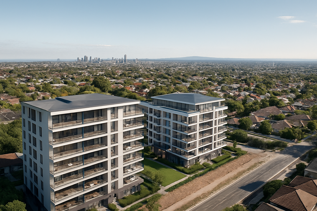
Drone surveying, mapping and reality capture services including LiDAR, photogrammetry, 3D modelling, Gaussian splatting, level views, aerial renders and high-accuracy site data capture.

Drone 3D mapping services using a DJI Inspire 3 to capture aerial photogrammetry over a major Australian construction project

Modern projects generate enormous amounts of spatial information.

Construction teams need accurate earthworks data. Engineers require detailed site models. Mining companies monitor stockpiles and excavation progress. Infrastructure projects demand accurate records of changing conditions throughout construction.

Professional drone 3D mapping services provide a fast, efficient and highly accurate way to capture that information.

Using advanced drone technology and photogrammetry, aerial imagery can be transformed into detailed three-dimensional models, orthomosaic maps and terrain data that support planning, engineering, construction and asset management.

Flying Glass provides professional drone 3D mapping services throughout Australia, supporting surveyors, engineers, construction companies, mining operations, government agencies and infrastructure organisations.

While we specialise in complex commercial drone operations, we also work alongside qualified specialist surveyors whenever survey-grade deliverables are required, combining advanced aviation capability with expert spatial data processing.

This collaborative approach allows clients to benefit from both disciplines.

The surveyor focuses on producing accurate spatial outputs, while Flying Glass manages the aviation component, including complex operational approvals, controlled airspace, challenging construction environments and difficult project locations.

Complex Mapping Projects Often Require Specialist Aviation Capability

Many drone mapping projects are undertaken on active construction sites, operating mines, transport corridors and major infrastructure projects where standard drone operations may not be suitable.

Flying Glass holds a CASA Operations Over or Near People (OONP) Instrument, allowing us to conduct eligible operations over or near people in accordance with the instrument and our approved procedures.

We have also invested in approved parachute recovery systems on suitable aircraft and have extensive experience obtaining operational approvals throughout Australia.

This means clients can undertake complex mapping projects with an experienced aerial partner capable of safely operating in environments where many drone operators cannot.

Drone 3D mapping services using a DJI Inspire 3 to capture aerial photogrammetry over a major Australian construction project

What Are Drone 3D Mapping Services?

Professional drone 3D mapping services use hundreds or even thousands of overlapping aerial photographs to generate highly detailed digital representations of the ground.

Specialist photogrammetry software analyses these images and reconstructs the project as accurate three-dimensional spatial data.

Depending on the client’s requirements, the resulting deliverables may include:

  • Orthomosaic maps.
  • Three-dimensional models.
  • Digital Surface Models (DSM).
  • Digital Terrain Models (DTM).
  • Dense point clouds.
  • Contour maps.
  • Stockpile volume calculations.
  • Earthworks progress.
  • Surface measurements.
  • High-resolution aerial imagery.

These outputs provide far more information than traditional aerial photography alone, allowing project teams to analyse sites with remarkable accuracy.

Industry Insight

One drone flight can often generate multiple valuable deliverables simultaneously. A single mapping mission may produce high-resolution photography for marketing, orthomosaic imagery for engineering teams, three-dimensional models for project managers and volume calculations for contractors.

Why Organisations Are Choosing Drone 3D Mapping

Traditional aerial surveying often relied on helicopters or fixed-wing aircraft.

While those platforms still play an important role on very large projects, professional drone 3D mapping services now provide a significantly more flexible and cost-effective solution for many commercial applications.

Drones can typically:

  • Mobilise quickly.
  • Capture extremely high-resolution imagery.
  • Fly repeatable flight paths.
  • Operate safely at lower altitudes.
  • Reduce mobilisation costs.
  • Improve project turnaround times.
  • Collect data more frequently.
  • Minimise disruption to ongoing site operations.

These advantages have made drone mapping an increasingly valuable tool across construction, mining, infrastructure, utilities and environmental projects throughout Australia.

Working With Qualified Surveyors

One of the biggest misconceptions surrounding drone mapping is that flying the drone and producing survey-grade spatial data require the same expertise.

In reality, they are two separate specialist disciplines.

Flying Glass specialises in professional commercial drone operations, particularly on complex projects involving controlled airspace, major infrastructure, construction sites and operational environments.

Where survey-grade deliverables are required, we partner with qualified specialist surveyors who process, verify and deliver the required spatial outputs.

This allows every member of the project team to focus on their area of expertise.

The result is an efficient workflow that combines advanced aviation capability with professional surveying knowledge, producing exceptional outcomes for clients.

Orthomosaic Mapping

One of the most common deliverables produced through professional drone 3D mapping services is an orthomosaic.

An orthomosaic is a highly detailed aerial map created by combining hundreds or thousands of overlapping photographs into a single, geometrically corrected image.

Unlike a standard aerial photograph, an orthomosaic is corrected for camera angle and terrain distortion, allowing accurate measurements to be taken directly from the imagery.

Orthomosaics are widely used across:

  • Construction projects.
  • Mining operations.
  • Infrastructure developments.
  • Environmental monitoring.
  • Utility corridors.
  • Road projects.
  • Rail projects.
  • Asset management.

Because they provide both visual detail and spatial accuracy, orthomosaics have become one of the most valuable mapping products available from modern drone technology.

Photogrammetry

Photogrammetry is the process that transforms aerial photographs into accurate three-dimensional information.

Professional drone 3D mapping services use carefully planned flight paths with significant image overlap, allowing specialist software to identify common points between photographs and reconstruct the site in three dimensions.

The resulting models provide valuable information for engineers, surveyors, project managers and asset owners, supporting planning and decision-making throughout the life of a project.

Because drone photogrammetry can be repeated regularly, organisations are also able to monitor changes over time using consistent datasets captured from identical flight plans.

Industry Insight

Accurate drone mapping is determined long before the software begins processing images. Careful flight planning, appropriate image overlap, consistent lighting and precise aircraft operation all contribute directly to the quality of the final deliverables.

Digital Surface Models and Digital Terrain Models

Professional drone 3D mapping services can generate a variety of terrain products depending on the requirements of the project.

Two of the most commonly requested are:

  • Digital Surface Models (DSM), which represent the visible surface including vegetation, buildings and other structures.
  • Digital Terrain Models (DTM), which represent the underlying ground surface after appropriate processing.

These models assist with planning, engineering design, drainage analysis, earthworks calculations and long-term project monitoring.

Depending on the project, they may also support visualisation, planning approvals and engineering design processes.

Construction and Earthworks

Construction projects are constantly changing.

Professional drone 3D mapping services provide project teams with an efficient way to monitor those changes using accurate, repeatable aerial data.

Applications commonly include:

  • Earthworks monitoring.
  • Bulk excavation.
  • Cut and fill analysis.
  • Site planning.
  • Construction progress.
  • Temporary works.
  • Stormwater planning.
  • Project documentation.

Because mapping flights can be repeated throughout construction, project teams gain an accurate visual record of how sites evolve over time while supporting engineering and project management decisions.

Stockpile Volume Calculations

Stockpile measurement is another common application for professional drone 3D mapping services.

By creating highly detailed three-dimensional models of stockpiles, specialist software can calculate material volumes far more efficiently than traditional manual methods.

Stockpile mapping is widely used across:

  • Mining.
  • Quarries.
  • Construction.
  • Waste facilities.
  • Recycling operations.
  • Bulk material storage.
  • Ports.
  • Industrial sites.

Frequent drone surveys also allow organisations to monitor inventory levels, track production and support operational planning throughout the year.

Infrastructure and Corridor Mapping

Many infrastructure projects extend across long distances.

Professional drone 3D mapping services provide an efficient way to capture detailed aerial information along roads, rail corridors, pipelines, transmission lines and utility easements.

By collecting consistent spatial data across large project areas, infrastructure organisations gain valuable information that supports planning, construction, inspections and long-term asset management.

Flying the Mission Is a Specialist Skill

Successful drone mapping requires more than processing software.

Many mapping projects involve controlled airspace, active construction sites, operating mines, transport corridors or other complex commercial environments.

Flying Glass specialises in safely conducting these challenging aerial operations, allowing qualified surveyors and spatial professionals to focus on producing accurate mapping deliverables.

By combining advanced aviation capability with experienced surveying partners, clients receive both professional drone operations and high-quality spatial outcomes.

Mining and Quarry Operations

Mining projects generate vast amounts of spatial information throughout exploration, production and rehabilitation.

Professional drone 3D mapping services help mining companies capture accurate aerial datasets that support operational planning, stockpile management, earthworks monitoring and environmental reporting.

The ability to safely collect detailed aerial data across large operational areas makes drone mapping an increasingly valuable tool throughout the mining industry.

Renewable Energy and Environmental Projects

Australia’s renewable energy sector continues to expand rapidly, creating increasing demand for accurate aerial mapping.

Professional drone 3D mapping services support the planning, construction and ongoing management of renewable energy projects by providing detailed spatial information across large sites.

Typical applications include:

  • Solar farms.
  • Wind farms.
  • Battery storage facilities.
  • Transmission corridors.
  • Environmental rehabilitation.
  • Vegetation monitoring.
  • Site planning.
  • Construction progress.

Repeat mapping throughout the life of a project provides valuable historical datasets that assist engineers, environmental consultants and asset owners with long-term decision-making.

Industry Insight

The greatest value of drone mapping often comes from consistency rather than a single survey. Capturing identical datasets at regular intervals allows organisations to accurately measure change, monitor progress and make better-informed project decisions over months or even years.

Planning Every Mapping Mission

High-quality mapping begins with careful planning.

Professional drone 3D mapping services require considerably more than simply launching a drone and taking photographs.

Every mapping mission is planned around the client’s required deliverables while considering the operational environment, airspace, weather conditions and project objectives.

Depending on the project, planning may include:

  • Flight planning.
  • Ground control planning where required.
  • Airspace assessments.
  • Operational approvals.
  • Weather monitoring.
  • Risk assessments.
  • Image overlap calculations.
  • Selection of the appropriate aircraft.
  • Coordination with surveyors and engineers.
  • Scheduling around active site operations.

This preparation helps ensure the collected imagery is suitable for producing reliable spatial outputs while allowing operations to be completed safely and efficiently.

Why Organisations Choose Flying Glass

Flying Glass combines advanced commercial aviation capability with extensive experience operating in some of Australia’s most complex commercial environments.

Rather than positioning ourselves as surveyors, we focus on delivering professional drone operations that enable high-quality mapping outcomes.

By partnering with qualified specialist surveyors where survey-grade deliverables are required, we provide clients with the best of both disciplines.

Clients choose Flying Glass because we provide:

  • More than 12 years of commercial drone operations.
  • More than 30 years of combined aviation experience.
  • Professional drone 3D mapping services throughout Australia.
  • Partnerships with qualified specialist surveyors.
  • Experience operating in controlled airspace.
  • Experience on major construction, mining and infrastructure projects.
  • A CASA ReOC.
  • A CASA Operations Over or Near People (OONP) Instrument.
  • Approved parachute recovery systems on suitable aircraft.
  • Nationwide availability throughout Australia.

Whether supporting construction, mining, engineering or infrastructure, our objective is to provide safe, professional aerial operations that produce outstanding mapping outcomes.

Frequently Asked Questions

What are drone 3D mapping services?

Drone 3D mapping services use overlapping aerial photographs captured by drones to generate accurate orthomosaic maps, three-dimensional models, point clouds and terrain models for engineering, construction, mining and infrastructure projects.

Can you produce survey-grade mapping?

Where survey-grade deliverables are required, Flying Glass works alongside qualified specialist surveyors. This combines professional drone operations with expert spatial processing and verification.

What industries use drone 3D mapping?

Construction, mining, infrastructure, engineering, utilities, renewable energy, environmental management, government and industrial organisations all benefit from professional drone mapping.

Do you travel throughout Australia?

Yes. Flying Glass provides professional drone 3D mapping services nationwide for projects across metropolitan, regional and remote Australia.

Can you work on active construction and infrastructure sites?

Absolutely. Flying Glass specialises in operating safely within complex commercial environments, including active construction sites, transport corridors, mines and major infrastructure projects, while working in accordance with applicable CASA requirements and site-specific operational procedures.

Partner With Flying Glass for Professional Drone 3D Mapping Services

Accurate spatial information leads to better project decisions.

Whether you’re managing a construction project, monitoring earthworks, mapping infrastructure, calculating stockpile volumes or supporting engineering design, Flying Glass delivers professional drone 3D mapping services backed by advanced aviation capability and extensive commercial experience.

By combining carefully planned drone operations with qualified specialist survey partners, we help organisations capture the accurate aerial data they need safely, efficiently and professionally.

Contact Flying Glass today to discuss your drone 3D mapping project anywhere in Australia.

Drone photogrammetry services across Australia for mapping, orthomosaics, point clouds, 3D models and measurable site data.

Turning aerial photographs into useful spatial information requires much more than simply flying over a site and taking pictures. Professional drone photogrammetry services use carefully planned overlapping aerial imagery to create measurable, high-resolution representations of sites, structures and terrain.

Flying Glass provides drone photogrammetry services across Australia for construction, infrastructure, mining, development, engineering, surveying support and other projects requiring accurate and repeatable aerial data capture.

Depending on the project requirements, photogrammetric datasets can be used to produce orthomosaic imagery, dense point clouds, 3D models, surface information, site measurements, volume calculations and detailed visual records of changing environments.

Photogrammetry forms part of our broader drone mapping services, with acquisition strategies designed around the required output rather than simply collecting as many photographs as possible.

Need Photogrammetry Data for a Project?

Send Flying Glass the site location, area, required outputs, accuracy expectations and intended use of the data. We can assess the drone photogrammetry services required and recommend an appropriate aerial capture strategy.

Discuss Your Photogrammetry Project

Drone photogrammetry services across Australia for mapping, orthomosaics, point clouds, 3D models and measurable site data.

What Are Drone Photogrammetry Services?

Drone photogrammetry services use a series of overlapping aerial photographs to reconstruct the geometry of a site or object.

Specialist software identifies common features across multiple photographs and uses the changing camera position to calculate their relative position in three-dimensional space. With appropriate flight planning, positioning data and processing, those photographs can be transformed into detailed spatial datasets rather than remaining a collection of individual images.

Typical photogrammetry outputs may include:

  • Orthomosaic imagery
  • Dense point clouds
  • 3D textured models
  • Digital surface information
  • Contour information where appropriate
  • Site measurements
  • Stockpile and material volumes
  • Progress datasets
  • High-resolution visual site records
  • Data suitable for integration into wider GIS, CAD or project workflows

The exact deliverables depend on the project brief, required accuracy, site conditions and how the information will ultimately be used.

High-Resolution Orthomosaic Mapping

One of the most common outputs from drone photogrammetry services is an orthomosaic.

An orthomosaic combines many overlapping aerial images into a single corrected image of the site. Unlike a normal aerial photograph, which contains perspective distortion, an appropriately produced orthomosaic provides a consistent overhead representation that can be used for viewing, planning and measurement within the limits of the dataset.

Orthomosaics can be useful for:

  • Construction site documentation
  • Engineering projects
  • Mine sites and quarries
  • Infrastructure corridors
  • Development sites
  • Environmental monitoring
  • Asset inventories
  • Site planning
  • Progress comparisons
  • Large-area visual records

Because the imagery is captured at much lower altitude than conventional aerial photography, drone-based acquisition can provide extremely detailed site imagery where operating conditions allow.

Drone Photogrammetry Point Clouds

Drone photogrammetry services can also generate dense point clouds representing visible surfaces across the captured area.

Each point contributes to a three-dimensional representation of the site, allowing terrain, structures, stockpiles and other visible features to be examined spatially rather than only as a flat image.

Point-cloud data can be particularly useful when a project team needs to understand:

  • Surface form
  • Site geometry
  • Earthworks
  • Stockpile shapes
  • Existing structures
  • Changes between capture dates
  • Construction progress
  • Terrain around infrastructure

Where vegetation penetration or detailed ground extraction beneath canopy is a key requirement, photogrammetry may not be the most appropriate technology. In those environments our LiDAR drone services may offer significant advantages.

3D Models and Reality Capture

Another major use of drone photogrammetry services is the creation of detailed three-dimensional models from aerial imagery.

These models can help project teams understand a site more intuitively than conventional photographs alone. Buildings, terrain, infrastructure and development sites can be viewed from multiple perspectives and incorporated into broader reality-capture workflows.

3D photogrammetry may support:

  • Development visualisation
  • Existing-condition documentation
  • Construction planning
  • Asset records
  • Engineering coordination
  • Heritage and archaeological documentation
  • Remote stakeholder review
  • Digital-twin and reality-capture workflows

Where a project requires highly realistic visual representation rather than primarily measurable mapping outputs, Flying Glass can also provide specialist Gaussian splatting drone capture as another form of advanced reality capture.

Drone Photogrammetry for Construction

Construction is one of the strongest applications for drone photogrammetry services because sites change continuously and project teams often need a repeatable record of those changes.

Photogrammetry can support construction teams with:

  • Existing-condition capture
  • Earthworks documentation
  • Site-wide orthomosaics
  • Stockpile volumes
  • Progress comparison
  • Site logistics planning
  • Visual records before areas are covered or changed
  • Coordination with engineering and project teams

Our broader construction drone services can combine mapping with aerial photography, video, inspections, level views and other project-specific capture throughout the development lifecycle.

For recurring projects, maintaining a consistent capture methodology can also make it easier to compare the site over time rather than producing unrelated datasets from each visit.

Where measurable site data needs to be accompanied by professional visual progress footage, our construction drone videography service can document the same project for stakeholder communications, milestones and marketing.

Drone Photogrammetry for Mining and Quarry Sites

Mine sites, quarries and large earthworks projects are well suited to drone photogrammetry services because aerial capture can efficiently document substantial areas and material volumes.

Potential applications include:

  • Stockpile measurement
  • Cut and fill monitoring
  • Pit and quarry documentation
  • Haul-road mapping
  • Site planning
  • Progress datasets
  • High-resolution site imagery
  • Asset and infrastructure context

Flying Glass’ broader mining drone services can combine mapping with inspection, LiDAR, visual documentation and specialist aerial operations for mine sites across Australia.

Infrastructure Photogrammetry

Infrastructure projects can involve large or difficult-to-access areas where consistent aerial data provides valuable context for engineering, construction and project teams.

Drone photogrammetry services may be used around:

  • Road projects
  • Rail corridors
  • Bridges
  • Utilities
  • Renewable-energy sites
  • Industrial facilities
  • Major civil works
  • Transport infrastructure

For projects requiring broader aerial capability across mapping, monitoring, inspection and visual documentation, see our infrastructure drone services.

Volumetric Measurement Using Drone Photogrammetry

Volume calculations are another common application of drone photogrammetry services.

By reconstructing the visible surface of a stockpile, excavation or material area, photogrammetric data can be used to estimate volumes against an appropriate reference surface.

This can support:

  • Stockpile management
  • Quarry operations
  • Construction materials
  • Earthworks monitoring
  • Waste and recycling sites
  • Bulk material reporting

The reliability of any measurement depends on the capture methodology, site geometry, ground visibility, positioning and processing approach. Where outputs are being relied on for surveying, contractual or engineering purposes, the required standards and professional responsibilities should be established before acquisition begins.

Photogrammetry and Drone Surveying

Photogrammetry is frequently used within surveying workflows, but the terms “photogrammetry” and “surveying” are not interchangeable.

Flying Glass provides professional aerial data acquisition and works alongside surveyors and other technical specialists where required. Our drone surveying services are designed to support professional survey workflows with specialist drone aviation and aerial capture capability.

For drone photogrammetry services intended to support survey-grade outcomes, the project should be planned around the required coordinate system, control methodology, accuracy and final deliverables from the outset.

Flying Glass does not treat a mapping flight as automatically equivalent to a cadastral or certified land survey. Where formal surveying certification is required, the appropriate qualified survey professional needs to be involved.

RTK, Positioning and Ground Control

The positioning strategy for drone photogrammetry services depends on the level of accuracy and repeatability required by the project.

Depending on the aircraft, workflow and brief, a project may involve:

  • RTK-enabled aerial capture
  • High-accuracy positioning workflows
  • Ground control points
  • Check points
  • Surveyor-provided site control
  • Known coordinate systems
  • Repeatable capture positions

Not every project requires the same level of control. A detailed construction visual record has different requirements from a dataset being incorporated into a professional engineering or survey workflow.

Understanding the intended use before flying allows the data-capture plan to be designed appropriately rather than discovering after the flight that critical control information was missing.

Drone Photogrammetry vs LiDAR

Photogrammetry and LiDAR are both valuable forms of aerial reality capture, but neither is universally better.

Drone photogrammetry services rely on visible imagery and can produce extremely detailed colour-rich models, orthomosaics and surface data. They are particularly effective where the subject is clearly visible and photographic detail is useful.

LiDAR actively measures distance using laser pulses and can offer advantages where projects involve vegetation, complex terrain or particular geometric capture requirements.

In simple terms:

  • Photogrammetry is often excellent for exposed surfaces, construction sites, stockpiles, structures and visually rich 3D capture.
  • LiDAR may be preferable where ground information beneath vegetation or specific geometric characteristics are more important.
  • Both technologies may be valuable on complex projects where visual and geometric datasets complement one another.

Flying Glass can discuss the intended deliverable before recommending whether photogrammetry, LiDAR or a combination of capture methods is most appropriate.

Vertical and Oblique Imagery for Photogrammetry

The flight pattern used for drone photogrammetry services should match the subject being reconstructed.

For terrain and large-area mapping, predominantly vertical imagery may provide the required coverage. For buildings, structures and complex three-dimensional subjects, oblique photographs can capture façades and geometry that are poorly represented from directly overhead.

Our experience in oblique and vertical aerial photography allows the capture strategy to be tailored around the required model rather than relying on a single generic grid flight.

Repeatable Photogrammetry for Progress Monitoring

One-off capture can establish detailed existing conditions, but repeated drone photogrammetry services can provide even greater value on long-running projects.

Repeat surveys may help teams compare:

  • Site development
  • Earthworks
  • Material movement
  • Construction progress
  • Changing access routes
  • Infrastructure installation
  • Environmental conditions

Where repeatability matters, flight planning, coordinate systems, capture area, camera settings and control methodology should remain as consistent as practical between visits.

Drone Photogrammetry Across Australia

Flying Glass provides drone photogrammetry services across metropolitan, regional and remote Australia.

Our crews can support projects throughout:

  • New South Wales
  • Victoria
  • Queensland
  • Western Australia
  • South Australia
  • Tasmania
  • Australian Capital Territory
  • Northern Territory
  • Regional and remote project locations

For multi-site projects, Flying Glass can also coordinate aerial capture across geographically distributed locations and draw on an established network of experienced drone professionals where appropriate.

Why Choose Flying Glass for Drone Photogrammetry Services?

Successful drone photogrammetry services depend on both the quality of the aerial capture and an understanding of how the resulting data will be used.

  • Professional commercial drone operations across Australia
  • Experience with mapping and reality capture for complex sites
  • RTK-capable aerial workflows where appropriate
  • Integration with survey professionals where formal surveying input is required
  • Photogrammetry and LiDAR capability allowing the capture method to suit the project
  • Construction, mining and infrastructure experience
  • Repeatable capture capability for ongoing projects
  • Australia-wide operations including regional and remote sites
  • Experienced aviation planning for controlled or complex operating environments
  • Project-specific capture planning based on required outputs rather than generic flights

Frequently Asked Questions About Drone Photogrammetry Services

What can drone photogrammetry produce?

Drone photogrammetry services can produce outputs including orthomosaic imagery, point clouds, 3D models, surface information, site measurements and volumetric data. The exact outputs depend on the capture and processing workflow.

How accurate is drone photogrammetry?

Accuracy depends on many factors including aircraft positioning, flight altitude, camera, image quality, overlap, ground control, site conditions and processing methodology. The required accuracy should be defined before the flight so the acquisition strategy can be designed accordingly.

Is drone photogrammetry the same as drone surveying?

No. Photogrammetry is a data-capture and reconstruction technique that can be used within a surveying workflow. Formal surveying outputs may require involvement from appropriately qualified survey professionals depending on the project and intended use.

Can you calculate stockpile volumes?

Yes. Drone photogrammetry services can support volumetric analysis of stockpiles, excavations and other visible material surfaces where the site and capture conditions are suitable.

Can photogrammetry create a 3D model?

Yes. Overlapping imagery can be processed into detailed three-dimensional representations of terrain, buildings, structures and other visible subjects.

Do you provide RTK drone photogrammetry?

RTK and other high-accuracy positioning methods can form part of the capture workflow where appropriate. The positioning and control strategy should be chosen around the accuracy and deliverable requirements of the project.

Should I use photogrammetry or LiDAR?

It depends on the project. Drone photogrammetry services are particularly useful where high-resolution visual information and exposed surface detail are important. LiDAR can have advantages around vegetation, terrain and certain geometric capture requirements. Some projects benefit from both.

Can you repeat the same mapping regularly?

Yes. Repeat photogrammetry can support construction, mining, infrastructure and other projects where changes need to be documented over time.

Do you provide drone photogrammetry outside Sydney?

Yes. Flying Glass provides drone photogrammetry services throughout Australia, including metropolitan, regional and remote project locations.

Discuss Your Drone Photogrammetry Project

If your project requires professional drone photogrammetry services, send Flying Glass the location, capture area, intended use of the data, required outputs and accuracy expectations.

We can assess the site, determine an appropriate aerial capture methodology and advise whether photogrammetry, LiDAR or another reality-capture approach is best suited to the project.

From construction sites and infrastructure projects to mining, stockpiles, engineering and large-area reality capture, Flying Glass provides the aerial expertise required to turn carefully planned imagery into useful spatial information.

Contact Flying Glass to discuss your drone photogrammetry project.

Professional drone surveying services using a commercial drone and qualified surveyor on a major Australian infrastructure project

Surveying projects are becoming larger, more complex and more time-sensitive than ever before. Whether planning a major infrastructure corridor, documenting a construction project, mapping a mine site or monitoring environmental change, organisations need accurate aerial data delivered efficiently, safely and professionally.

Professional drone surveying services have transformed the way spatial data is collected. Modern drone technology allows large areas to be captured quickly while producing highly detailed imagery suitable for mapping, modelling and analysis.

At Flying Glass, we provide specialist aerial data capture for projects throughout Australia. Rather than replacing qualified surveyors, we work alongside experienced surveying professionals, engineering consultancies and project teams to safely collect the aerial imagery and datasets required for high-quality survey outcomes.

Our strength lies in commercial drone operations.

Many surveying firms are experts in measurements, coordinate systems and spatial analysis. We bring the aviation expertise required to safely capture aerial data in some of Australia’s most operationally challenging environments.

From controlled airspace and busy construction sites to rail corridors, major infrastructure projects and complex urban environments, Flying Glass helps make projects possible where specialist aviation capability is just as important as surveying expertise.

Drone surveying is one specialist capability within Flying Glass’ broader drone mapping services, supporting orthomosaic capture, terrain modelling, 3D datasets and repeat aerial data collection for projects across Australia.

Complex Drone Surveying Services Require More Than Just a Drone

Many aerial survey projects take place in environments where simply owning a drone is not enough.

Operations may involve controlled airspace, construction sites, active rail corridors, major roads, ports, industrial facilities or locations where people remain nearby during data collection.

Flying Glass holds a CASA Operations Over or Near People (OONP) Instrument, allowing us to conduct eligible operations over or near people in accordance with the instrument and our approved procedures.

We have also invested in approved parachute recovery systems on suitable aircraft and regularly undertake projects requiring detailed aviation planning, operational approvals and complex risk assessments.

For surveying firms, engineering consultancies and infrastructure clients, this means working with an aerial acquisition partner capable of safely operating where many standard drone operators cannot.

Why Drone Surveying Services Are Changing Modern Surveying

Traditional surveying remains essential across countless industries, but aerial technology has fundamentally changed how information can be collected.

Instead of relying solely on ground crews to access every part of a site, drone surveying services allow vast areas to be documented efficiently while producing exceptionally detailed aerial imagery.

This provides project teams with valuable spatial information while significantly reducing the time required to collect data across large or difficult sites.

Professional aerial survey operations are now commonly used for:

  • Construction projects.
  • Transport infrastructure.
  • Mining operations.
  • Land development.
  • Industrial facilities.
  • Environmental monitoring.
  • Renewable energy projects.
  • Government infrastructure.
  • Utility corridors.
  • Large commercial developments.

As drone technology has evolved, aerial survey data has become an increasingly valuable component of planning, engineering and asset management across Australia.

Professional drone surveying services using a commercial drone and qualified surveyor on a major Australian infrastructure project

Surveying Expertise and Aviation Expertise Are Different Disciplines

One of the biggest misconceptions surrounding drone surveying is that operating a drone and undertaking a professional survey require exactly the same skill set.

In reality, they are two highly specialised disciplines.

Qualified surveyors bring expertise in:

  • Survey control.
  • Coordinate systems.
  • Spatial accuracy.
  • Geodesy.
  • Data validation.
  • Engineering requirements.
  • Boundary interpretation.
  • Survey deliverables.

Commercial drone operators, meanwhile, require expertise in:

  • CASA regulations.
  • Airspace approvals.
  • Operational risk management.
  • Aircraft selection.
  • Weather assessment.
  • Emergency procedures.
  • Flight planning.
  • Operations Over or Near People.

Flying Glass focuses on delivering that aviation expertise.

Rather than attempting to replace qualified surveyors, we work collaboratively with experienced survey professionals who process and interpret the collected information while we focus on safely acquiring exceptional aerial data.

The result is a stronger project team where every specialist contributes their own expertise.

Industry Insight

Many organisations assume drone surveying is simply another surveying tool. In reality, the success of many projects depends just as much on aviation planning as survey methodology. Airspace restrictions, operational approvals and site-specific risk management can often determine whether aerial data collection is possible at all.

Working Alongside Qualified Surveyors

Many of our projects begin with a surveying firm that already has an established relationship with the client.

Rather than attempting to replace that relationship, Flying Glass integrates into the existing project team by providing the aerial acquisition component of the survey.

This collaborative approach allows surveyors to focus on delivering accurate spatial outcomes while we manage the aviation component of the operation.

Together, we help deliver:

  • Efficient aerial data capture.
  • Safe commercial drone operations.
  • Professional flight planning.
  • Airspace approvals where required.
  • Consistent image quality.
  • Reliable repeat data collection.
  • High-quality datasets for processing.
  • Professional project coordination.

This partnership model provides significant value for engineering consultancies, developers, infrastructure managers and government organisations seeking a complete aerial survey solution.

A Smarter Alternative to Traditional Helicopter Surveying

Before commercial drones became widely available, many aerial surveys required helicopters or fixed-wing aircraft to capture large areas of land.

While those platforms remain appropriate for some very large-scale projects, advances in commercial drone technology have created an efficient alternative for many surveying applications.

Professional drone surveying services can often provide:

  • Lower mobilisation costs.
  • Higher image resolution.
  • Lower operating altitudes.
  • Greater flexibility.
  • Improved repeatability.
  • Reduced environmental impact.
  • Rapid deployment.
  • Detailed site coverage.

For many construction, infrastructure, mining and development projects, drones now offer an efficient way to collect high-quality aerial data without many of the costs traditionally associated with helicopter operations.

Because drones can be deployed quickly and revisit identical flight paths over time, they are particularly valuable for repeat surveys and long-term monitoring programs.

Planning Comes Before Flying

Successful drone surveying services begin long before the aircraft leaves the ground.

Every site presents its own operational challenges. Airspace restrictions, weather, nearby infrastructure, terrain, temporary obstacles and project-specific requirements all influence how aerial data should be collected.

At Flying Glass, every project begins with detailed operational planning to ensure data collection can be undertaken safely, efficiently and in accordance with Australian aviation regulations.

Depending on the project, this planning may include:

  • Site assessments.
  • Airspace reviews.
  • Operational approvals.
  • Risk assessments.
  • Weather evaluations.
  • Coordination with survey teams.
  • Coordination with principal contractors.
  • Selection of the most appropriate aircraft.

By investing time before the survey begins, projects are more likely to proceed efficiently, minimise delays and produce high-quality aerial datasets that support the broader objectives of the project team.

Applications for Professional Drone Surveying Services

Modern drone surveying services support an enormous range of industries. From major infrastructure projects through to land development and environmental monitoring, aerial data has become an essential decision-making tool for organisations across Australia.

Because drones can efficiently collect high-resolution imagery across large areas, they are increasingly being used wherever accurate, repeatable aerial information is required.

Flying Glass works alongside qualified surveyors and engineering professionals on projects including:

  • Major infrastructure.
  • Road and highway upgrades.
  • Rail corridors.
  • Commercial construction.
  • Residential subdivisions.
  • Mining operations.
  • Industrial facilities.
  • Renewable energy developments.
  • Government assets.
  • Environmental monitoring.

Every project is different, but the objective remains the same: safely collect reliable aerial data that supports informed decision-making.

For survey and engineering workflows that require image-based reality capture, our drone photogrammetry services can provide orthomosaics, point clouds, 3D models and other aerial datasets captured around the required project methodology.

Drone Surveying Services for Construction Projects

Construction is one of the industries that has embraced drone surveying more rapidly than almost any other.

Developers, builders and project managers increasingly rely on aerial data throughout every stage of a project, from initial site investigations through to practical completion.

Professional drone surveying services provide accurate, repeatable aerial imagery that supports:

  • Existing site documentation.
  • Earthworks monitoring.
  • Construction progress.
  • Volume calculations.
  • Site planning.
  • Infrastructure coordination.
  • Stakeholder reporting.
  • Project completion records.

Because drone flights can be repeated using consistent flight paths, project teams can build an accurate visual record throughout the life of a development.

Infrastructure and Transport Projects

Large infrastructure projects often extend for many kilometres and involve multiple stakeholders, contractors and government agencies.

Collecting reliable aerial data efficiently is critical for keeping projects moving.

Flying Glass supports infrastructure projects throughout Australia by providing specialist aerial acquisition services for qualified survey teams.

Typical projects include:

  • Road corridors.
  • Motorway upgrades.
  • Rail infrastructure.
  • Bridges.
  • Tunnels.
  • Ports.
  • Airports.
  • Utility corridors.
  • Water infrastructure.
  • Renewable energy facilities.

These environments frequently involve complex operational requirements that extend well beyond standard recreational drone operations.

Industry Insight

Infrastructure surveys often involve multiple approval authorities rather than a single client. Aviation approvals, site access, traffic management, rail operators, local councils and principal contractors may all need to be coordinated before aerial data collection can commence.

Mining and Resources

Mining operations present some of the largest and most demanding environments for drone surveying services.

Large open-cut mines, processing facilities, haul roads and stockpile areas all benefit from regular aerial data collection.

Working alongside qualified surveyors, Flying Glass supports mining projects by providing professional aerial acquisition across complex industrial environments.

For mine operators requiring broader aerial capability alongside survey acquisition, see our mining drone services, covering mapping, inspection, monitoring and specialist site operations.

Applications commonly include:

  • Site mapping.
  • Progress monitoring.
  • Infrastructure planning.
  • Stockpile surveys.
  • Environmental monitoring.
  • Haul road documentation.
  • Asset recording.
  • Project reporting.

Many mining operations are located in remote areas where efficient mobilisation and reliable equipment become particularly important.

Renewable Energy and Utility Corridors

Australia’s renewable energy sector continues to expand rapidly, creating increasing demand for professional aerial survey capability.

Wind farms, solar farms, battery projects and transmission infrastructure all require accurate spatial information throughout planning, construction and ongoing operation.

Professional drone surveying services provide an efficient way to collect consistent aerial datasets across these large sites while reducing the need for extensive ground access.

For solar farms, wind farms and associated energy projects, surveying and aerial data capture can form part of our wider renewable energy drone services across Australia.

Our aerial acquisition capability also supports utility corridor projects involving:

  • Transmission lines.
  • Substations.
  • Pipelines.
  • Water infrastructure.
  • Telecommunications.
  • Energy infrastructure.

Supporting Engineers and Infrastructure Consultants

Engineering consultancies often manage complex multidisciplinary projects involving planners, surveyors, environmental specialists and construction teams.

Professional aerial data collection provides an efficient way to give every stakeholder access to the same visual information.

Flying Glass regularly works alongside engineering teams by providing aerial acquisition services that integrate seamlessly into broader project workflows.

Rather than becoming another consultant to manage, we become part of the existing project team.

Working in Controlled Airspace

Some of Australia’s highest-value infrastructure projects are located within controlled airspace.

Major airports, capital cities, ports and transport corridors often sit inside controlled aviation environments where drone operations require significantly more planning than standard recreational flights.

This is where Flying Glass provides genuine value.

Our experience operating in complex airspace environments allows us to support projects that many operators simply cannot undertake.

We regularly work on projects requiring careful operational planning, aviation approvals and coordination with relevant stakeholders before flying begins.

Rail Corridors and Operational Infrastructure

Rail infrastructure presents unique operational challenges for aerial surveying.

Active rail corridors require careful planning, coordination with the relevant rail authority and an understanding of the operational risks associated with working around live transport infrastructure.

Flying Glass has significant experience supporting projects involving rail environments and understands the importance of integrating aviation planning into broader project delivery.

For broader rail applications beyond survey acquisition, our rail drone services support mapping, inspection, project documentation and complex aerial operations across rail environments.

For many surveying companies, these operational requirements can become a major barrier to undertaking aerial data collection.

Our role is to help remove that barrier.

Complex Approvals Are Often the Biggest Challenge

Some of the most valuable surveying projects take place where aviation approvals are anything but straightforward.

Busy construction sites, controlled airports, rail corridors, ports, CBDs and operational infrastructure frequently require significantly more planning than simply arriving with a drone.

Flying Glass specialises in commercial drone operations that require detailed aviation planning and coordination.

Our experience includes complex urban environments, controlled airspace, Operations Over or Near People and projects requiring close collaboration with multiple stakeholders before aerial data collection can begin.

For surveying companies, this means having an experienced aviation partner capable of helping deliver projects that might otherwise prove operationally difficult.

Consistent Data Collection Across Long-Term Projects

Many surveying projects continue for months or even years.

Whether supporting major construction, transport infrastructure or mining operations, consistency becomes just as important as image quality.

Flying Glass carefully plans repeat flights so aerial datasets can be captured using consistent methodologies wherever practical.

This repeatability provides surveyors with reliable aerial information while helping project teams monitor change over time with confidence.

Professional Equipment for Professional Outcomes

Every project has different technical requirements.

Aircraft selection depends on factors including site size, operational complexity, weather conditions, surrounding airspace and the specific requirements of the survey team.

Rather than relying on a one-size-fits-all approach, Flying Glass selects the most appropriate aircraft and operational methodology for each individual project.

This ensures aerial acquisition is carried out efficiently while delivering the high-quality imagery required for professional survey workflows.

What Do Drone Surveying Services Deliver?

One of the advantages of modern drone surveying services is the flexibility of the information that can be captured.

Depending on the objectives of the project and the requirements of the survey team, aerial data may support planning, engineering, construction, environmental management or long-term asset management.

Flying Glass works closely with qualified surveyors to ensure aerial data is collected in the format required for downstream processing and analysis.

Projects may involve the collection of:

  • High-resolution aerial photography.
  • Orthomosaic imagery.
  • Photogrammetric datasets.
  • Digital surface models.
  • Digital terrain models.
  • 3D point clouds.
  • 3D mesh models.
  • Contour mapping.
  • Volume calculations.
  • Progress imagery.

Where a project requires dense point-cloud capture or detailed terrain data beneath vegetation, Flying Glass can also provide LiDAR drone services as part of the aerial acquisition program.

By working alongside experienced survey professionals, clients receive aerial datasets that integrate seamlessly into existing surveying and engineering workflows.

Industry Insight

Successful aerial surveys rarely depend on the drone alone. Ground control, survey control networks, flight planning, environmental conditions and data processing all contribute to the quality of the final deliverables. The most successful projects occur when aviation specialists and survey professionals work together from the outset.

Repeat Surveys for Long-Term Monitoring

Many organisations require more than a single survey.

Construction projects evolve over many months, infrastructure assets require ongoing monitoring and mining operations continually change as works progress.

Professional drone surveying services make repeat aerial data collection practical, allowing project teams to compare changes over time using consistent flight planning and repeatable image capture.

Long-term monitoring programs commonly support:

  • Construction progress.
  • Earthworks.
  • Land development.
  • Environmental rehabilitation.
  • Infrastructure expansion.
  • Asset management.
  • Mining operations.
  • Renewable energy developments.

Because the aerial perspective remains consistent, project teams gain a far clearer understanding of how sites evolve throughout the life of a project.

Safety Is Built Into Every Operation

Professional drone surveying services are about much more than collecting data efficiently.

Every operation must be carefully planned to ensure aerial acquisition can be undertaken safely while meeting both aviation requirements and site-specific safety procedures.

Before every project, Flying Glass considers factors such as:

  • Site hazards.
  • Airspace restrictions.
  • Weather conditions.
  • Emergency procedures.
  • Ground risks.
  • Nearby infrastructure.
  • Worker movements.
  • Public access.
  • Aircraft selection.
  • Operational approvals.

Our objective is simple: complete efficient aerial data collection while maintaining the highest standards of operational safety and professionalism.

Choosing the Right Drone Surveying Partner

Not all providers of drone surveying services offer the same level of aviation capability.

When projects involve straightforward rural locations, many operators may be suitable.

However, projects located within controlled airspace, major construction sites, operational infrastructure or busy urban environments often require considerably greater aviation expertise.

Before selecting an aerial acquisition partner, it is worth asking:

  • Do they regularly undertake complex commercial operations?
  • Do they understand Australian aviation regulations?
  • Can they obtain operational approvals where required?
  • Do they have experience supporting qualified surveyors?
  • Can they work alongside engineering and infrastructure teams?
  • Do they understand controlled airspace?
  • Can they safely operate around active worksites?
  • Do they have appropriate insurances and approvals?

These questions often become particularly important on projects involving multiple stakeholders, strict deadlines and operationally challenging environments.

Why Organisations Choose Flying Glass

Flying Glass has built a reputation for delivering complex commercial drone operations across Australia.

While many people know us for our work in television, film and major events, that same aviation capability supports some of Australia’s most demanding engineering, infrastructure and surveying projects.

Clients choose Flying Glass because we offer:

  • More than 12 years of commercial drone operations.
  • More than 30 years of combined aviation experience.
  • Partnerships with qualified surveying professionals.
  • Specialist aerial acquisition capability.
  • Experience operating in controlled airspace.
  • Operations Over or Near People capability.
  • Approved parachute recovery systems on suitable aircraft.
  • Experience supporting infrastructure, construction and mining projects.
  • Nationwide operations throughout Australia.
  • Professional project planning and communication.

Our role is to provide the aviation expertise that allows survey teams to focus on delivering accurate spatial outcomes for their clients.

Frequently Asked Questions

Do you provide surveying services?

Flying Glass specialises in professional aerial data acquisition. Where survey deliverables are required, we work alongside qualified surveying professionals who undertake the surveying component of the project.

Can you work with our existing surveyor?

Absolutely. Many of our projects involve supporting an existing surveying company by providing the commercial drone operations required to collect high-quality aerial data.

Can you undertake projects in controlled airspace?

Yes. Flying Glass has extensive experience operating in complex airspace environments and managing the aviation planning required for challenging commercial projects.

Do you travel throughout Australia?

Yes. We regularly undertake projects nationwide for surveyors, engineers, developers, government agencies and infrastructure organisations.

Can drone surveying replace helicopter surveys?

For many projects, yes. Modern drone surveying services can often provide exceptionally detailed aerial data while reducing mobilisation costs and improving operational flexibility. The most appropriate solution will always depend on the size, location and objectives of the project.

Partner With Flying Glass for Professional Drone Surveying Services

Whether you’re a surveying company looking for a specialist drone operator, an engineering consultancy requiring aerial data collection, or a developer seeking a complete solution delivered alongside qualified surveyors, Flying Glass can help.

Our professional drone surveying services combine advanced aviation capability with experienced project planning, allowing us to safely capture high-quality aerial data across some of Australia’s most challenging operating environments.

From construction and infrastructure through to mining, renewable energy and major development projects, we help clients collect the aerial information they need while navigating the operational challenges that often come with complex commercial drone operations.

Contact Flying Glass today to discuss professional drone surveying services anywhere in Australia.

Cinematic drone flying over cliffs at sunrise capturing data for Gaussian Splatting 3D reconstruction.

If you have heard a cinematographer mention a gaussian splat when talking about drones, they are referring to a modern way to turn overlapping images into a realistic 3D scene that a viewer can explore from many angles.

Picture a drone orbiting a sandstone cliff at sunrise, gliding through a rainforest canopy, or circling a heritage building before dusk – each pass capturing light, texture and movement. Gaussian Splatting takes that imagery and turns it into an explorable 3D environment. Directors can navigate inside it, VFX artists can integrate CG seamlessly, and producers can visualise sets without moving a crew. This approach is reshaping aerial cinematography, digital twins and immersive brand experiences.

At Flying Glass, we use Gaussian Splatting for our film and TVC clients to blend high-end aerial cinematography with 3D reconstruction workflows. From capturing remote Australian landscapes to international productions, our team delivers cinematic-grade data tailored for post-production, virtual production and visual effects pipelines.

Cinematic drone flying over cliffs at sunrise capturing data for Gaussian Splatting 3D reconstruction.

What is Gaussian Splatting?

Gaussian Splatting (3DGS) is a next-generation 3D reconstruction method. Instead of building models from triangles or dense point clouds, it represents a scene as millions of semi-transparent ellipsoids — or “splats” — each carrying information about colour, position, and light. When rendered together, these splats form a smooth, photorealistic volume that reacts naturally to virtual lighting.

The result is a scene that can be viewed from any angle, allowing productions to reframe shots or explore environments virtually. For example, if a drone captured a windswept coastal headland, the director could later move a virtual camera through that reconstructed space to find the perfect composition — even months after filming.

The technology is part of a broader trend known as novel-view synthesis, where AI and mathematical modelling create new perspectives from real imagery. It’s redefining how aerial cinematography, photogrammetry, and virtual production intersect.

Drone Reality Capture and 3D Reconstruction

Gaussian Splatting sits within the growing field of drone reality capture, where high-resolution imagery and positional data combine to form digital replicas of real environments. Our work often involves UAV 3D reconstruction for cinematic storytelling, visual effects, and architectural visualisation.

For property development projects where the objective is to visualise an unbuilt building within its real-world surroundings, see our dedicated drone renders service.

By integrating GPS and RTK-enabled metadata, our drone flights can produce georeferenced drone scanning suitable for both artistic and analytical use. This makes the same dataset valuable for creative direction and technical validation. Whether building a digital twin of a coastal resort or reconstructing a film set for post-production, this hybrid approach ensures both accuracy and visual integrity.

Our aerial capture for digital twins has been used by tourism boards and brands to create explorable experiences that double as marketing assets — immersive, interactive, and cinematic.

High-End Drone Capture and Workflow

To make Gaussian Splatting work for cinema-level productions, every detail matters. Our fleet includes the DJI Inspire 3 (8K full-frame sensor with interchangeable lenses), Mavic 3 Pro Cine (5.1K Micro 4/3 sensor with ProRes support), and custom FPV drones built for dynamic movement. These systems capture the high dynamic range imagery needed for 3D reconstruction while maintaining the cinematic tone expected by directors of photography.

We design each aerial session for Gaussian Splatting from the outset: multi-orbit flights with 70–80% image overlap, fixed exposure settings, and RAW or D-Log profiles to maintain consistency. Light is our biggest variable, and we favour the golden hour or diffused conditions for balanced contrast and depth.

Post-production involves importing imagery into professional software such as DJI Terra, PIX4Dcloud, or Luma AI. These tools align and process imagery into dense volumetric datasets ready for rendering or VFX pipelines. We then colour balance and calibrate the scene, ensuring it matches on-set footage.

Example: For a luxury automotive TVC, we combined Inspire 3 and FPV footage across sunrise passes. Gaussian Splatting allowed the creative team to render additional angles in post, transforming a two-hour shoot into a full suite of cinematic options for the editor.

Drone Photogrammetry vs Gaussian Splatting

Many professionals are familiar with photogrammetry — stitching images into a detailed 3D mesh. While photogrammetry remains ideal for survey and engineering applications, Gaussian Splatting offers something different: cinematic realism. It reproduces light scattering, transparency, and fine textures like foliage or reflections that traditional mesh models often miss.

Where the priority is measurable geospatial data rather than cinematic reconstruction, our drone mapping services provide technical outputs such as orthomosaics, terrain models and point-cloud datasets for engineering, planning and project workflows.

For visual storytelling, splats are faster to generate, lighter to render, and more visually faithful. This balance of quality and speed makes it perfect for drone-based virtual environment creation where realism takes priority over exact measurement. In a production setting, the combination of both techniques can be powerful — photogrammetry for structure, splats for beauty.

As DroneSplat and similar research tools advance, the boundary between measurement and cinematic artistry continues to blur. Flying Glass operates across this frontier, offering clients both precision and creative freedom.

For projects where measurable mapping outputs such as orthomosaics, point clouds and conventional 3D models are required, see our dedicated drone photogrammetry services.

Drone Workflows for Virtual Production

Virtual production is where Gaussian Splatting truly shines. Drone data can be integrated directly into Unreal Engine or Unity environments, giving filmmakers a way to scout and light virtual sets based on real-world imagery. This bridges pre-production and post, saving time and increasing creative control.

Our drone workflows for virtual production involve on-location capture, near real-time processing, and rendering of the splat environment for LED stage use. This lets cinematographers adjust camera paths and lighting virtually before committing to a reshoot — a huge advantage for continuity and budget.

This is part of a broader movement towards real-time rendering from drone data. As GPUs become more powerful, splatted models can now be previewed interactively, transforming the way directors visualise aerial scenes.

Creative Applications and Case Studies

We’ve applied Gaussian Splatting across diverse settings — from film sets in remote desert landscapes to global brand campaigns and tourism content. One recent project involved creating a 3D twin of an island resort for an international travel company. Using georeferenced drone scanning, we built an interactive model allowing virtual fly-throughs of beaches, villas, and coral reefs. The model doubled as both a cinematic backdrop and a digital marketing tool.

Another example comes from a feature production where we reconstructed a rainforest gully captured by FPV and Inspire 3 drones. The splatted scene became a living digital set for additional plate work, letting the director design fluid transitions between aerial and ground footage in post.

These hybrid workflows illustrate why immersive aerial cinematography is becoming a defining element of modern production — merging creative vision with real-world physics.

The Future of Drone-Based 3D Capture

The pace of change is rapid. Research teams are now exploring on-board AI that performs Gaussian Splatting live during flight, effectively turning drones into autonomous 3D scanners. Combined with edge computing, this could mean directors reviewing splatted environments within minutes of landing the aircraft.

For Flying Glass, the focus is on integration — connecting drone-based virtual environment creation directly with post-production workflows. Our goal is to give producers immediate, cinematic-quality assets that are ready for compositing or virtual lighting.

As machine learning optimises reconstruction and denoising, Gaussian Splatting will continue to expand beyond creative use into practical fields like construction, heritage documentation and environmental monitoring — blurring the line between art and data.

Working with Flying Glass

Flying Glass is a CASA-certified aerial drone cinematography services company with a global footprint. We specialise in film, TV and commercial productions, combining decades of aviation expertise with creative storytelling. Our work spans from Australia to international shoots, supporting directors, DPs and VFX teams with reliable, cinematic aerial capture.

We manage everything — from flight permissions and multi-drone coordination to colour pipeline and delivery. Our experience with UAV 3D reconstruction, drone reality capture and Gaussian Splatting makes us a trusted partner for studios wanting both artistry and accuracy.

Contact Flying Glass to discuss Gaussian Splatting for your next production

Key Takeaways

  • Gaussian Splatting turns drone imagery into volumetric 3D environments that preserve cinematic realism.
  • It complements photogrammetry, offering faster rendering and higher visual fidelity for creative work.
  • Drone-based reality capture supports digital twins, virtual production, and immersive storytelling.
  • High-end drones and disciplined workflows ensure consistency, accuracy, and flexibility in post.
  • Flying Glass delivers global drone cinematography and 3D reconstruction services trusted by film and TV professionals.

Gaussian Splatting is redefining what’s possible with aerial storytelling. With Flying Glass, productions can bridge the gap between the real and the virtual, transforming drone footage into immersive, cinematic experiences.

What is the Difference Between Oblique and Vertical Aerial Photography?

Aerial photography plays a vital role in many industries, including real estate, construction, surveying, and cinematography. But when discussing drone-based aerial imagery, a key question often arises: what is the difference between oblique and vertical aerial photography? This blog post explores the definitions, applications, benefits, and limitations of both, helping you determine which style is best for your next drone project in Australia.

Definitions: Oblique vs Vertical Aerial Photography

To understand the distinction, we must first define the terms:

  • Vertical Aerial Photography: Captured with the camera pointed straight down at a 90-degree angle to the ground. This is also called nadir photography.
  • Oblique Aerial Photography: Captured with the camera angled diagonally, typically between 30 to 60 degrees from vertical, allowing the horizon and sides of objects to be visible.

What Is an Oblique Aerial Photograph?

An oblique aerial photograph is taken at an angle, rather than straight down. This style is used frequently in real estate, tourism, marketing, and cinematography because it provides depth and context. You can see buildings in relation to their surroundings, as well as the elevation and three-dimensional structure.

There are two types of oblique aerial photographs: low oblique and high oblique. Low oblique images do not show the horizon, while high oblique ones include the horizon line and a larger field of view. Drones can capture both types depending on the altitude and angle of the camera, offering flexibility for a variety of creative and practical purposes.

What Are the Advantages of Oblique View?

  • More visually appealing, especially for marketing purposes
  • Shows scale and height better than vertical photos
  • Can capture the horizon and background landscape
  • Ideal for storytelling and cinematic use
  • Allows clients to better visualise space and surroundings

What Are the Disadvantages of Oblique Aerial Photographs?

  • More distortion, especially towards the edges of the image
  • Not ideal for precise measurements or mapping
  • Can include unwanted elements like distant clutter or shadows
  • Harder to geo-reference or stitch together in software
  • May be less useful for scientific analysis or regulatory submissions

How Can You Tell if an Aerial Photograph Is Vertical?

Vertical aerial photographs appear flat, with objects maintaining their true scale and shape. They look like a satellite image or map, with no visible horizon or sides of structures. A vertical photo taken from a drone at height will show rooftops and roads without perspective distortion.

You can identify a vertical image by the uniform geometry and consistent scale across the image. These photos are commonly used in topographical analysis, cartography, and in creating orthophotos used for precise digital mapping.

What Are the Advantages of Vertical Aerial Photography?

  • Ideal for mapping and measurement
  • Minimal distortion makes it suitable for analysis
  • Used in surveying, planning, and orthophoto generation
  • Allows accurate overlays with GIS or CAD tools
  • Efficient for large-scale inspections and progress monitoring

For infrastructure, engineering and development projects requiring professional aerial acquisition for surveying workflows, see our drone surveying services across Australia.

What Are the Three Features of Vertical Aerial Photography?

  1. Camera faces directly downward (90 degrees)
  2. No visible horizon or background landscape
  3. Used for measurement, mapping, and scientific data collection

What Is the Difference Between a Vertical Aerial Photograph and Oblique Aerial Photograph?

The primary difference lies in the camera angle. Vertical photographs are taken from directly overhead, resulting in a map-like view. Oblique photographs are taken from an angle, capturing the sides and façade of objects. Each has its own strengths and applications, depending on the project goals.

Oblique images often offer a more immersive feel, perfect for marketing or storytelling, whereas vertical images provide structured, technical data for planning and analysis. At Flying Glass, we guide our clients to choose the most effective method – or a combination of both – based on their intended use.

What is the Difference Between Oblique and Vertical Aerial Photography?

What Is the Difference Between a Vertical Aerial Photograph and an Orthophoto?

While both are captured from a vertical perspective, a vertical aerial photograph is a raw image. An orthophoto has been geometrically corrected (orthorectified) to remove distortion and ensure uniform scale across the entire image. Orthophotos are used in precise applications such as GIS mapping, environmental monitoring, and urban planning.

Orthorectification involves aligning vertical photos with topographic data to create a consistent scale, correcting for terrain variation and lens distortion. This process turns standard drone imagery into valuable scientific tools.

Applications of Vertical vs Oblique Aerial Photography

Application Vertical Photography Oblique Photography
Real Estate Useful for site overview Excellent for promotional shots
Surveying Highly accurate Rarely used
Film & TV Occasional scene establishment Common for dynamic angles
Construction Monitoring Used for site measurements Used for stakeholder presentations
Mapping & GIS Primary method Not suitable
Tourism Promotion Limited use Preferred for visual impact
Environmental Studies Best for area comparisons Used for showing terrain and vegetation

Which Style Does Flying Glass Use?

At Flying Glass, we use both vertical and oblique aerial photography depending on the needs of the client. For example, in a property development shoot, we might capture vertical imagery for planning and mapping, then switch to oblique angles to create dynamic marketing visuals. Our experienced drone operators and high-end camera gear allow us to offer stunning imagery across both styles.

For commercial projects where high-quality still imagery is the primary objective, our drone photography services provide professional aerial photography for property, tourism, construction, infrastructure, advertising and major events.

In recent cinematography work, we have combined these techniques using FPV drones for dramatic movement while maintaining strict geometric framing for consistency. This approach is especially effective in architectural filming, combining precision with creativity.

Final Thoughts: Choosing the Right Aerial Perspective

If you’re trying to decide whether to use vertical or oblique imagery for your drone project, consider your end goal. Do you need accurate data for planning? Go vertical. Are you looking to wow an audience with visual impact? Oblique is your answer. Of course, a combination of both often delivers the most value.

If you’re unsure, contact us and we’ll help you choose the right solution based on your needs. With offices in Sydney and operators across Australia, Flying Glass is trusted for high-quality drone cinematography and aerial imagery. We understand the science behind vertical photography and the art behind oblique shots – and we use both to tell your story with clarity and creativity.

Why is drone technology useful for archaeologists capturing aerial site data

Drone technology has rapidly transformed the way archaeologists approach excavation, surveying, and site documentation. These tools offer high-resolution aerial perspectives, speed up traditional processes, and reduce site disturbance. In this article, we’ll explore Why is drone technology useful for archaeologists, and how it intersects with related disciplines like geology and geographic research.

The Evolution of Archaeological Surveying

For decades, archaeologists relied on traditional tools like trowels, maps, and hand-drawn illustrations. While these methods remain valuable, they’re limited in terms of scale and accuracy. The introduction of drones — or Remotely Piloted Aircraft (RPA) — has opened new opportunities for capturing detailed site data without physically disturbing fragile areas.

The use of LiDAR-equipped drones allows archaeologists to scan beneath vegetation, detecting buried structures that would otherwise go unnoticed. This is particularly useful in dense forested areas like Mesoamerica, where entire cities have been uncovered through aerial LiDAR scans.

This alone demonstrates Why is drone technology useful for archaeologists working across varied terrain and fragile environments.

What Is the Usefulness of Aerial Photography for Archaeology?

Aerial photography has long been used in archaeological work, but drones make it accessible, affordable, and far more detailed. High-resolution orthomosaic images can be stitched together to form detailed site maps, allowing archaeologists to assess the terrain, layout, and changes over time.

The usefulness of aerial photography for archaeology lies in its ability to document large areas quickly and in high detail. Structures, trenches, and landscape features can be measured and analysed with photogrammetry, enhancing interpretation and planning.

In practice, this means archaeologists can maintain a visual record of each excavation phase. These images can be used to compare seasonal changes, track erosion, or observe vegetation growth that may indicate buried ruins. In underwater archaeology, drones can help pinpoint shoreline patterns and ancient harbour remnants when paired with coastal data.

Drone Mapping and 3D Modelling

Through drone mapping services, archaeologists can generate accurate 3D models of dig sites. These models are vital for preserving cultural heritage digitally, especially in locations at risk from development, erosion, or conflict. By recording detailed spatial data, researchers can revisit a site virtually for further analysis or comparison years after the fieldwork concludes.

3D models created from drone photogrammetry allow for virtual tours, which can be shared with scholars, students, and the public. These digital assets also reduce the need for re-excavation, since they preserve the site’s condition at each excavation layer. Drones thus support both educational outreach and scholarly analysis.

If you’re still wondering Why is drone technology useful for archaeologists, the ability to generate lasting digital records is one of its most powerful contributions.

What Is the Main Advantage of Using Aerial Photographs in Geographic Research?

Aerial photographs offer an unparalleled top-down view of landscapes. In geographic research, this visibility provides spatial context that’s difficult to perceive from the ground. What is the main advantage of using aerial photographs in geographic research? It’s the ability to analyse large-scale terrain patterns, detect anomalies, and identify relationships between natural and human-made features.

For archaeologists, this becomes even more powerful when assessing ancient trade routes, settlement patterns, and environmental interactions. Drones give researchers immediate access to these images, often within hours of the flight. Aerial views can also highlight soil discolouration, vegetation differences, or surface undulations indicating buried structures.

Additionally, drones can capture multi-spectral and thermal imagery, which provides further insights into landscape changes. For instance, thermal sensors may reveal underground walls due to heat retention differences in the soil. Such imagery supports a broader interdisciplinary understanding, particularly when collaborating with geographers or ecologists.

Why is drone technology useful for archaeologists Working in Remote Areas

Drones excel in remote, hazardous, or hard-to-access sites — one key reason Why is drone technology useful for archaeologists conducting fieldwork in isolated regions. Unlike ground crews that require days to hike into rugged locations, drones can be deployed in minutes and fly above inaccessible terrain. Whether it’s desert ruins or mountaintop petroglyphs, drones provide a safe, efficient way to record data without endangering human crews.

The use of drones in archaeology has been particularly effective in parts of the Australian outback, where heat and isolation make traditional fieldwork slow and challenging. Drones mitigate these issues while providing superior data collection.

Battery-powered and highly portable, drones also require less logistical support. Researchers can carry a drone in a backpack and launch it from virtually anywhere, reducing transportation costs and field crew sizes. This mobility allows for fast-paced exploration and real-time decision-making in the field.

How Do Drones Help Geologists and Archaeologists Alike?

Geologists and archaeologists often work side by side. Geologists study soil composition, erosion, and sedimentation — all vital factors in archaeological interpretation. So, how do drones help geologists? By providing elevation models, thermal imagery, and surface structure analysis, drones assist in geological mapping which in turn aids archaeologists in dating and understanding a site’s context.

From tracking landslides near cliffside settlements to assessing ancient irrigation systems, drones bridge the two fields through shared visual and spatial data. For example, in desert regions, geologists may use drones to study sediment build-up patterns around ruins, offering clues about environmental shifts that influenced site abandonment. By offering unified spatial data, drones illustrate Why is drone technology useful for archaeologists and geologists working in tandem.

LiDAR: Seeing What the Eye Cannot

One of the most transformative technologies for archaeologists is Light Detection and Ranging (LiDAR). This active sensing method sends laser pulses from the drone to the ground, penetrating vegetation and measuring distances based on light reflection. The result? Precise elevation models that expose features invisible to standard cameras.

When used in conjunction with photogrammetry, LiDAR data reveals subsurface structures, sunken roads, or long-lost settlements. If you’re interested in deeper applications, read more about our LiDAR drone services across Australia.

Even in urban settings, LiDAR can help identify foundational layers of ancient cities beneath modern development. This makes it a critical tool not only for discovery but also for heritage conservation planning in areas undergoing construction or redevelopment.

What Archaeologists Need to Know Before Flying

Australia’s Civil Aviation Safety Authority (CASA) requires licences for drone operations used commercially, including archaeology. Archaeologists looking to fly RPAs on digs may need training or partnership with licensed operators. Our team can help you become a certified drone surveyor or work alongside your research team to handle compliant flights.

If your research project requires professional aerial data capture rather than building an in-house drone capability, Flying Glass can also support project teams through our drone surveying services, working alongside qualified surveying and specialist consultants where required.

Operating drones near heritage sites may also require separate permits from state or territory cultural heritage bodies. Flying Glass can advise on the regulatory landscape, including safe flying procedures, equipment choices, and insurance considerations for archaeological applications.

Case Studies: Drones in Archaeology

To better understand Why is drone technology useful for archaeologists, these real-world case studies highlight its diverse applications.

1. Ancient Aboriginal Sites: In northern Australia, archaeologists have used drones to map Aboriginal rock art and sacred landscapes, enabling respectful distance while still gathering high-resolution data.

2. Roman Roads in Europe: Drones have helped trace and document Roman infrastructure through rural areas, revealing patterns in construction and settlement alignment that weren’t clear from the ground.

3. Maya Ruins in Central America: Drone-mounted LiDAR was responsible for uncovering thousands of previously unknown Maya structures, proving that ancient cities were far more densely populated than previously thought.

4. Middle Eastern Fortifications: In conflict zones like Syria and Iraq, drones have been used to document threatened heritage sites from a safe distance, preserving records even as the sites themselves face destruction.

why is drone technology useful for archaeologists capturing aerial site data

Drone Limitations in Archaeology

Despite their benefits, drones are not without limitations. Weather can ground flights, legal restrictions can complicate usage, and in some regions, cultural or privacy concerns may prevent drone deployment. It’s essential to consult local guidelines and partner with experienced drone pilots for best outcomes.

Other technical limitations include battery life, payload capacity, and signal interference in dense environments. However, continued improvements in drone design are steadily overcoming these challenges. For example, hybrid drones with extended flight times are emerging as a solution for large-scale archaeological sites.

Future of Drone Technology in Archaeology

As drone technology evolves, archaeologists can expect even more integration with artificial intelligence and machine learning. Automated image classification, predictive mapping of likely dig sites, and instant 3D rendering will soon become standard tools. Drones may also play a role in live broadcasting excavations to remote classrooms or stakeholders across the globe.

New sensor types, including ground-penetrating radar and hyperspectral cameras, are being miniaturised for drone use. This expands the range of data that can be collected from the air, allowing archaeologists to detect mineral traces, organic residues, and other subtle clues.

Final Thoughts

Why is drone technology useful for archaeologists? The answer lies in its versatility, efficiency, and accuracy. Whether mapping vast desert settlements or delicately documenting rock art from above, drones allow researchers to do more, faster, and with less impact. Their role in archaeology is only growing, unlocking mysteries of the past from a whole new perspective.

Interested in flying drones legally for archaeology or research? Our RePL training program gives you the skills and certification needed to operate professionally in Australia.

Ready to explore how drones can support your next archaeological or research project? Contact Flying Glass to learn more about our aerial services across Australia.

Drone Mapping Services Australia

In recent years, drone mapping services have revolutionised the way businesses capture, analyse and interpret spatial data. At Flying Glass, we provide professional drone mapping services to clients throughout Australia, with experienced operators delivering exceptional results in a fraction of the time of traditional surveying methods. Whether you’re managing a construction project, agricultural property, or mining site, our drones provide a smarter, safer and more cost-effective solution.

The benefits of drone mapping are numerous: reduced on-site time, improved data accuracy, safer data collection in hazardous areas, and access to detailed outputs such as 3D terrain models and orthomosaics. By leveraging aerial technology, you gain insights faster, improve operational planning, and significantly reduce manual survey labour. It’s no surprise that drone mapping is quickly becoming standard practice across many industries.

Drone mapping is one specialist capability within Flying Glass’ broader commercial drone services, supporting construction, infrastructure, mining, industrial, environmental and development projects throughout Australia.

Where project teams also need visual progress content alongside spatial data, Flying Glass provides construction drone videography for recurring site documentation, stakeholder updates and project marketing.

What Are Drone Mapping Services?

Drone mapping services involve the collection of high-resolution aerial imagery, which is then processed using specialised software to generate maps, models, and analytics. Our drones are equipped with state-of-the-art cameras and sensors, capable of capturing data from hundreds of hectares in a single flight. Outputs include:

  • 2D orthomosaic maps
  • 3D models and digital elevation models (DEMs)
  • Topographic maps and contour lines
  • Volumetric measurements for stockpiles and excavation
  • Thermal and multispectral imagery for specialised applications

All data is processed using industry-leading photogrammetry tools, ensuring precision and consistency across every deliverable. We can also integrate data into CAD or GIS platforms for your existing workflow, making it ideal for engineers, architects, and environmental consultants.

Where a project requires photorealistic 3D visualisation rather than survey-focused spatial outputs, Flying Glass also provides Gaussian Splatting drone capture for immersive reality-capture and virtual-production workflows.

Where high-resolution overlapping imagery is used to create orthomosaics, point clouds, 3D models and measurable surface data, Flying Glass provides dedicated drone photogrammetry services for projects across Australia.

Drone Surveying in Australia

When it comes to drone surveying Australia, Flying Glass sets the benchmark. Our drone pilots are CASA-licensed and experienced in navigating a range of site conditions, from remote outback mines to dense urban environments. We tailor each flight plan according to client needs and ensure regulatory compliance at all stages.

For projects requiring specialist aerial acquisition delivered alongside qualified surveying professionals, explore our dedicated drone surveying services.

Beyond the flight, our post-processing workflows are built for accuracy. From GCP calibration to 3D reconstruction, every dataset is validated before delivery. Many clients use our maps to compare against CAD plans, inform project design, or provide updates to stakeholders. Whether you need to monitor a construction site weekly or map 500 hectares of farmland, we have the tools and expertise to assist.

Interested in becoming a drone mapping professional? We’ve outlined the pathway to becoming a drone surveyor in our comprehensive guide, including licence requirements and career prospects.

How Accurate Is Drone Mapping?

Accuracy is a critical factor in drone surveying. So how accurate is drone mapping? With the right equipment and setup, drone maps can achieve ground sample distances (GSD) as fine as 2–3 centimetres. Using RTK (Real-Time Kinematic) or PPK (Post-Processing Kinematic) positioning systems, we ensure sub-5cm horizontal and vertical accuracy when properly calibrated with GCPs.

This level of accuracy is more than sufficient for most engineering, construction, and environmental planning needs. For ultra-precise applications such as vegetation penetration or geological analysis, we offer specialised LiDAR mapping which provides even higher resolution 3D point clouds, including data beneath the tree canopy.

How Much Does Drone Mapping Cost?

How much does drone mapping cost? The answer depends on your project’s location, size, and required outputs. Small projects such as mapping a construction block may start from $800–$1,200. Larger sites or projects requiring advanced sensors (like thermal or LiDAR) may range from $2,000 to $10,000+.

We provide transparent, itemised quotes based on the deliverables needed, which may include:

  • Flight planning and CASA approvals
  • GCP placement and verification
  • Data acquisition (standard or RTK)
  • Processing (2D, 3D, point clouds, elevation, thermal)
  • Reporting, GIS integration or post-analysis

Our team will work with you to ensure the final deliverables are both cost-effective and tailored to your site’s requirements.

Drone Mapping Services NSW and Brisbane

We offer drone mapping services NSW and drone mapping services Brisbane to a broad range of industries. In NSW, we serve clients from Sydney and Wollongong through to the Central West and Northern Rivers. In Brisbane, our work spans civil infrastructure, agriculture, and government clients throughout Southeast Queensland.

Each region presents unique terrain, vegetation, and environmental factors. Our local expertise allows us to plan efficient flights while complying with restricted zones and airspace regulations. Whether you’re based in metro or regional Australia, we offer responsive scheduling and dependable delivery timeframes.

Drone Mapping Australia: Use Cases

The utility of drone mapping Australia goes far beyond pretty pictures. Some of the most impactful use cases include:

    • Floodplain assessment: Rapid mapping after natural disasters to support emergency response and risk analysis
    • Infrastructure planning: Surveying corridors for roads, pipelines, or utilities, reducing field survey time dramatically
    • Vegetation mapping: Monitoring regrowth, weed management, or land clearing compliance
    • Mining operations: Regular volumetric updates for stockpiles and excavation sites
    • Environmental baseline surveys: Supporting biodiversity audits or pre-development assessments

For mining, infrastructure, energy and other asset-intensive sectors, mapping can form part of a much broader aerial program. Explore Flying Glass’ industrial drone services in Australia for inspection, LiDAR, monitoring and advanced operational capability.

Is a Drone Survey Worth It?

If you’re still asking, is a drone survey worth it?, consider this: traditional ground surveys can take days, require multiple personnel, and pose safety risks in complex terrain. In contrast, drone surveys can cover vast areas in hours, generate detailed maps without entering hazardous zones, and provide visual context to go with your numerical data.

Drone surveys are also easier to repeat — making them ideal for change detection over time. From a financial standpoint, clients consistently report reduced costs in labour, equipment and time. If you’re seeking clarity, safety, and efficiency, drone surveys offer excellent return on investment.

How Much Does a Drone Survey Cost?

Wondering how much does a drone survey cost? For a basic 5–10 hectare property, costs range between $1,000 and $1,500 including a detailed orthophoto. Add-ons such as DEMs, 3D mesh, GCP processing, or CAD overlays may raise this to $2,000 or more depending on complexity and required precision.

We also offer volume discounts for repeat surveys or scheduled projects across multiple sites. Our clients include developers, architects, project managers, and councils — all of whom rely on our data to keep their workflows efficient and compliant.

Drone Mapping Services Cost Breakdown

To further explain drone mapping services cost, here’s a more detailed look at common line items in our quotes:

  • Site visit & CASA approvals: May be required for operations near airports or populated areas
  • GCP setup: Used to enhance accuracy and ground-truth results
  • Flight time: Typically charged per hour or per area
  • Processing: Time and software used to generate outputs and QA checks
  • Data delivery: Transfer, cloud hosting or integration into your platform

We’re always happy to review your project brief and provide a custom quote with no obligation.

Drone Mapping Services Australia

How Long Does a Drone Survey Take?

For those wondering how long does a drone survey take? the answer depends on size, complexity, and weather. For a small urban block, the flight can be completed in under an hour. For large properties or infrastructure corridors, data capture may take a full day.

Post-processing typically requires 1–3 business days. Complex deliverables like multi-layer maps or 3D reconstructions may take longer, but we’ll always confirm your timeline up front. We also offer priority turnarounds where possible.

Best Drone Mapping Services in Australia

At Flying Glass, we’re proud to be recognised among the best drone mapping services providers in Australia. Our team blends aviation expertise with data precision and a cinematographer’s eye. That means better framing, clearer data, and outputs that are both technically sound and presentation-ready.

We are trusted by infrastructure giants, local councils, real estate developers and production companies. From urban development to coastal erosion studies, we bring a depth of experience and a commitment to excellence that sets us apart.

Drone Mapping Services Near Me

If you’re searching for drone mapping services near me, Flying Glass has operators throughout New South Wales, Victoria, SA and Queensland — with national deployment options available. We bring local insight to every region we work in, from wind farms to wetlands.

We understand local council regulations, airspace restrictions and environmental factors, ensuring your job is delivered legally and smoothly. Even in regional and remote areas, our team can travel and set up with minimal lead time.

For solar, wind and energy infrastructure projects, our mapping capability can also form part of Flying Glass’ broader drone services for renewable energy, including inspection, thermal imaging, site monitoring and construction documentation.

Get in Touch

Ready to elevate your project with precision drone mapping? Contact Flying Glass today for a free consultation and discover why our clients return again and again. From land surveys to 3D models, our drone mapping services are built to suit your industry, timeline, and budget.

Aerial photo used for drone renders of a high-rise development with cityscape backdrop in Sydney Australia

In today’s competitive property and construction market, high-quality visuals aren’t just a nice-to-have – they’re a critical sales tool. Drone renders are becoming a game-changer for developers, architects, visualisation studios, and marketing agencies across Australia. At Flying Glass, we deliver ultra-accurate drone imagery to support photomontage, CGI compositing, and 3D visualisations that help your audience picture your future development with absolute clarity.

Drone renders form part of Flying Glass’ broader construction drone services, supporting developers and project teams from pre-construction visualisation and level views through to progress capture, mapping and completed-project imagery.

What Are Drone Renders?

Drone renders combine high-resolution aerial photography with computer-generated images (CGIs) of proposed developments. This integration places your unbuilt structure directly into the real-world environment it will one day occupy. Whether it’s a new apartment block, commercial precinct, or luxury home, drone renders showcase exactly how your project will appear from any angle or elevation. Clients across Sydney and Australia use drone renders for:

  • Pre-sales and off-the-plan marketing
  • Development Application (DA) submissions
  • Investor presentations
  • Stakeholder engagement
  • Sun shadow and viewline analysis

Why Drone Captured Renders Matter

Most renders fall flat when they don’t match the real-life context. Our drone survey imagery is captured at exact floor heights, using approved flight plans and precise GPS locking, ensuring your 3D model integrates perfectly with the surrounding landscape.

Benefits of Drone Renders for Your Project

  • Authentic Visual Context: Showcase actual viewlines and outlooks from Level 3, 10, 18 and beyond.
  • Faster Approvals: Council DAs and town planners are more likely to approve developments when they can visualise the impact with photorealistic precision.
  • Higher Buyer Engagement: Buyers respond emotionally to renders that reflect real-life views, lighting, and landscaping.
  • Customised to Your Timeline: We can simulate different times of day, seasons, or weather conditions to match your marketing strategy.

Our Process: From Flight to Final Render

  1. Flight Planning: We assess your site, airspace regulations, and line-of-sight to ensure safe and legal drone operations.
  2. Drone Capture: Our CASA-certified pilots capture high-resolution images, including spherical panoramas, bracketed exposures, and backplates.
  3. Visual Integration: Your rendering team (or ours) inserts the 3D model of your development into the imagery for realistic and compliant presentation.
  4. Delivery: We provide layered images, high-resolution JPEGs for marketing, and optional TIFFs for large-format printing.

Who We Work With

Our drone renders are used by:

  • Property Developers – to show views and architectural impact from every floor.
  • Architects and Town Planners – for shadow studies, council submissions, and design validation.
  • CGI and Visualisation Studios – needing accurate drone-captured backplates to match their models.
  • Real Estate Marketing Teams – creating campaigns that attract off-the-plan buyers and investors.

Use Cases for Drone Rendering

Drone renders are incredibly flexible and can be used in a variety of projects:

  • Multi-level residential towers with panoramic views
  • Commercial precincts that need exact elevation context
  • Luxury homes in coastal or hillside locations
  • Master-planned communities showing integration with surrounding infrastructure

360-Degree Views and Spherical Panoramas

Our drone fleet includes aircraft capable of capturing 360-degree spherical panoramas at defined elevations. These can be embedded in online sales tools, displayed in virtual reality environments, or stitched into immersive flythroughs. Using Gaussian Splatting, we can now turn those panoramic image sets into interactive 3D reconstructions — offering developers and architects a more immersive way to visualise their future builds.

Aerial photo used for drone renders of a high-rise development with cityscape backdrop in Sydney Australia

Secondary Services to Enhance Your Visualisation

  • Drone Videography: Dynamic aerial video sequences to pair with your still renders.
  • Time-Lapse Setup: Monitor progress from site acquisition to project completion.
  • Sun Path Simulation: Show light exposure and shading throughout the day/year.

Industry Services We Offer

We understand the language of architecture, planning, and design. That’s why our work aligns with the services and deliverables you rely on throughout a project lifecycle, including:

  • Drone survey capture: Aerial data acquisition to support site accuracy and terrain modelling workflows.
  • Photomontage backplates for seamless CGI integration
  • 360-degree drone panoramas at key floor heights
  • Architectural visualisation inputs for DA submissions and client approval
  • Aerial imagery for rendering with calibrated lens data and GPS metadata
  • Drone photography for architects supporting sun studies and view assessments
  • CGI-ready drone capture tailored for visualisation studio workflows

In addition to our Sydney-based crew, for Melbourne developments, Flying Glass provides specialist RLs and level views Melbourne imagery captured at nominated heights and camera positions for integration into architectural renders and visualisations.

Why Choose Flying Glass for Drone Renders?

  • 30+ years of combined aviation and cinematography experience
  • Trusted by property developers and architects
  • Full compliance with CASA regulations
  • Flexible scheduling across NSW, Victoria and major Australian cities
  • Fast turnaround times and collaborative workflows

Need a Quote for Your Next Project?

We can provide a tailored quote based on location, number of levels, required outputs and usage rights. Whether you’re a boutique architectural studio or a national property developer, we’ll ensure you receive compelling, accurate aerial imagery tailored to your visualisation workflow. Contact Flying Glass today to start planning your next drone render session.

How to become a drone surveyor operating drone at Australian construction site

With rapid advancements in drone technology, the world of surveying is undergoing a revolution. Traditional surveying techniques are being enhanced, and often replaced, by efficient, cost-effective, and safer drone-based solutions. In Australia, the demand for drone surveyors is growing fast, opening doors to diverse and rewarding career opportunities. This guide explores everything you need to know about how to become a drone surveyor, including required training, equipment, and job pathways.

What is Drone Surveying?

Drone surveying refers to the use of remotely piloted aircraft (drones) to capture aerial data that can be processed into detailed maps, models, or measurements. These aerial surveys are commonly used in civil construction, mining, agriculture, environmental studies, and infrastructure monitoring. Drone surveyors use GPS, LiDAR, photogrammetry, and other geospatial technologies to ensure accuracy and consistency.

What Do You Need for Drone Surveying?

To start drone surveying, you’ll need a combination of certifications, equipment, and software. Here’s a breakdown:

  • Remote Pilot Licence (RePL) – Required by CASA for anyone operating drones commercially.
  • Operator’s Certificate (OC) – For those managing their own drone business or operation.
  • Survey-grade drone – Typically equipped with RTK/PPK GPS, a high-resolution camera or LiDAR sensor.
  • Mapping and processing software – Such as Pix4D, DroneDeploy, or Agisoft Metashape.
  • Strong understanding of airspace regulations – Including how to obtain approvals where necessary.

Drone Surveying Jobs in Australia

Drone surveying jobs span multiple industries across Australia. Whether working in-house with civil contractors, mining firms, or environmental agencies, or running your own operation as a contractor, drone surveyors are in high demand. The role may include tasks such as site inspections, progress monitoring, volumetric analysis, boundary mapping, and asset documentation. Positions range from field technicians to GIS analysts and survey project leads.

Drone Surveying from Scratch

If you’re new to the world of drones or surveying, don’t worry. Many professionals transition into drone surveying from photography, IT, engineering, or construction. The best place to start is with a certified Remote Pilot Licence (RePL) course, which we offer at Flying Glass. From there, you can build your experience with mapping tools and flight hours, eventually taking on more complex survey tasks. Mentorship and hands-on projects are essential to develop skills and confidence.

What Are Two Industries That Benefit from Drone Surveying?

Drone surveying plays a crucial role in:

  • Construction: Drones are used for site planning, volume measurement, and progress tracking, reducing manual labour and increasing safety.
  • Mining: Aerial surveys help with stockpile analysis, terrain modelling, and monitoring hazardous zones with precision and speed.

What is the Purpose of Drone Mapping?

The primary purpose of drone mapping is to collect accurate, up-to-date spatial data from above. This data is used to generate orthophotos, digital surface models (DSMs), digital terrain models (DTMs), and 3D reconstructions. These outputs allow decision-makers to plan, analyse, and manage projects more effectively. Whether it’s tracking erosion, assessing roadworks, or measuring crop health, drone mapping provides insights that are otherwise expensive or time-consuming to acquire.

How to become a drone surveyor operating drone at Australian construction site

Which Drone is Best for Survey?

Choosing the best drone for surveying depends on the job. Popular models include:

  • DJI Mavic 3 Enterprise: Compact and RTK-capable, great for small-to-medium mapping projects.
  • DJI Matrice 350 RTK: Designed for rugged field conditions and compatible with multiple sensors including LiDAR.
  • WingtraOne Gen II: A fixed-wing VTOL drone ideal for covering large areas with high precision.

At Flying Glass, we fly a range of drones suitable for survey-grade mapping and can provide guidance on selecting the right platform.

Drone Mapping and Surveying in Australia

Drone mapping and surveying in Australia must comply with CASA regulations. This includes holding the appropriate RePL and following strict operational guidelines. Surveying companies often employ pilots who are experienced in both drone flight and geospatial data processing. Australia’s vast landscapes, mining sites, and infrastructure projects make it an ideal environment for drone mapping technologies to thrive.

Drone Surveyor Course Options

To become a professional drone surveyor, training is essential. At Flying Glass, we offer comprehensive RePL training that equips you with the legal and practical skills required for commercial drone work. We also provide mentorship for those wanting to specialise in aerial surveying, including how to interpret mapping outputs, conduct safe operations, and manage data workflows. When choosing a drone surveyor course, look for those that include real-world flying, CASA-approved content, and instructors with industry experience. You’ll benefit from learning in small groups with hands-on field training, ensuring you’re job-ready from day one.

If you’re looking to commission aerial survey data rather than train as a pilot, Flying Glass also provides professional drone surveying services for projects across Australia, working alongside qualified surveying professionals where required.

How to Become a Drone Surveyor – Step-by-Step

  1. Get your RePL: Enrol in a certified Remote Pilot Licence course. This is the legal minimum for commercial drone work in Australia.
  2. Gain flying experience: Log hours with a variety of drone types and payloads.
  3. Learn mapping software: Tools like DroneDeploy, Pix4D, and Metashape are essential.
  4. Understand surveying principles: Learn about georeferencing, ground control points (GCPs), and photogrammetry basics.
  5. Invest in equipment: Choose a drone setup tailored to your surveying niche (e.g. construction, mining, agriculture).
  6. Get your OC (Operator’s Certificate): If you’re starting your own drone surveying business.
  7. Find work or freelance: Apply for roles in engineering firms, councils, construction companies, or start your own survey operation.

Drone Surveying: Future Outlook

Drone surveying is a rapidly growing profession. With the rise of smart cities, precision agriculture, and renewable infrastructure, the need for accurate spatial data will only increase. Becoming a drone surveyor puts you at the forefront of this technological evolution. Australia’s regulatory environment supports safe drone growth, and skilled professionals are increasingly sought-after. If you’re ready to launch your career in drone surveying Australia, there’s never been a better time to start. At Flying Glass, we provide expert training, guidance, and opportunities for aspiring drone professionals. Whether you want to join a company or fly solo, the journey begins with learning the rules and building your skillset from the ground up. Interested in getting your RePL and starting a new career in drone mapping? Check out our RePL drone training course.

Drone RLs and level views of waterfront residential development site in Australia

Need drone RLs and level views for a development?

Flying Glass captures precise drone RLs and level views for property developers, architects, builders, planning consultants, visualisation studios and real estate marketing teams across Australia.

We fly drones to specific Reduced Levels, floor heights or proposed apartment levels so your team can show the future view before the building exists. These images can support architectural renders, off-the-plan sales, planning submissions, investor presentations and view impact assessments.

Book Drone RLs and Level Views

Drone RLs and Level Views for Architects, Developers and Render Studios

At Flying Glass, we specialise in capturing drone RLs and level views for architects, property developers, building companies, planning consultants and visualisation studios across Australia. These images help project teams show buyers, councils, investors and stakeholders what the future view will look like from each level of a proposed development.

In a competitive property market, a clear view can make an enormous difference. If a future apartment, hotel room, rooftop terrace or commercial space will have ocean views, skyline views, district views or a particular outlook, your marketing and design team needs to show that accurately before construction begins.

Our drone RLs and level views service gives your team real imagery captured from the correct height. This can be used in architectural renders, planning reports, sales campaigns, visual impact studies, DA documentation and investor materials.

Instead of relying entirely on simulated views, street-level guesses or generic aerials, drone RLs and level views allow you to ground your project visuals in real, site-specific imagery.

RL and level-view photography is one of the specialist services available through our broader construction drone services, supporting developers, architects and builders from early planning and visualisation through to construction progress and project completion.

What Are Drone RLs and Level Views?

Drone RLs and level views are height-based drone photographs or videos captured at specific Reduced Levels, also known as RLs. An RL is a measured height used in architectural, planning and construction documentation.

Where these images are being used to visualise an unbuilt development, our drone renders service provides the accurately positioned aerial backplates required to integrate proposed buildings into their real-world surroundings.

For a proposed building, your architect or surveyor may provide RLs for each level, apartment, balcony, rooftop or key viewpoint. Flying Glass can then fly a drone to those heights and capture the view from each nominated position.

These images are commonly used to show:

  • The future view from each apartment level
  • Views from balconies, terraces and rooftop areas
  • Outlooks from proposed hotel rooms or commercial spaces
  • View corridors from a future development
  • Visual impact from specific heights
  • Real-world context for architectural renders
  • Marketing imagery for off-the-plan sales

Drone RLs and level views are especially useful before construction begins, when developers need to demonstrate what buyers, councils or investors will see from a building that does not yet exist.

Show the Future View Before the Building Exists

The real value of drone RLs and level views is simple: they help your team show the future.

For off-the-plan buyers, the view can be one of the biggest drivers of perceived value. A premium apartment may achieve a stronger result if buyers can clearly understand the outlook from Level 6, Level 10 or the penthouse. For developers, accurate drone level views can support pricing, sales conversations and campaign confidence.

For architects and render studios, drone RLs and level views provide real-world photographic material that can be integrated into renders, photomontages and visualisation packages. This helps the final imagery feel more credible, more accurate and more site-specific.

For planning consultants, drone level views can support view sharing analysis, visual impact reports, design review documentation and stakeholder communication.

Who Uses Drone RLs and Level Views?

Our drone RLs and level views service is used across the Australian property, architecture, construction and visualisation industries.

Typical clients include:

  • Property developers preparing off-the-plan sales campaigns
  • Architects developing visual material for design and planning
  • Render studios needing real view plates for 3D imagery
  • Building companies preparing stakeholder presentations
  • Town planners preparing development application material
  • Real estate marketers promoting premium apartments
  • Visualisation teams building accurate project imagery
  • Landscape architects assessing outlook and view corridors
  • Environmental consultants preparing visual impact studies
  • Councils and urban designers reviewing development impacts. For development teams requiring aerial support beyond RL photography alone, our drone services for property developers can support the project across planning, visualisation, construction progress, marketing and completion.
  • Investment teams preparing feasibility or funding material

Drone RLs and level views are useful wherever a project team needs to understand, explain or market the view from a proposed future height.

Why Drone RLs Are Essential for Property Developers

For developers, drone RLs and level views can support the commercial story of a project. A future view is not just a design detail. It can influence pricing, buyer confidence, investor appetite and marketing strength.

Drone RLs and level views can help developers:

  • Demonstrate views before construction begins
  • Support off-the-plan apartment sales
  • Show buyers the difference between lower and upper levels
  • Provide real imagery for brochures, websites and display suites
  • Give sales teams stronger visual material
  • Support investor and financier presentations
  • Show the value of premium outlooks
  • Provide accurate reference material for renders
  • Improve confidence in pricing and positioning

When buyers can see the likely view from a specific level, they have a clearer sense of what they are purchasing. This is especially important for coastal developments, high-rise apartments, waterfront sites, city towers and premium residential projects.

Drone Level Views for Architects

Architects use drone RLs and level views to better understand the relationship between a proposed building and its surroundings. Height-based drone photography can help design teams assess outlook, orientation, neighbouring structures, landscape features and potential visual constraints.

Drone RLs and level views can support architects with:

  • Concept design
  • Design development
  • View corridor assessment
  • Client presentations
  • DA imagery
  • Photomontage reference material
  • Rooftop and balcony outlook studies
  • Site context analysis
  • Coordination with render studios

Flying Glass can work from architectural plans, RL schedules, marked-up drawings or a simple list of required floor heights. We can also liaise directly with your project architect or visualisation team to ensure the imagery is captured in the right direction, format and sequence.

Drone Photography for Architectural Renders

One of the most common uses for drone RLs and level views is architectural rendering. Render studios need accurate view plates, context imagery and background photography to create credible project visuals.

By capturing drone photographs from nominated RLs, Flying Glass helps visualisation teams produce renders that reflect the real outlook from the proposed building. This is far more useful than generic aerial photography because the image is captured from the height and direction required for the project.

Drone RLs and level views can be supplied for:

  • Apartment view renders
  • Balcony outlook renders
  • Penthouse marketing visuals
  • Hotel room views
  • Rooftop terrace imagery
  • Commercial office outlooks
  • Mixed-use precinct renders
  • Sales suite displays
  • Interactive project websites

We can capture stills, panoramas, 360-degree views or video footage depending on the needs of the render workflow.

Our Process for Drone RLs and Level Views

Flying Glass makes the process straightforward for busy project teams. We understand that developers, architects and render studios often need this material quickly, clearly and without unnecessary back and forth.

Our process usually works like this:

  1. You send the site details: including the address, access notes and any known timing requirements.
  2. You provide the RLs or floor heights: this may be an RL schedule, architectural plan, marked-up drawing or simple list of heights.
  3. We confirm the shot requirements: including direction, angle, stills, video, panoramas or 360-degree views.
  4. We conduct airspace and site checks: including CASA requirements, access, weather and operational constraints.
  5. We capture the drone RLs and level views: flying to the specified heights and documenting the requested outlooks.
  6. We deliver organised files: labelled by level, height, direction or agreed naming convention.

Our goal is to make drone RLs and level views easy for your team to use. We can match your required naming convention, preferred file format and delivery structure so the images flow smoothly into your render, marketing or planning workflow.

What We Need From You

To quote and plan drone RLs and level views accurately, we usually need:

  • The site address
  • The required date or deadline
  • The RLs, floor heights or nominated viewpoints
  • The number of levels or positions required
  • The required directions, such as north, south, east and west
  • Whether you need stills, video, panoramas or 360-degree imagery
  • Any access instructions or site restrictions
  • Any preferred file naming or delivery requirements

If you do not have everything ready, that is fine. We can often work with preliminary information and help you identify what is needed before the shoot.

Why Accuracy Matters for Drone RLs and Level Views

Drone RLs and level views need to be captured carefully because small height or direction errors can create confusion later. If imagery is being used for architectural renders, sales material or planning documentation, it needs to be organised and reliable.

Flying Glass uses professional drone equipment, flight logging systems and experienced pilots to capture height-based imagery with care. We understand that the files may be used by several different teams, including architects, developers, marketers, render artists and consultants.

Accuracy matters because drone RLs and level views can influence:

  • Buyer expectations
  • Sales presentations
  • Architectural visualisations
  • Planning discussions
  • Visual impact assessments
  • Investor confidence
  • Marketing claims

We take a methodical approach so your team receives clear, well-labelled imagery that is easy to interpret and use.

Fast Drone RLs and Level Views for Tight Deadlines

Development projects often move quickly. Marketing teams may need imagery for a sales launch. Render studios may need view plates before a presentation. Architects may need supporting material for a DA package. Developers may need images for an urgent investor meeting.

Flying Glass can support tight timelines for drone RLs and level views across many Australian locations. We are Sydney-based with experienced drone crews available across the country, allowing us to service projects in capital cities, coastal areas and regional development locations.

Where possible, we can prioritise urgent RL drone photography and provide fast delivery of high-resolution files. Weather, airspace and access requirements still need to be managed, but we understand the commercial urgency behind development timelines.

Need Future Views for Renders, Sales or Planning?

Flying Glass captures drone RLs and level views for property developers, architects and visualisation teams across Australia. Send us the site address, required heights and deadline, and we can help plan the shoot.

Request Drone RL Photography

What Formats Can You Receive?

Different project teams need different formats. A render studio may need RAW stills, while a marketing team may want ready-to-use JPEGs, panoramas or video. Flying Glass can tailor delivery to the needs of the project.

For drone RLs and level views, clients can request:

  • High-resolution JPEG stills
  • RAW stills
  • Panoramic views
  • 360-degree aerial panoramas
  • Raw video footage from each RL height
  • Short cinematic clips
  • Time-stamped files
  • Height and GPS reference information where available
  • Files labelled by level, height, direction or apartment stack
  • Custom folders for architects, render studios or marketing teams

We can also capture repeated views at multiple heights so your team can compare outlooks across levels. This is particularly useful when assessing which floors have clear views, partial views or obstructed views.

Drone RLs and level views of waterfront residential development site in Australia

Drone RLs and Level Views for Off-the-Plan Marketing

Off-the-plan marketing relies on confidence. Buyers are often making decisions before they can physically stand inside the finished apartment. Drone RLs and level views help bridge that gap.

By showing the expected view from specific levels, your sales team can explain the differences between apartments more clearly. For example, Level 3 may have a leafy outlook, Level 7 may clear neighbouring buildings, and Level 12 may achieve broader ocean or skyline views.

These view differences can influence:

  • Apartment pricing
  • Sales strategy
  • Premium positioning
  • Display suite content
  • Website imagery
  • Buyer conversations
  • Investor presentations

Drone RLs and level views give your marketing team real imagery to support the story of the building.

Drone RLs and Level Views for Development Applications

Drone RLs and level views can also support planning and development application material. While marketing images focus on buyer appeal, planning imagery often focuses on context, impact, views and relationship to surrounding sites.

Planning teams may use drone RLs and level views for:

  • Visual impact assessments
  • View sharing studies
  • Urban context documentation
  • Neighbouring property outlook analysis
  • Design review presentations
  • Council submissions
  • Community consultation material

Flying Glass can work with planning consultants and architects to capture the required viewpoints in a structured, repeatable and well-documented way.

Drone RLs and Level Views for Coastal and Waterfront Developments

Coastal and waterfront projects often benefit strongly from drone RLs and level views because the view is a major part of the project’s value. Ocean, harbour, lake and river outlooks can become key selling points, but only if they are shown accurately.

Flying Glass can capture drone level views for:

  • Beachside apartment projects
  • Waterfront residential developments
  • Harbour-view sites
  • Lakefront projects
  • Coastal hotel developments
  • Rooftop terraces
  • Mixed-use precincts near water

For these projects, drone RLs and level views can help demonstrate how the outlook changes from lower floors to upper levels. This can be especially important when neighbouring buildings, vegetation, topography or future development may affect view corridors.

Drone RLs and Level Views for Urban and High-Rise Projects

Urban developments often need drone RLs and level views to show skyline outlooks, district views, street context and the relationship between neighbouring buildings.

In city and suburban environments, the challenge is often not just height. It is also airspace, access, nearby buildings, people, roads and operational constraints. Flying Glass manages these practical considerations as part of the shoot planning process.

Urban drone level views may support:

  • High-rise residential towers
  • Mixed-use developments
  • Commercial office projects
  • Hotel developments
  • Build-to-rent projects
  • Student accommodation
  • Senior living and retirement projects

Our CASA-aware planning process helps ensure the drone RLs and level views are captured safely and legally, even in complex urban environments.

Once construction begins, many of the same clients continue with scheduled construction site drone flyovers to document progress, provide stakeholder updates and create a consistent visual record through to completion.

Do You Need Permission for Drone Level Views?

Many drone RLs and level views jobs require careful aviation planning. Some sites are straightforward. Others may be near controlled airspace, airports, heliports, dense urban areas, roads, buildings or public spaces.

Flying Glass handles CASA permissions and operational planning where required. We assess the site, review airspace, plan the flight and manage the safety requirements so your team can focus on design, sales and approvals.

Our background in aviation means compliance is built into the process. We do not simply arrive and hope the location is suitable. We check the operational requirements before the shoot.

Why Choose Flying Glass for Drone RLs and Level Views?

Flying Glass is trusted by clients across Australia for specialist drone work that requires precision, professionalism and aviation expertise.

Clients choose us for drone RLs and level views because:

  • We hold a full Operator’s Certificate (OC) and operate in compliance with CASA regulations.
  • Our team includes aviation professionals with decades of flying experience.
  • We understand the needs of developers, architects and render studios.
  • We can capture floor-by-floor imagery at nominated heights.
  • We provide clear file organisation and practical delivery formats.
  • We can work to tight development and marketing timelines.
  • We are Sydney-based with experienced drone crews across Australia.
  • We regularly support projects in Sydney, Brisbane, Melbourne, regional NSW and other locations.
  • We can support connected services such as construction site drone filming, property marketing imagery and architectural render support.
  • Flying Glass has local Victorian crews providing specialist RLs and level views Melbourne services for property developers, architects and rendering companies throughout metropolitan Melbourne and regional Victoria.

Our role is to make the process easy for your team. You provide the site, RLs and required outcome. We handle the drone planning, capture and delivery.

When You Might Need This Service

In addition to searching for drone RLs and level views, clients often contact us when they need:

  • Drone level views
  • Drone views for property developers
  • Future apartment views
  • Height-based drone photography
  • Drone photography for architectural renders
  • Drone imagery for off-the-plan sales
  • Drone images for development applications
  • Drone view studies for property development
  • Pre-construction drone views
  • Drone architectural photography Australia
  • Drone elevation views for marketing
  • Level height drone photos
  • Development visualisation drone services
  • Drone photos for urban planning
  • Aerial RL surveys

Whatever terminology your team uses, the goal is usually the same: accurate imagery from the future height of the project.

Work With Flying Glass

If you need drone RLs and level views captured for an upcoming development, Flying Glass can help. We support property developers, architects, planning consultants, builders, render studios and marketing teams with accurate height-based drone imagery across Australia.

Whether you need future apartment views for a sales campaign, view plates for architectural renders, supporting imagery for a DA or visual material for an investor presentation, we can plan and capture the required footage efficiently.

These views are not just photographs. They are the future of your project, visualised before a single brick is laid.

Book Drone RLs and Level Views

Send Flying Glass your site address, required RLs or floor heights, deadline and preferred output format. We will assess the shoot, manage the drone requirements and capture the imagery your project team needs.

Contact Flying Glass