

LiDAR Drone Solutions for Precision Surveying Across Australia
LiDAR drones are changing the way Australians map, plan, and build — from tracking erosion after bushfires to modelling CBD developments with centimetre accuracy. At Flying Glass, we use LiDAR-equipped drones to capture the invisible: terrain beneath trees, unstable mine walls, or contours on inaccessible hillsides. This guide explains how we use LiDAR technology to deliver reliable, detailed results — whether you’re in Sydney, the Pilbara, or a coastal town on the NSW South Coast.
What Is a LiDAR Drone?
A LiDAR drone is a remotely piloted aircraft carrying a Light Detection and Ranging (LiDAR) sensor. These sensors emit thousands of laser pulses per second to map the terrain below with extreme precision. By combining LiDAR data with GPS and IMU readings, we create detailed 3D models, terrain maps, and structural outlines. Unlike traditional photogrammetry, LiDAR can penetrate vegetation and operate in low-light conditions, making it ideal for complex environments.
This makes LiDAR drones an incredibly powerful tool for applications where traditional survey methods fall short. Whether you’re working on an infrastructure upgrade, a conservation project, or a geological assessment, the quality and speed of LiDAR data capture is transformative. With the right equipment and experienced operators, the possibilities are endless — and that’s exactly what we deliver at Flying Glass.
Flying Glass: LiDAR Drone Services for Australia
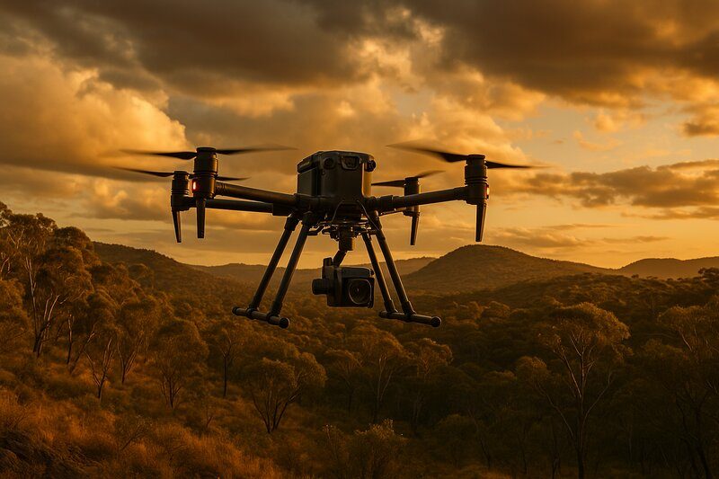
At Flying Glass, we specialise in cinematography and advanced data acquisition. Our LiDAR drone services support industries such as construction, infrastructure, mining, and environmental science. From major cities to remote sites, our team provides precision LiDAR solutions using DJI Matrice and other heavy-lift platforms. All operations are conducted by CASA-certified pilots with deep experience in aerial survey and data processing.
Unlike some providers who rely on off-the-shelf solutions, we customise every mission to fit the terrain, vegetation, and resolution requirements of your project. Our use of real-time kinematic (RTK) and post-processed kinematic (PPK) correction systems ensures that your data is accurate down to the centimetre. Whether you’re scanning a road corridor, assessing slope stability, or capturing contours under dense canopy, we’ve got the equipment and the know-how.
View our latest work in action on our showreel.
LiDAR is also one capability within Flying Glass’ wider industrial drone services, supporting mining, infrastructure, energy, environmental and remote-site projects across Australia.
LiDAR is also one of the advanced capture methods available within our broader drone mapping services, alongside photogrammetry, terrain modelling and repeat aerial data capture.
Where exposed surfaces, high-resolution visual detail and image-based 3D reconstruction are the priority, our drone photogrammetry services may be more suitable, or can be combined with LiDAR on projects requiring complementary datasets.
Key Benefits of Using a Drone with LiDAR
- Access Tough Terrain: Quickly scan areas like hillsides, rivers, and dense forests.
- Vegetation Penetration: Map under canopies for bare-earth models.
- Speed: Reduce project turnaround from weeks to hours.
- Accuracy: Achieve sub-5cm resolution for critical applications.
- Safety: No need to put people in dangerous locations.
- Repeatability: Conduct regular monitoring using time-stamped data.
- Cost-effectiveness: Compared to manned aerial surveys or ground crews, LiDAR drones offer a significant reduction in operational costs.
How LiDAR Surveys Work
Every successful drone LiDAR mission starts with a thorough planning process. This includes a detailed consultation with the client, a review of the target area, and a risk assessment to ensure compliance with CASA regulations. Once flight parameters are defined, our experienced pilots and payload operators take over.
- Flight Planning: Customised routes based on project scope and terrain.
- Data Capture: RTK-supported LiDAR scanning from drone flight paths.
- Point Cloud Creation: Pulses are logged into dense 3D point clouds.
- Processing: Data is cleaned, classified, and georeferenced.
- Deliverables: You receive DTMs, DSMs, contour maps, and 3D models.
Our team uses industry-leading post-processing software to create highly accurate deliverables suitable for CAD, GIS, and engineering applications. We can also provide data visualisation tools to help you interpret the results and integrate them into your existing workflows.
Real-World Use: Post-Flood Recovery in Regional NSW
In early 2024, we deployed one of our DJI Matrice drones equipped with a Riegl LiDAR sensor to survey a flood-affected zone in the Hunter Valley. The area was unsafe for ground crews and needed urgent drainage modelling to inform rebuilding efforts. In less than a day, we captured terrain data with 4 cm accuracy, allowing the civil engineers to prioritise work efficiently. This type of rapid response would have been impossible without drone-based LiDAR.
Applications of LiDAR Drones Across Australia
Urban Development & Planning
Used by councils to model infrastructure, assess flood zones, and plan transport upgrades. 3D data helps planners evaluate long-term urban growth and site feasibility.
Environmental Monitoring
Track post-bushfire recovery, erosion, or seasonal vegetation shifts with timestamped data. Repeated LiDAR scans help conservation groups and researchers assess long-term environmental change.
Construction & Infrastructure
Assess cut/fill, site boundaries, and structural changes with repeat flyovers. Pre-construction and as-built data improve compliance, reduce rework, and minimise delays.
For broader project support beyond LiDAR capture, see our construction drone services and infrastructure drone services.
LiDAR can also support large energy and infrastructure projects where detailed terrain and vegetation data is required. See our drone services for renewable energy projects for our wider capability across solar, wind and energy infrastructure.
Mining & Resource Management
Survey open-pit mines, calculate volumes, and monitor terrain changes. LiDAR excels in volumetric analysis and ongoing stability assessments around tailings dams and pit walls.
For wider mine-site capability, our mining drone services combine mapping, inspection, monitoring and specialist aerial operations for complex resources environments.
Forestry & Agriculture
Analyse biomass, plan irrigation, and map plantation health with high accuracy. Tree height, canopy density, and terrain mapping help plan harvesting or water infrastructure.
Utilities & Infrastructure Maintenance
Inspect pipelines, roads, and power corridors for encroachment and degradation. With high-resolution terrain data, crews can identify issues before they become safety hazards.
Choosing the Right LiDAR System
- Lightweight sensors for small drones and rapid missions.
- Advanced payloads for ultra-dense data and complex analysis.
Choosing the right LiDAR setup depends on terrain complexity, desired resolution, vegetation cover, and the type of deliverables required. We help our clients select the ideal balance of cost and capability to get the best results for their specific goals.
LiDAR vs Photogrammetry
Both LiDAR and photogrammetry are powerful mapping technologies, but they suit different needs. Photogrammetry is excellent for creating textured models and is more affordable, but it struggles under tree cover and in low-light conditions. LiDAR, on the other hand, excels in rough terrain and delivers highly accurate data regardless of lighting.
| Feature | LiDAR | Photogrammetry |
|---|---|---|
| Under-tree capability | Yes | No |
| Best for | Topography, vegetation, elevation | Inspections, textured 3D models |
| Typical accuracy | Up to 5 cm | 10–50 cm |
| Processing speed | Faster (cleaner datasets) | Slower (image-heavy) |
Why Choose Flying Glass?
- CASA Licensed: Nationally approved and insured.
- Experienced Team: Background in cinematography and engineering surveys.
- Advanced Hardware: DJI Matrice series and high-end LiDAR systems.
- Australia-Wide: Based in Sydney and servicing projects nationwide.
Frequently Asked Questions
What is the cost of a drone LiDAR survey?
Pricing depends on the survey size and location. We provide fixed quotes after a short briefing.
Can LiDAR see through trees?
Yes — laser pulses penetrate foliage, reaching the ground below.
What kind of accuracy can I expect?
Our systems deliver up to 5cm vertical accuracy with RTK correction.
Will I get raw data or processed results?
We can supply both. Choose from raw point clouds or clean, GIS-ready files.
Can you work in regional or remote areas?
Absolutely. We regularly deploy to remote locations across Australia, from outback mines to coastal environments.
The Future of LiDAR in Australia
LiDAR is becoming more accessible, affordable, and powerful. Flying Glass continues to invest in the latest hardware and training so we can offer best-in-class drone LiDAR services for Australian industries. From rainforest mapping to coastal erosion studies, we’re ready to help. As the demand for high-resolution spatial data grows, we’re committed to being ahead of the curve.
Let’s Talk About Your Project
Let’s make your next site visit unnecessary. Whether you’re a council planner or a remote mine operator, our LiDAR drone services deliver detailed spatial data — faster, safer, and more affordably. Contact us for a free consultation.