How Drones Are Revolutionising Mining Inspections in Australia
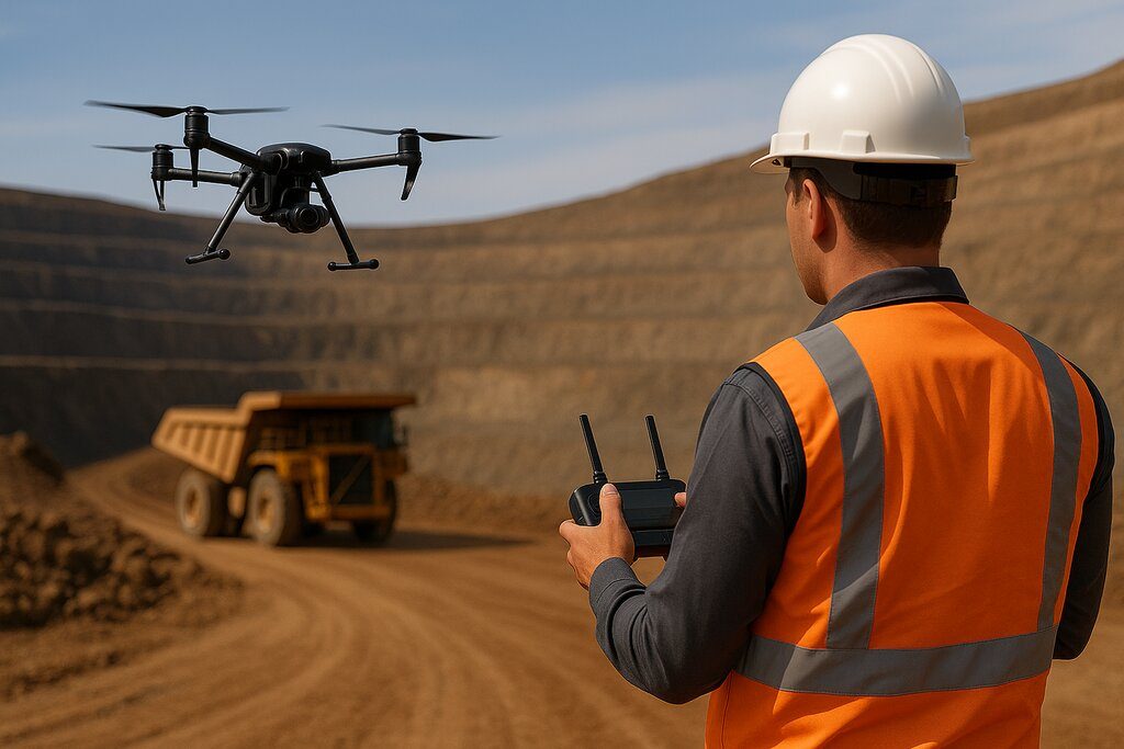
When you picture a mine site, you might think of rugged terrain, heavy equipment, and immense scale. What you might not imagine is a compact drone soaring overhead, collecting high-resolution imagery, thermal data, and LiDAR scans. Yet today, that’s exactly what’s happening across Australia’s mining sector.
Mining companies nationwide are turning to drone technology to streamline operations, reduce costs, and improve site safety. At Flying Glass, we specialise in delivering premium drone cinematography and inspection services -including drone mining inspections. In this post, we’ll explore how drones are used in mining, what services they support, the benefits they bring, and how your team can become certified to operate drones in mining environments.
Why Use a Drone in Mining?
Mining operations are vast, remote, and often dangerous. Traditional surveying, inspection, and monitoring methods are time-consuming, costly, and sometimes hazardous. Drones provide a safer, faster, and more cost-effective alternative.

With aerial technology, mining teams can collect accurate data across large or difficult-to-access areas – without putting personnel at risk. This data is critical to optimising mine planning, monitoring progress, and ensuring compliance with environmental and safety standards.
Key applications include:
- Aerial site mapping
- Stockpile volume calculations
- Infrastructure inspections
- Environmental monitoring
- Blast planning and post-blast analysis
- Thermal inspections of conveyors and machinery
Drone Services for the Mining Industry
At Flying Glass, we offer a comprehensive suite of drone mining services. Our work supports every stage of the mining lifecycle – from exploration and development to operation and rehabilitation.
1. Aerial Mapping and Surveying
Using RTK and PPK-enabled drones, we create highly accurate topographic maps and 3D models. These allow surveyors and planners to analyse terrain features, plan excavation, and monitor site changes over time. Unlike traditional ground-based surveys, aerial mapping is faster, safer, and more scalable.
Drone flight rules are essential to ensure all operations remain compliant.
2. Stockpile Measurements
Drone-based photogrammetry provides accurate volumetric analysis of stockpiles and tailings. This enables better material management, reconciliations, and reporting for financial or operational purposes.
3. Infrastructure Inspection
From haul roads and rail lines to power infrastructure, conveyors, and crushers – our drones capture high-resolution visual data that can be analysed for wear, damage, or inefficiencies. Infrared capabilities help detect overheating or potential failure in electrical systems.
4. Blast Planning and Analysis
Pre-blast aerial data helps optimise blast layouts, while post-blast inspections provide insight into fragmentation and movement. This minimises overbreak, underbreak, and flyrock risks, improving safety and efficiency.
5. Environmental Monitoring
Drones can monitor water run-off, vegetation regrowth, erosion, and dust emissions – providing visual evidence for compliance reporting and environmental stewardship.
Our LiDAR drone services support detailed terrain mapping and vegetation analysis for such tasks.
Equipment We Use for Mining Inspections
Mining demands robust, reliable drone platforms with advanced sensor payloads. At Flying Glass, we deploy:
- DJI Inspire 3: For high-end visuals and cinematography
- Mavic 3 Pro Cine: Compact but powerful, great for tight areas and recon
- Custom FPV drones: For dynamic, immersive inspections
- LiDAR-equipped drones: For terrain modelling and vegetation analysis
We tailor the equipment to each job, ensuring the right tools are used for every scenario.
Watch our showreel to see Flying Glass in action.
Benefits of Using Drones in Mining
Drones offer transformative benefits to mine operators, engineers, and project managers. Let’s break them down:
1. Enhanced Safety
No need to send surveyors into hazardous zones. Drones eliminate fall risk, exposure to dust, and interactions with heavy machinery.
2. Cost Efficiency
Aerial inspections cut the time, manpower, and equipment needed for ground surveys – resulting in significant savings.
3. Faster Decision-Making
Real-time or rapid data delivery allows mining teams to make operational decisions quickly.
4. Improved Accuracy
High-resolution imagery and precise GPS coordinates deliver centimetre-level data for maps and measurements.
5. Regular Monitoring
Frequent flights allow you to track progress, spot issues early, and optimise logistics.
Check out our drone accessories buyer’s guide to see how the right gear enhances these capabilities.
Key Use Cases in Australian Mining
Iron Ore (WA)
Operators in the Pilbara region use drones for pit-to-port inspections, conveyor checks, and stockpile reconciliations.
Coal (NSW & QLD)
Aerial mapping and environmental monitoring help ensure compliance with regulations near communities and ecologically sensitive areas.
Gold & Rare Earth Minerals
Exploration companies use drone LiDAR to survey challenging terrain and identify promising drilling zones.
Rehabilitation Projects
Drones help monitor vegetation growth and erosion, making it easier to report progress to government agencies.
Getting Your Team Certified for Mining Drone Work
Want to bring drone operations in-house? You’ll need properly trained and certified pilots.
We recommend our sister company, SkyMedia Training, for obtaining the CASA Remote Pilot Licence (RePL) -required for commercial drone work.
Their course offers:
- In-person and on-site training
- CASA-approved curriculum
- Practical flight assessment
- Knowledge of Australian airspace, rules, and safety protocols
Regulatory Compliance
Mining companies must ensure drone flights comply with CASA regulations. Key requirements include:
- RePL and Operator’s Certificate (OC)
- Flight within visual line of sight (VLOS)
- Operating outside restricted airspace or with the proper approvals
Understand how to obtain a drone permit in Australia or secure your Operator’s Certificate.
Our comprehensive guide to Australian drone laws can also help keep your team compliant.
Choosing a Drone Partner for Mining Projects
If you’re looking to outsource drone work, choose a provider with:
- CASA licensing and insurance
- Industry experience in mining and infrastructure
- Post-processing capabilities for photogrammetry and LiDAR
- Safety-first mindset
- Local knowledge of your site and airspace
At Flying Glass, we’ve worked with major clients across Australia’s mining sector and understand the unique demands of the field.
Final Thoughts
The future of mining is digital, data-driven, and drone-powered. Whether you’re managing active operations, rehabilitating a site, or exploring new terrain – drone mining inspections offer a safer, faster, and more accurate way to work.
To learn more or to get started with an inspection project, contact us today.
Or, if you want to get your own team certified and operational, check out our training partner at SkyMedia Training.