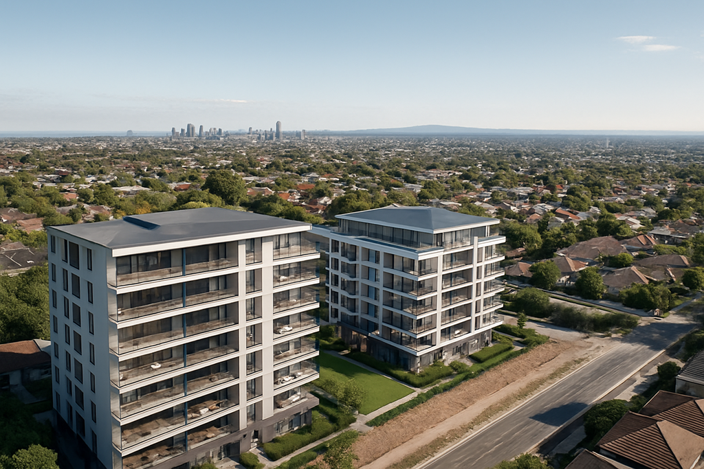
Drone Renders: Capturing Real-World Context for Unbuilt Projects
In today’s competitive property and construction market, high-quality visuals aren’t just a nice-to-have – they’re a critical sales tool. Drone renders are becoming a game-changer for developers, architects, visualisation studios, and marketing agencies across Australia. At Flying Glass, we deliver ultra-accurate drone imagery to support photomontage, CGI compositing, and 3D visualisations that help your audience picture your future development with absolute clarity.
What Are Drone Renders?
Drone renders combine high-resolution aerial photography with computer-generated images (CGIs) of proposed developments. This integration places your unbuilt structure directly into the real-world environment it will one day occupy. Whether it’s a new apartment block, commercial precinct, or luxury home, drone renders showcase exactly how your project will appear from any angle or elevation.
Clients across Sydney and Australia use drone renders for:
- Pre-sales and off-the-plan marketing
- Development Application (DA) submissions
- Investor presentations
- Stakeholder engagement
- Sun shadow and viewline analysis

Why Drone Captured Renders Matter
Most renders fall flat when they don’t match the real-life context. Our drone survey imagery is captured at exact floor heights, using approved flight plans and precise GPS locking, ensuring your 3D model integrates perfectly with the surrounding landscape.
Benefits of Drone Renders for Your Project
- Authentic Visual Context: Showcase actual viewlines and outlooks from Level 3, 10, 18 and beyond.
- Faster Approvals: Council DAs and town planners are more likely to approve developments when they can visualise the impact with photorealistic precision.
- Higher Buyer Engagement: Buyers respond emotionally to renders that reflect real-life views, lighting, and landscaping.
- Customised to Your Timeline: We can simulate different times of day, seasons, or weather conditions to match your marketing strategy.
Our Process: From Flight to Final Render
- Flight Planning: We assess your site, airspace regulations, and line-of-sight to ensure safe and legal drone operations.
- Drone Capture: Our CASA-certified pilots capture high-resolution images, including spherical panoramas, bracketed exposures, and backplates.
- Visual Integration: Your rendering team (or ours) inserts the 3D model of your development into the imagery for realistic and compliant presentation.
- Delivery: We provide layered images, high-resolution JPEGs for marketing, and optional TIFFs for large-format printing.
Who We Work With
Our drone renders are used by:
- Property Developers – to show views and architectural impact from every floor.
- Architects and Town Planners – for shadow studies, council submissions, and design validation.
- CGI and Visualisation Studios – needing accurate drone-captured backplates to match their models.
- Real Estate Marketing Teams – creating campaigns that attract off-the-plan buyers and investors.
Use Cases for Drone Rendering
Drone renders are incredibly flexible and can be used in a variety of projects:
- Multi-level residential towers with panoramic views
- Commercial precincts that need exact elevation context
- Luxury homes in coastal or hillside locations
- Master-planned communities showing integration with surrounding infrastructure
360-Degree Views and Spherical Panoramas
Our drone fleet includes aircraft capable of capturing 360-degree spherical panoramas at defined elevations. These can be embedded in online sales tools, displayed in virtual reality environments, or stitched into immersive flythroughs.
Secondary Services to Enhance Your Visualisation
- Drone Videography: Dynamic aerial video sequences to pair with your still renders.
- Time-Lapse Setup: Monitor progress from site acquisition to project completion.
- Sun Path Simulation: Show light exposure and shading throughout the day/year.
Industry Services We Offer
We understand the language of architecture, planning, and design. That’s why our work aligns with the services and deliverables you rely on throughout a project lifecycle, including:
- Drone survey capture for site accuracy and terrain modelling
- Photomontage backplates for seamless CGI integration
- 360-degree drone panoramas at key floor heights
- Architectural visualisation inputs for DA submissions and client approval
- Aerial imagery for rendering with calibrated lens data and GPS metadata
- Drone photography for architects supporting sun studies and view assessments
- CGI-ready drone capture tailored for visualisation studio workflows
Why Choose Flying Glass for Drone Renders?
- 30+ years of combined aviation and cinematography experience
- Trusted by property developers and architects
- Full compliance with CASA regulations
- Flexible scheduling across NSW, Victoria and major Australian cities
- Fast turnaround times and collaborative workflows
Need a Quote for Your Next Project?
We can provide a tailored quote based on location, number of levels, required outputs, and usage rights. Whether you’re a boutique architectural studio or a national property developer, we’ll ensure you get compelling visuals that stand out.
Contact us today to start planning your next drone render session, or enquire about RePL training if you’re looking to capture your own footage legally and professionally.

